
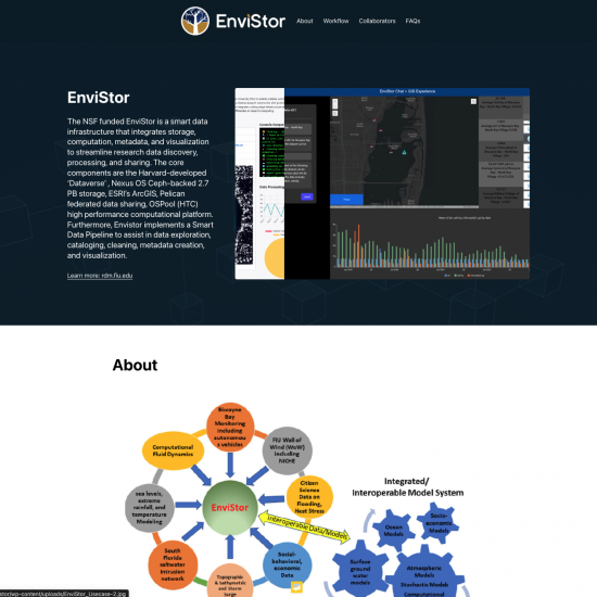
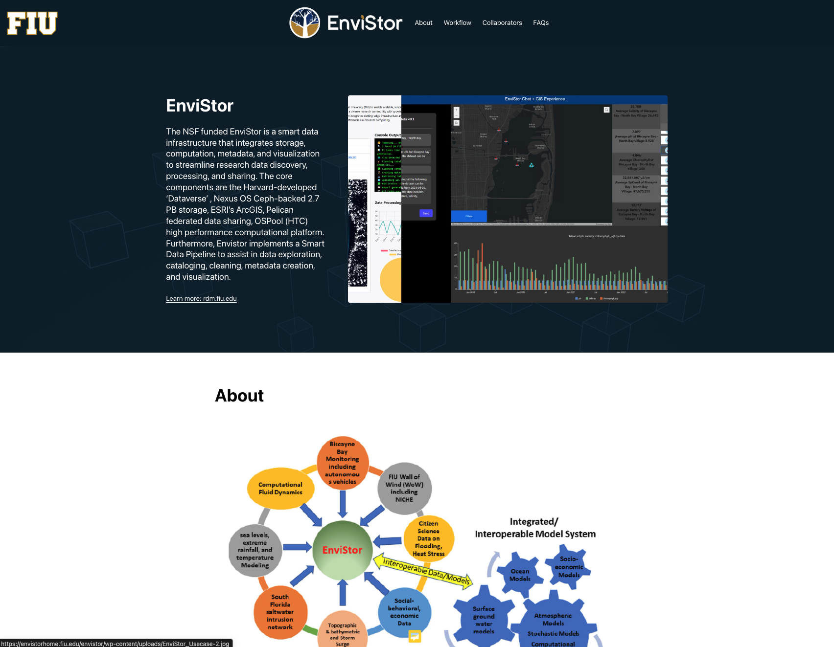
EnviStor
AI / GeoAI / Digital Archives & History

The Geographic Information Systems Center (GIS Center) at Florida International University supports and facilitates the teaching and research activities of the FIU community in the areas of geographic information systems, remote sensing, geospatial web visualization and geospatial data management.

Autodesk Inventor Professional 2020 – https://abcoemstore.com/product/autodesk-inventor-professional-2020/ is known for being high-quality 3D CAD software.

To read the full job announcement and apply, go to careers.fiu.edu and look for Job ID...
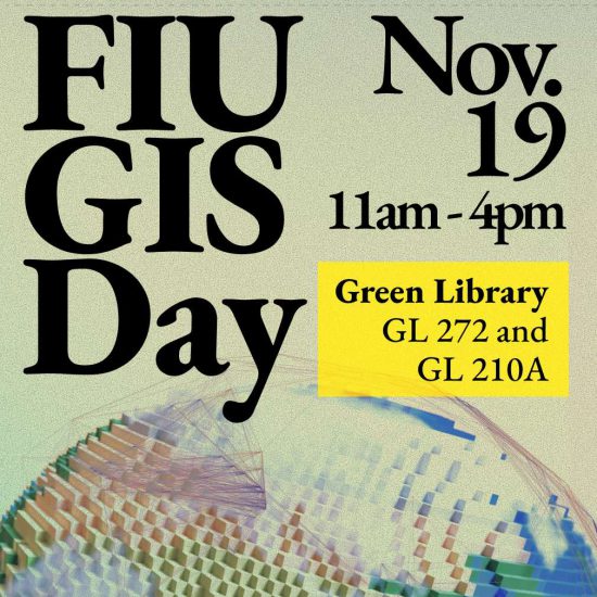
Date: Wednesday, November 19, 2025, 11am-4pm Location: MMC, Green Library GL 272 (GIS Cent...
Exercise #4 -Regression analysis using ArcGIS Pro Objective: Learn how to build, interpret...
Exercise #3 -Analyzing point patterns in ArcGIS Pro Objective: Learn how to aggregate poin...