WalkSmart Route Planner – Safe Routes to Schools
People: David Henderson, Program Manager / Julian Gottlieb, UI & Designer
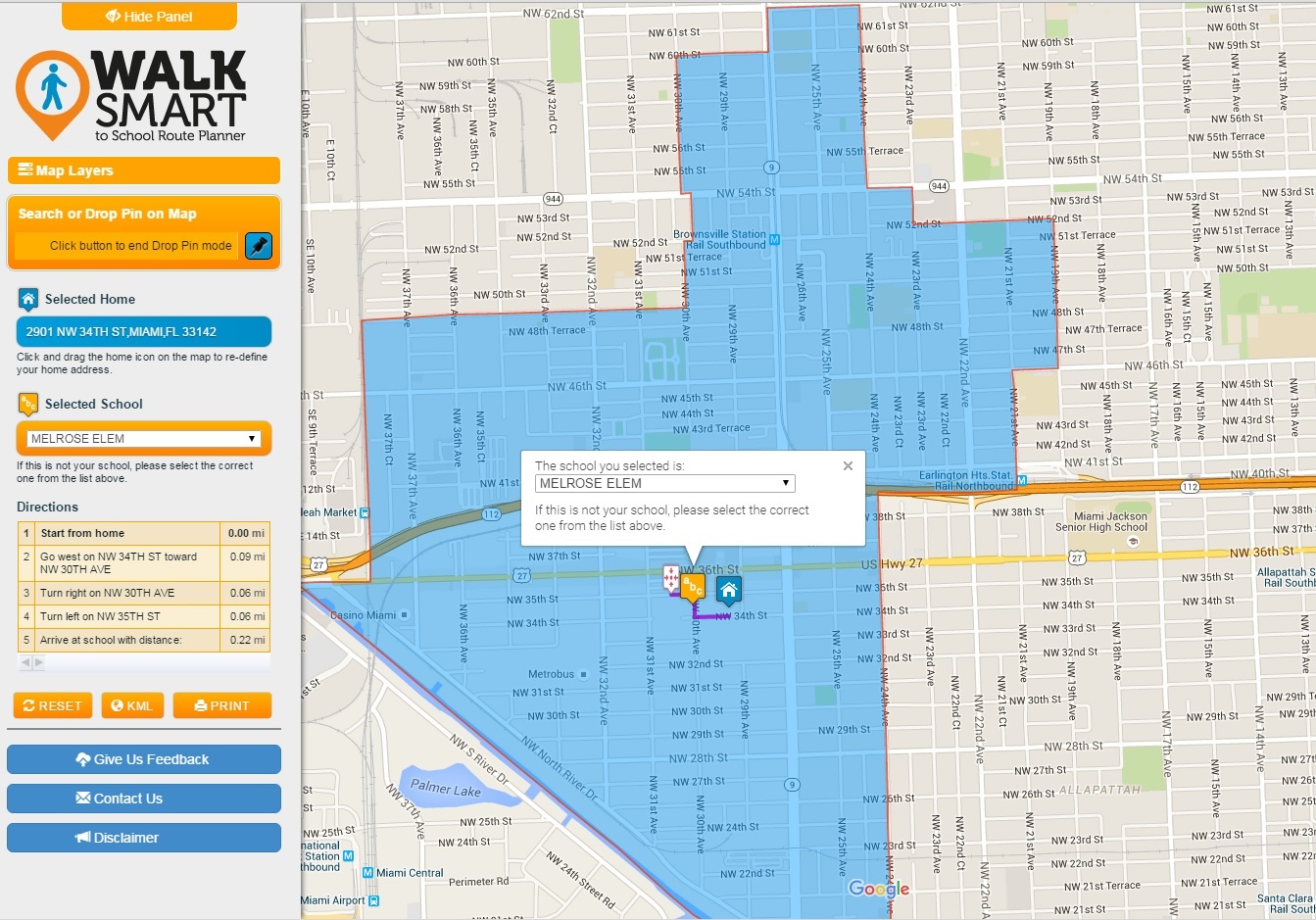
The “WalkSmart Route Planner” is a Web application that dynamically identifies the designated elementary school for a given home location and computes the safest route to that designated school. The criteria for the computation of the safest routes take into account the number of intersections, traffic lights, crosswalks, speed limits, road class, and sidewalks. ┬áA fully functioning interactive Web route planner for 63 selected schools in Miami-Dade County is included.
Project end date June, 2024.
Date
September 16, 2010
Category
Transportation Planning