Monitoring of Tree Island Condition in the Southern Everglades
Funding Agency: U.S. Army Corps of Engineers
People: Jay P. Sah, Co-PI / Michael S. Ross, Co-PI / Daniel Gann, Co-PI / Danielle Ogurcak, Laboratory Technician / Allison Jirrout, Laboratory Technician / Paulo Olivas, Research Associate
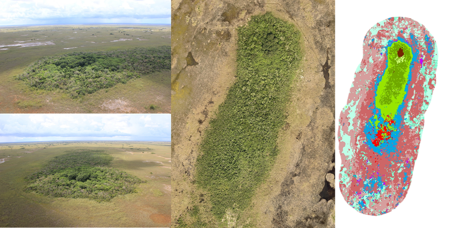
Information is needed about all elements of South Florida tree islands in order to formulate meaningful tree island performance measures and to monitor how restoration efforts affect them. Most critical is information on structural and compositional responses of vegetation to hydrologic change that result in changes in aerial extent or relative proportion of forests on tree islands and the boundary between islands and marshes. Our current research addresses the relevant performance measures (1) Ridge and Slough Sustainability and (2) Total System Performance Measure (RECOVER 2011). The working hypothesis of the study is expressed as ‘the loss of elongated patterns of ridges, sloughs, and tree islands in the direction of water flow in the ridge and slough landscape of the Everglades is attributed to disrupted sheet flow and related changes in water depth’, identified in the hypothesis cluster of sub-section 3.3.7.1 of the 2009 CERP Monitoring and Assessment Plan (RECOVER 2009).
The specific objectives of the project are:
- To characterize relationships among the hydrologic regimes of adjacent marshes with demographic fluctuations in the hardwood forests.
- To assess change in the structure and composition of both swamp forest and hardwood hammock.
- To develop a tree island vegetation classification scheme based on canopy and understory vegetation types.
- To develop and validate methods to consistently differentiate vegetation assemblage and to delineate their boundaries from spectral signatures of bi-seasonal satellite data and aerial photography.
- To detect changes and trends in aerial extent of the relative proportion of different vegetation communities.
- To investigate the correlation of vegetation changes in response to hydrological regime changes.
Date
December 15, 2013
Category
Ecosystems