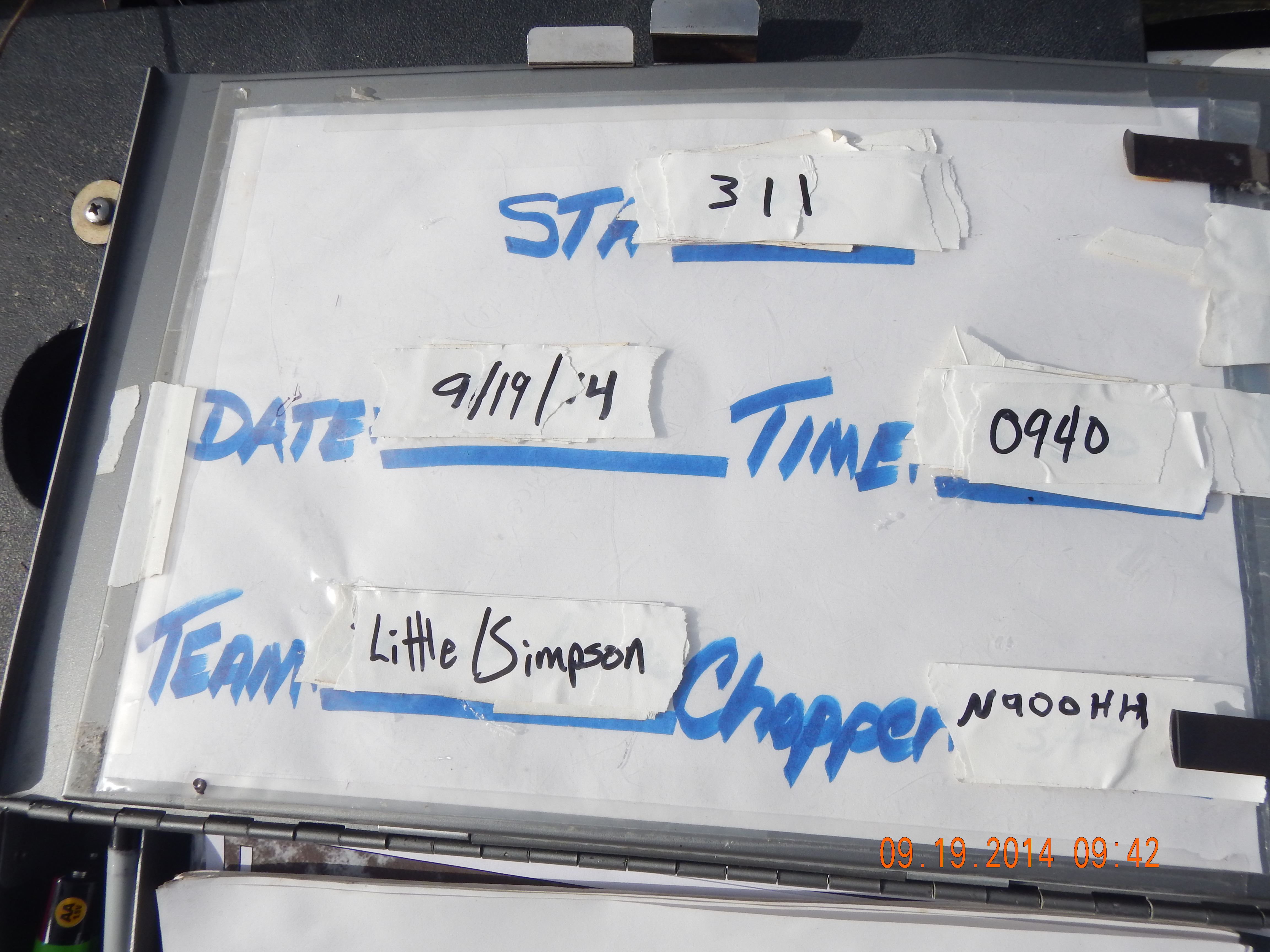
Station: 311
Sub Area: LNWR
| BioChem Date: 2014-09-19 | |
| BioChem Crew: DML/TDS |
| Location | |
|---|---|
| Latitude | 26.43065595 |
| Longitude | -80.35340174 |
NOTES: Fish were from nearby slough. All floc measurements after dewatering inside core tube, measurements taken inside core tube
Basic
| Item | Value | Description |
|---|---|---|
| AIR_DEP | Y | Mercury air deposition water sample field blank site (Y/N) |
| BIOVOLUME | 0 | Periphyton within water column (floating and sweaters) harvested from 0.25 square meter quadrat, measured in graduated cylinder, mL |
| CAMERA_A | S49551 | EPA property number of digital camera used for field documentation of habitat and soil core |
| CAMERA_B | S15996 | EPA property number of digital camera used for field documentation of habitat and soil core |
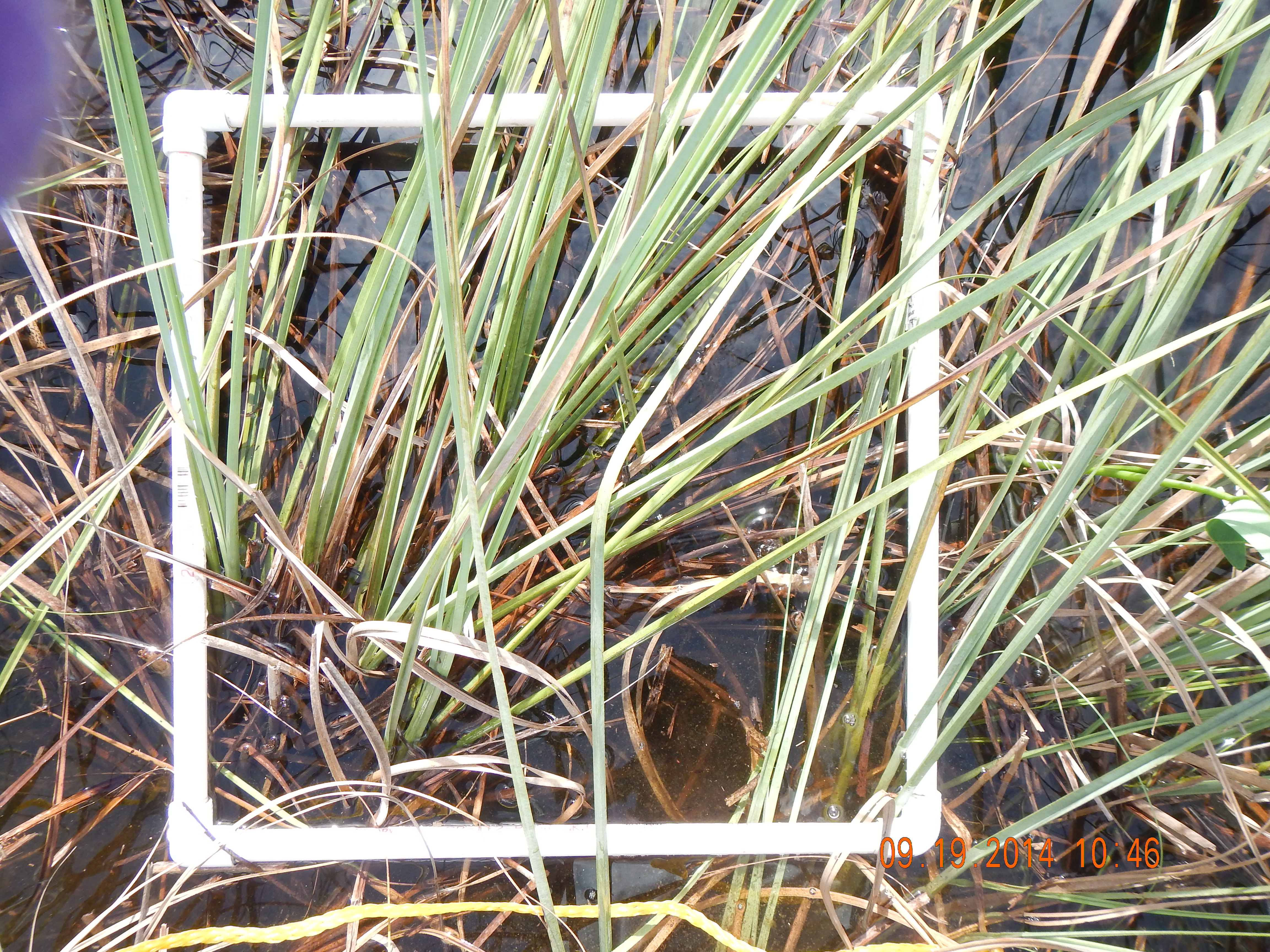
| CATTAIL | N | Cattail present at the station, based on visual observation, Y/N |
| CHAMBER | 2 | EPA unit number for the surface water sampling chamber |
| CHOPPER | N900HH | number of helicopter and associated sampling equipment and supply cache |
| COND | 70 | in situ surface water specific conductance, YSI sonde, umhos/cm |
| CYCLE | 11 | sampling cycle number |
| DEVICE | T | Device used for biovolume estimate, trash can T (area 0.062 square meters) or quadrat Q (area 0.25 square meters) |
| DO | 1.73 | in situ surface water dissolved oxygen, YSI sonde, mg/L |
| DOCSWEA | 13 | Dissolved organic carbon in surface water, mg/L (EPA SESD) |
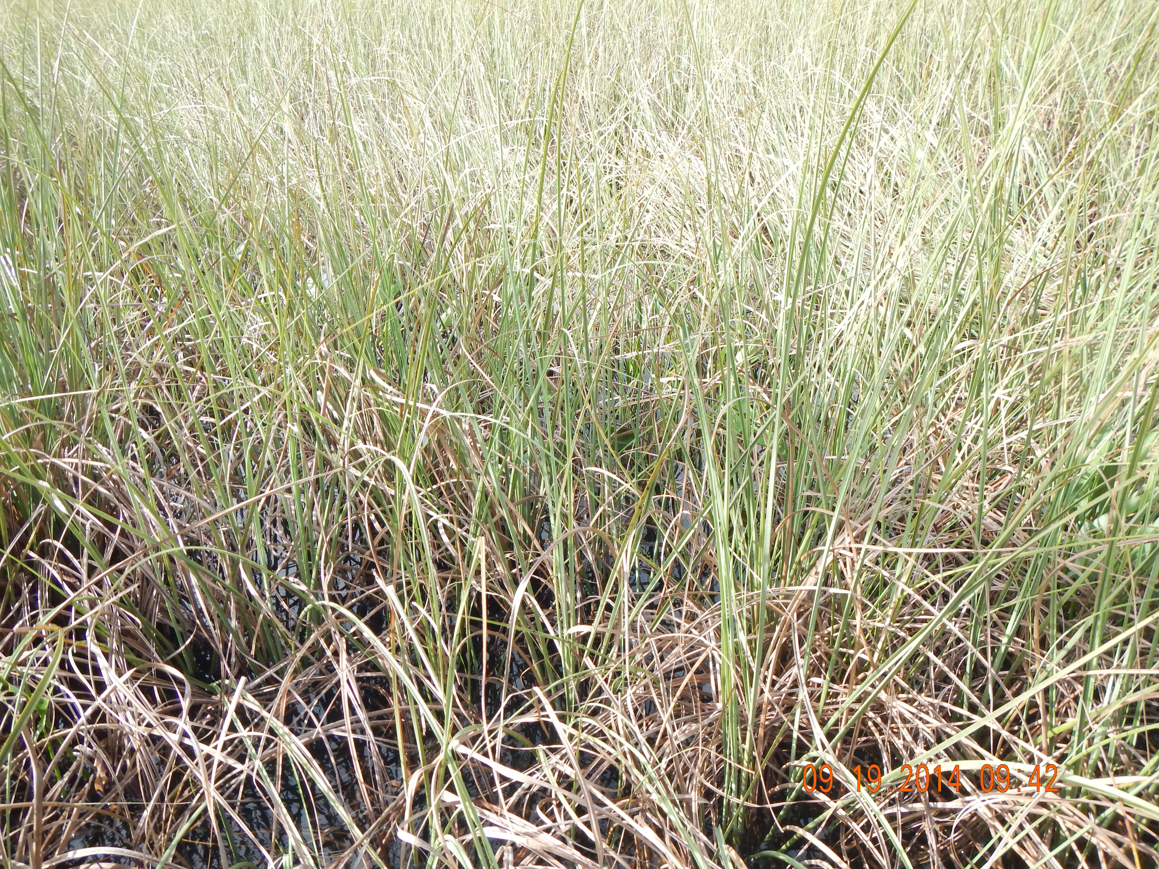
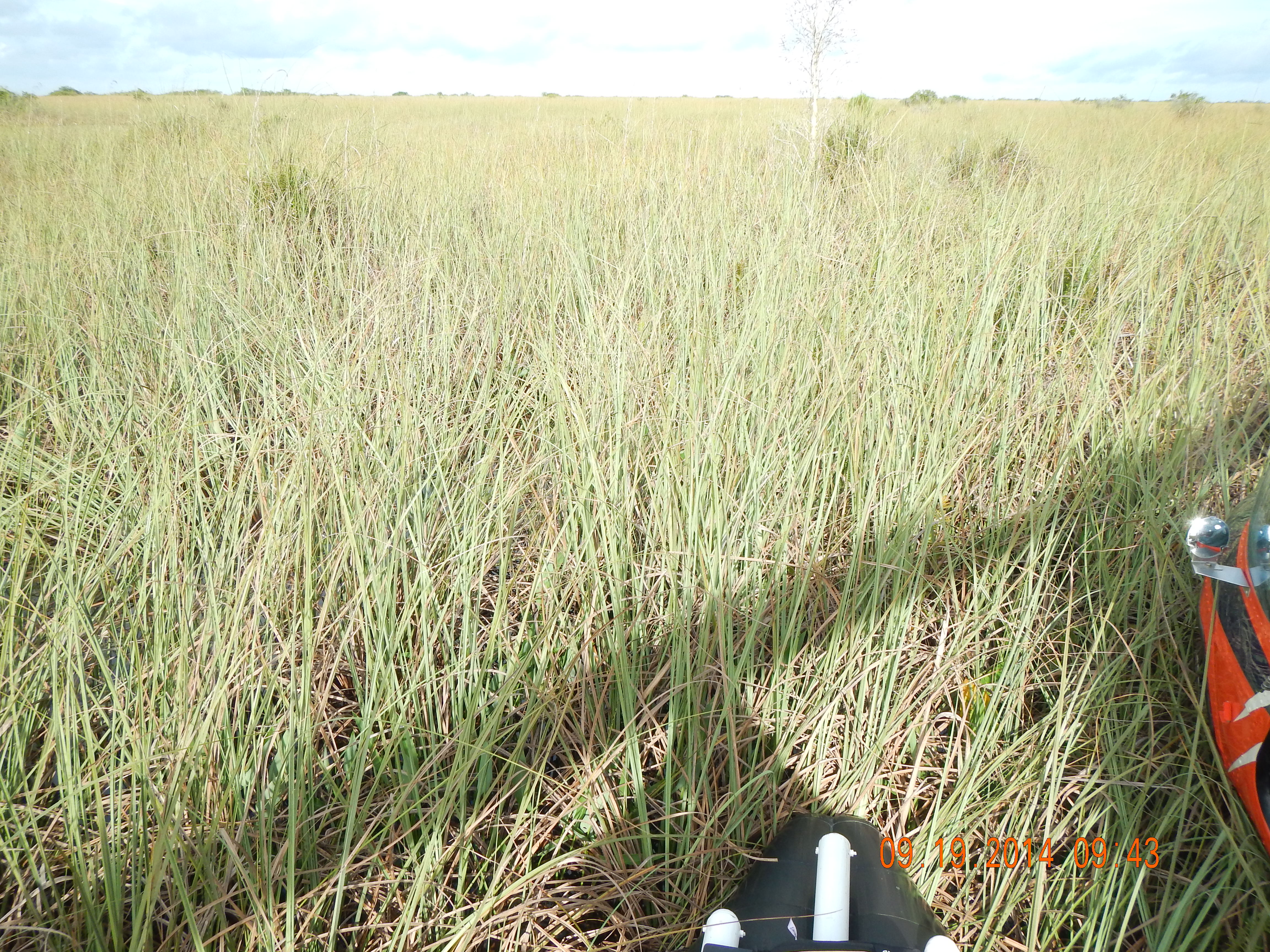
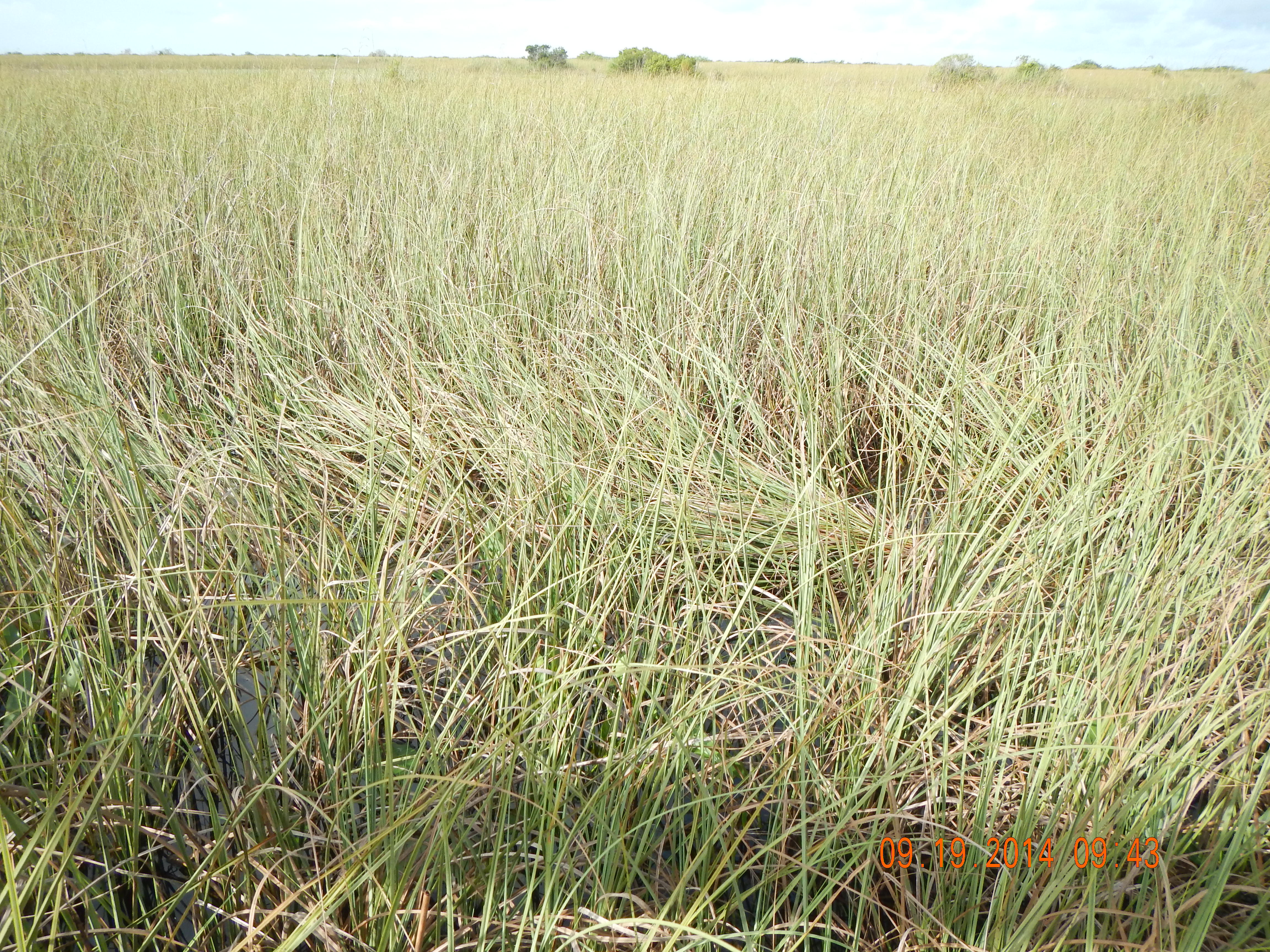
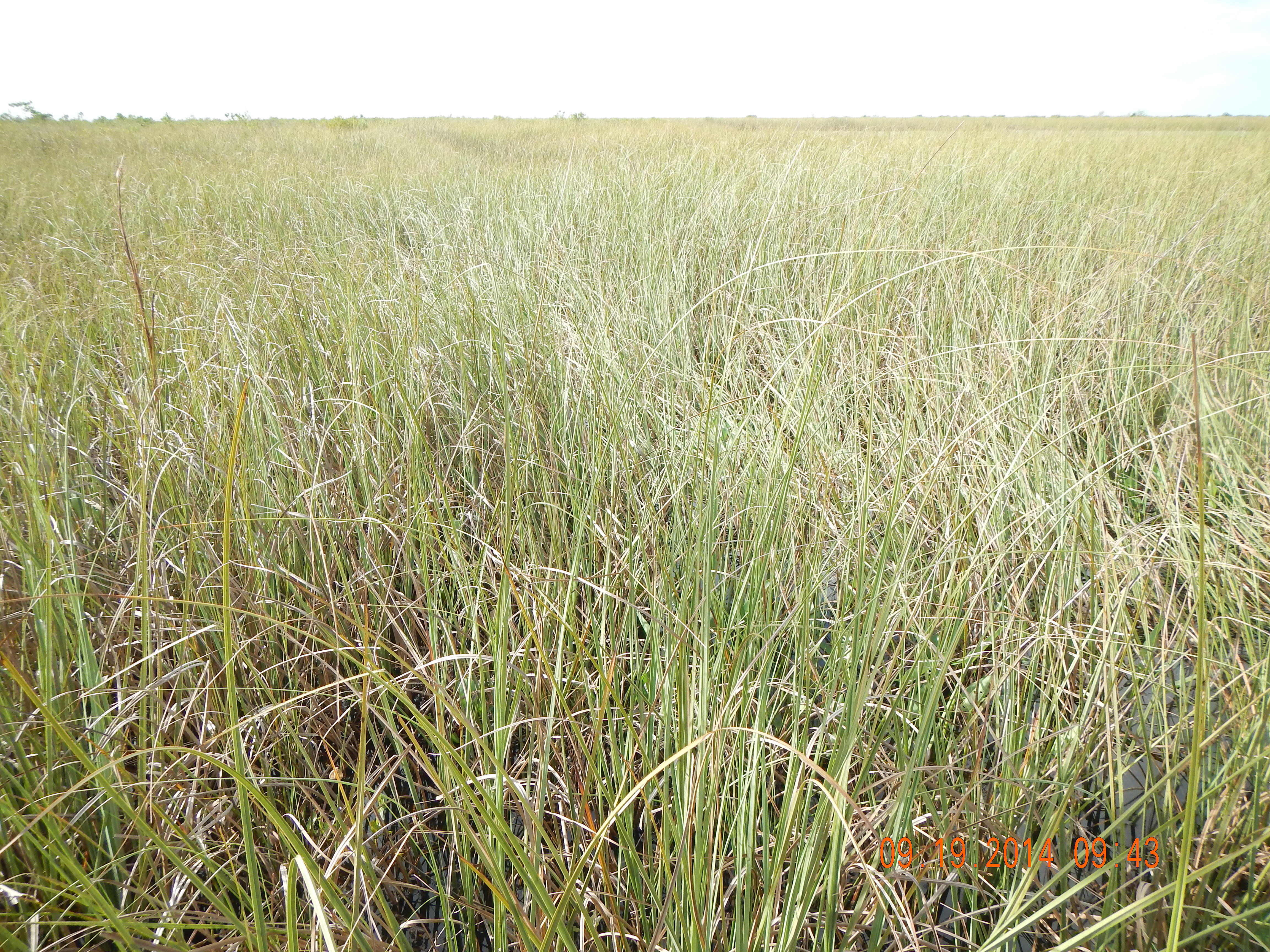
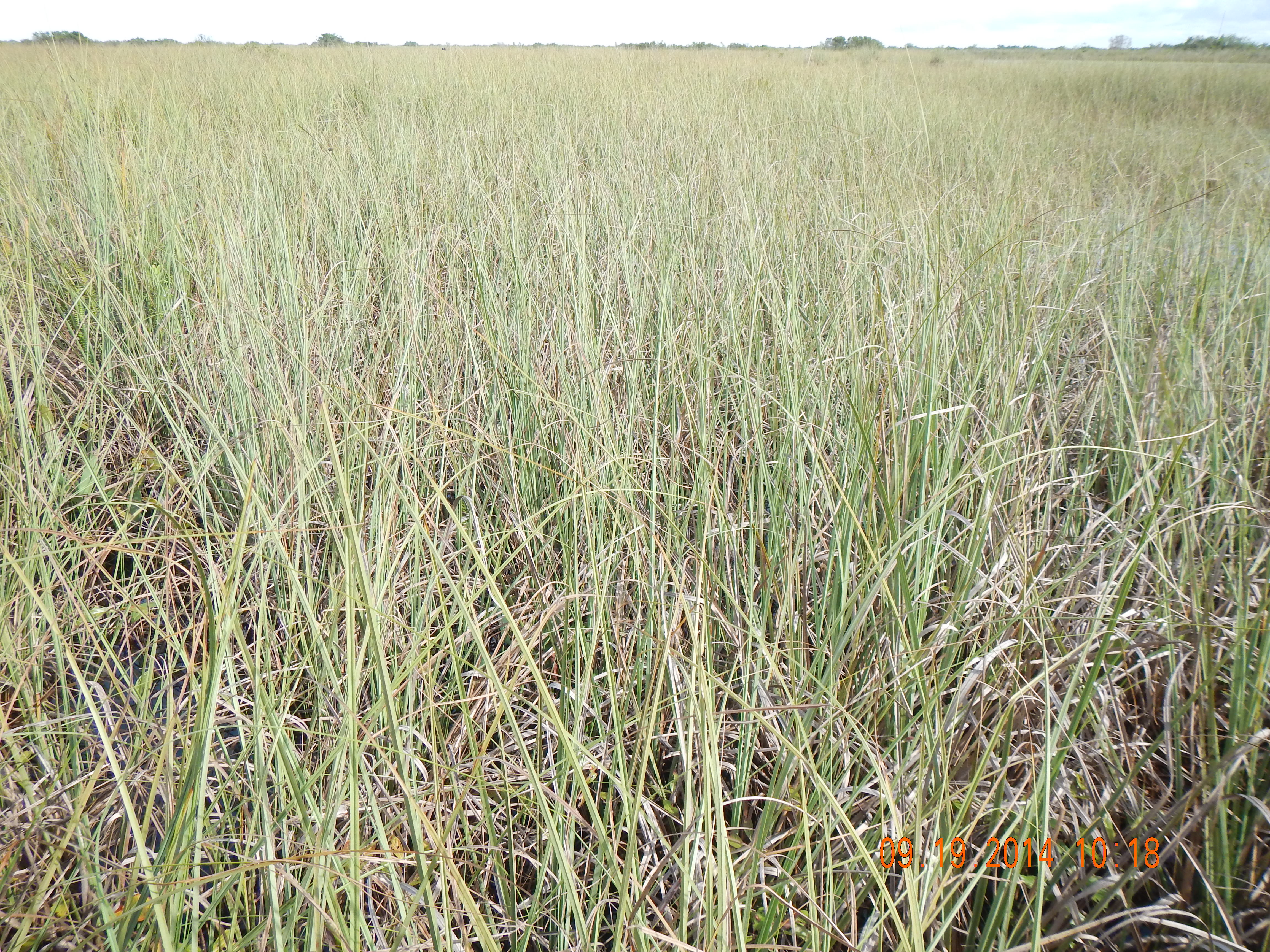
| DOMINANT_MACRO | sawgrass | Dominant macrophyte at station based on visual observation |
| DUPE | N | Field duplicate station (Y/N) |
| FISHNUM | 15-20 | number of mosquitofish collected for Hg analysis |
| FLOC_or_FILM | Y | biofilm or floc presence within 0.25 square meter quadrat (Y/N) |
| FLOCCOLPOR | PART | Portion of floc collected from core; none, part or all |
| FLOCCONTB | 2 | number of storemore bottles used for floc collection |
| FLOCCONTT | 0 | number of tubs used for floc collection |
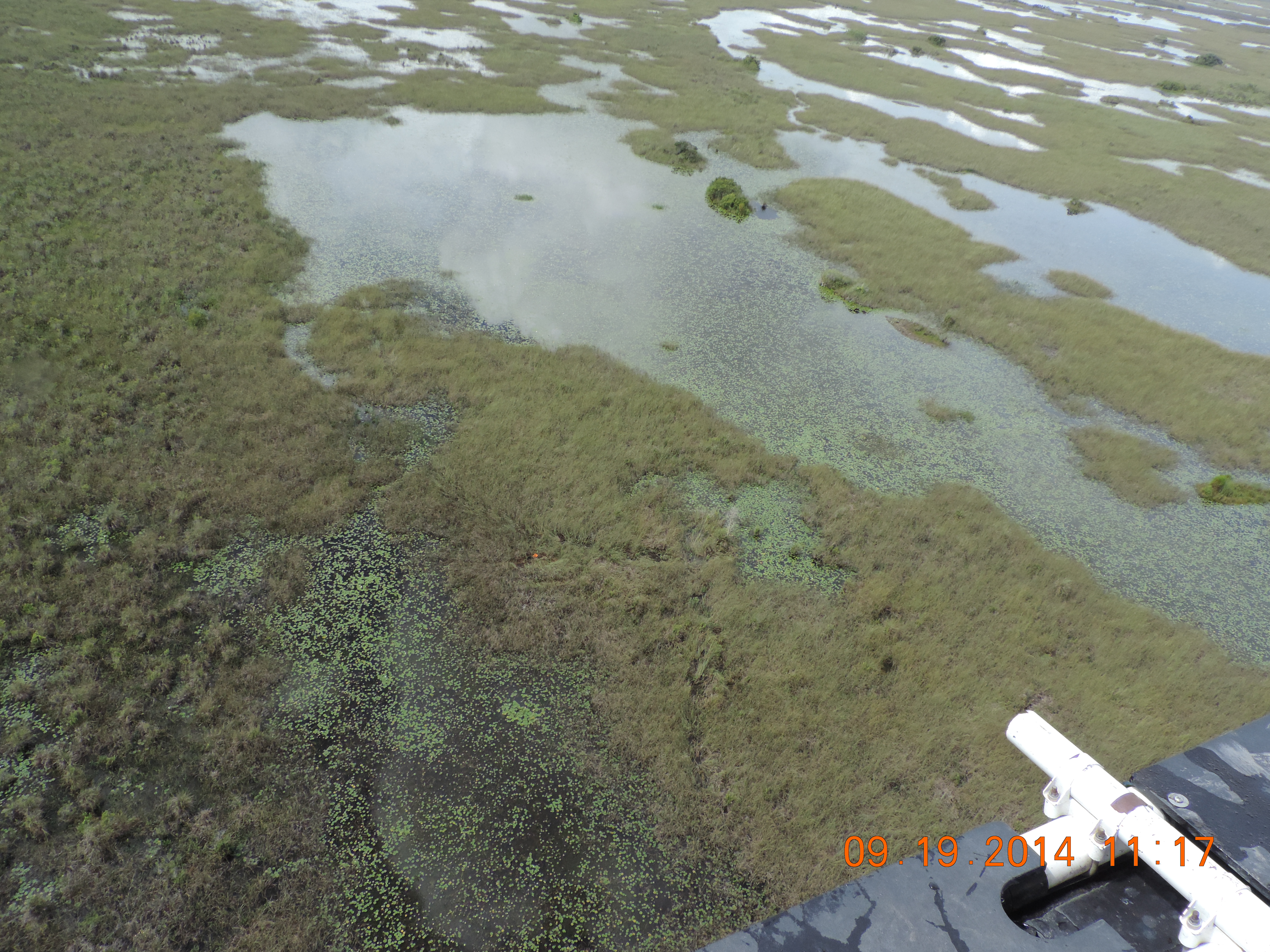
| FLOW | 1 | description of surface water flow at sampling site, based on visual observation: 1=sheetflow, 2=isolated pool (no flow), 3=uncertain |
| GARMIN | S49553 | Garmin Global Positioning System EPA property number, used for navigation to the station |
| GREEN_AL | N | green algae presence in 0.25 square meter quadrat (Y/N) |
| LOCATION | NOMINAL | sampled within 5 meters of GPS coordinates = nominal; 5-20 meters = shifted; >20 meters = station rejected; |
| LOGBOOK | 5 | Field logbook number |
| OMSDFS | 94 | organic matter in soil, %, calculated as 100-ASHSDFS % (FIU Soil/Sediment Biogeochemistry Lab) |
| ORP | 114.3 | Redox potential from YSI sonde, mV |
| PB_PERISM | N | benthic periphyton (soil mat) presence in 0.25 square meter quadrat (Y/N) |
| PE_PERISW | N | epiphytic (sweaters) periphyton presence in 0.25 square meter quadrat (Y/N) |
| PERI | 0 | Total percent cover of periphyton within 0.25 square meter quadrat, covered by all periphyton (PE, PB, PF) if 3-dimensional quadrat volume was compressed into a 2-dimensional plane |
| PF_PERIF | N | floating periphyton presence in 0.25 square meter quadrat (Y/N) |
| pH | 5.99 | in situ surface water pH, YSI sonde, std units |
| PILOT | JORGE GOMES | Helicopter pilot |
| PLANT_COLL | N | whole sawgrass plant collected for mercury analysis? (Y/N) |
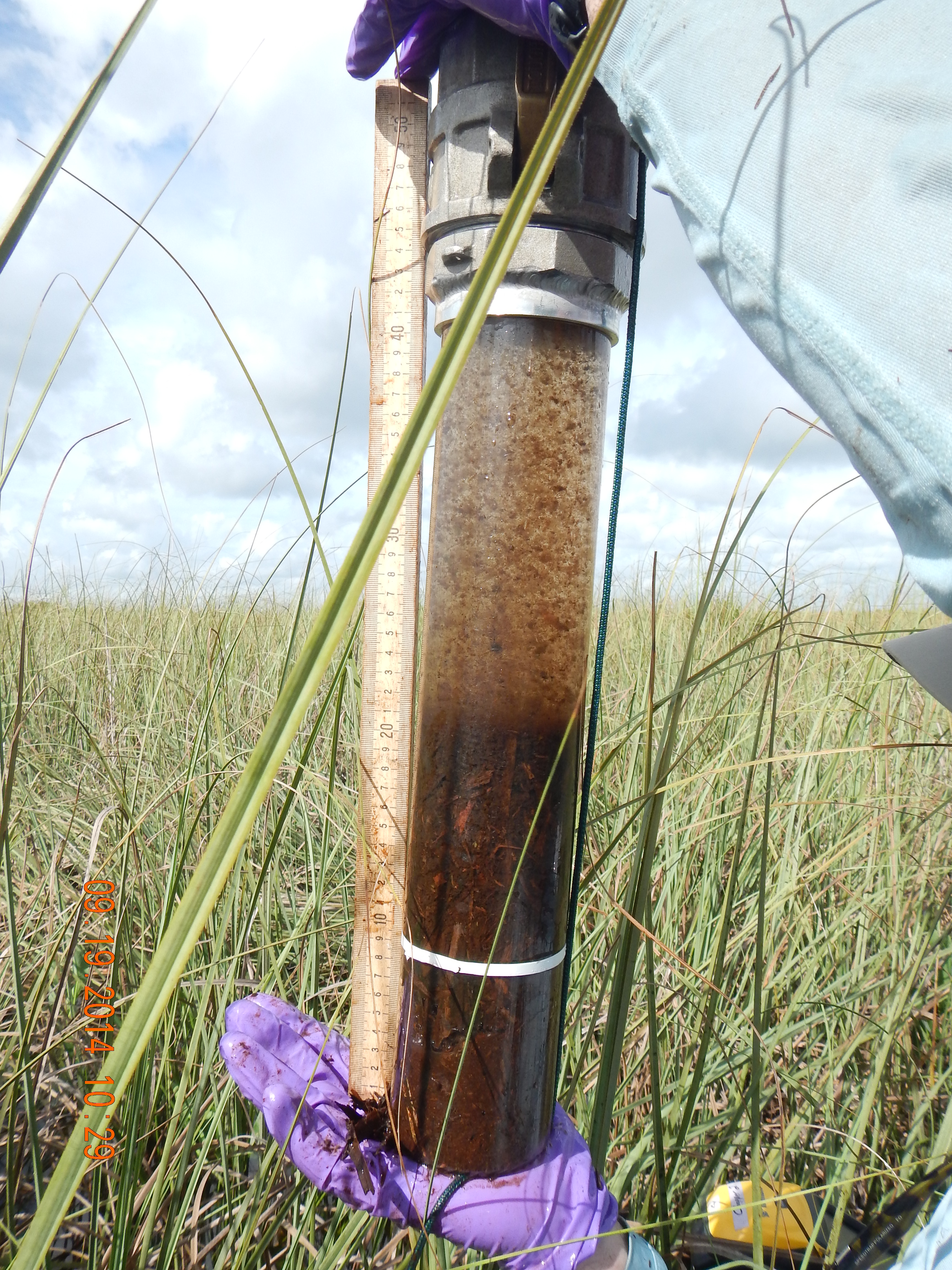
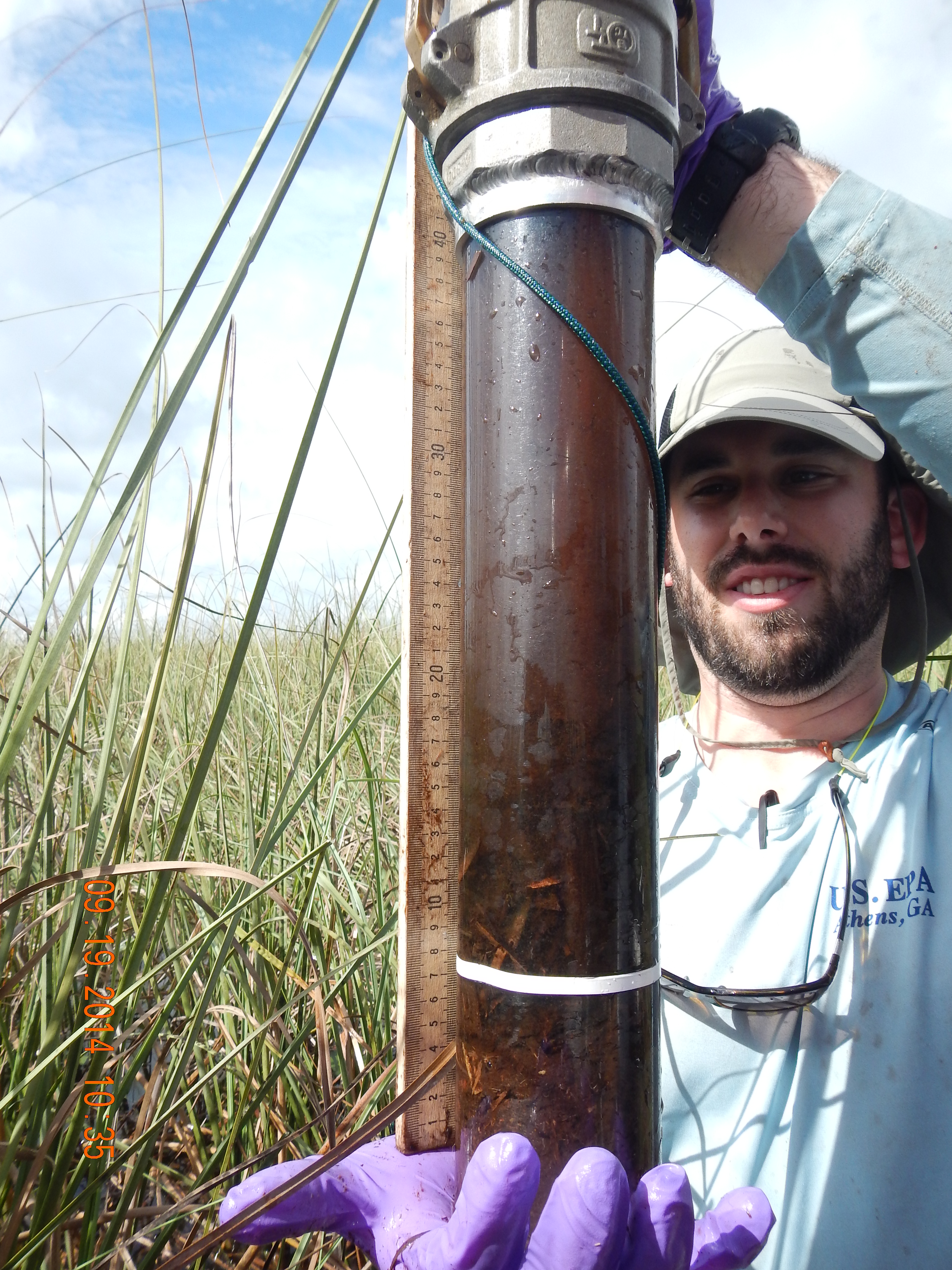
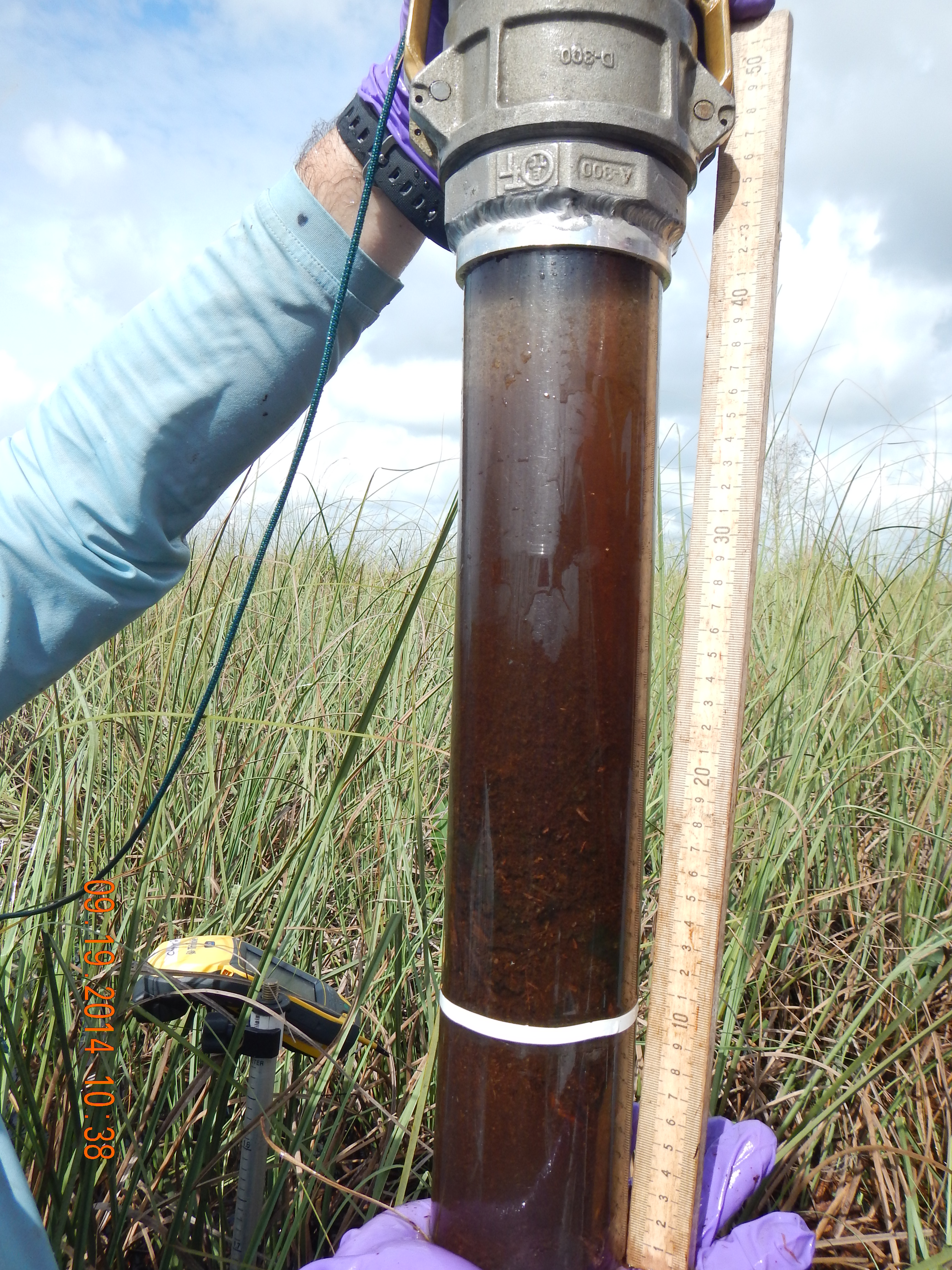
| SOILTYPE | 1 | soil type categories, by visual observation of core: 1=peat, 2=peat layers, 3=marl, 4=marl layers, 5=sand, 6=other, 7=peat over marl, 8=marl over peat, 9=marl+peat mixed |
| TIME_LANDING | 09:40:00 | Helicopter landing time at station |
| TIME_SAMPLE | 09:55:00 | Water sample collection time |
| TIME_TAKE_OFF | 11:17:00 | Helicopter departure time from station |
| TRIMBLE | A77112 | Trimble Global Positioning System EPA property number, used to determine final station coordinates, taken at the centroid of the soil core collection locations |
| TRIMBLE_FILE_NAME | 4091911A | File name logged at the station by the Trimble unit |
| TRIMBLE_LONG | 80.35340174 | Longitude, decimal degrees, from Trimble, post-processed |
| TURB | 1.2 | in situ surface water turbidity, YSI sonde, NTU |
| VEGTYPE | 2 | plant community observed at sampling site: 1=wet prairie, 2=sawgrass marsh, 3=pond/gator hole, 4=cattail, 5=willow, 6=cypress, 7=brush, 8=other, 9=slough |
| WEATHER | 1 | weather conditions: 1=clear, 2=slightly overcast, 3=medium overcast, 4=very overcast, 5=drizzle, 6=rain |
| YSI_DEPTH | 6 | depth of deployment of probe array in surface water, inches |
| YSI_ID | 18 | EPA unit number for the YSI sonde |
| Item | Value 1 | Value 2 | Value 3 | Average | Units | Description |
|---|---|---|---|---|---|---|
| DEPBEDR | 9.9 | 9.9 | 10 | 9.93 | FEET | depth to bedrock, point of refusal with metal probe, feet |
| FLOCTH | 8.5 | 32 | 15 | 18.5 | CM | vertical extent (length) of floc layer in core, cm |
| PB | 0 | 0 | 0 | 0 | CM | field data: benthic periphyton, or cookie, thickness, cm, collected from 3-inch inner diameter clear polycarbonate core |
| SOILCTH | 10 | 10 | 10 | 10 | CM | vertical extent (length) of soil sample, from soil surface to bottom of core, centimeters |
| SOILTHI | 7.3 | 7.6 | 7.3 | 7.4 | FEET | soil thickness, feet, metal probe to point of refusal, calculated as difference between WATDEPTH and DEPBEDR |
| WATDEPTH | 2.6 | 2.3 | 2.7 | 2.53 | FEET | water depth, measured with probe, feet |
BioChemistry
| Item | Value | Units | Q | Protocol | Description |
|---|---|---|---|---|---|
| ASHFCFS | 76000 | mg/kg | FIU Soil/Sediment Biogeochemistry Laboratory | Ash in dry samples, floc, after ashing at 550 C, mg/kg, (FIU Soil/Sediment Biogeochemistry Lab) | |
| ASHSDFS | 60000 | mg/kg | FIU Soil/Sediment Biogeochemistry Laboratory | Ash in dry samples, soil, after ashing at 550 C, mg/kg, (FIU Soil/Sediment Biogeochemistry Lab) | |
| ASHSDFSP | 6 | % | FIU Soil/Sediment Biogeochemistry Laboratory | Ash in dry samples, soil, after ashing at 550 C, percent, (FIU Soil/Sediment Biogeochemistry Lab) | |
| BDFCFS | 0.02 | g/cc | FIU Soil/Sediment Biogeochemistry Laboratory | Bulk Density of floc, g/cc dry weight (FIU Soil/Sediment Biogeochemistry Laboratory) | |
| BDSDFS | 0.04 | g/cc | FIU Soil/Sediment Biogeochemistry Laboratory | Bulk Density of soil, g/cc dry weight (FIU Soil/Sediment Biogeochemistry Laboratory) | |
| CHLAFCFB | 400 | mg/kg | FIU nutrient analysis laboratory | Chlorophyll a in floc, mg/kg dry weight (FIU Nutrient Analysis Lab) | |
| CHLASWFB | 17 | ug/L | FIU nutrient analysis laboratory | Chlorophyll a in surface water, ug/L (FIU Nutrient Analysis Lab); MRL= 0.1 ug/L | |
| CHLAVOL | 70 | ML | volume of surface water filtered for chlorophyll-a analysis, ml | ||
| CLSWEA | 11 | mg/L | Chloride in surface water, mg/L (EPA SESD); MRL=0.1 mg/L | ||
| FNH4SWFB | 0.007 | mg/L | J,Q-2 | FIU nutrient analysis laboratory | Filtered Ammonia in surface water, mg/L (FIU Nutrient Analysis Lab); MRL = 0.0031mg/L; PQL = 0.0140 mg/L |
| FNNSWFB | 0.0015 | mg/L | J,Q-2 | FIU nutrient analysis laboratory | Filtered Nitrite + Nitrate in surface water, mg/L (FIU Nutrient Analysis Lab) |
| FNO2SWFB | 0.0012 | mg/L | J,Q-2 | FIU nutrient analysis laboratory | Filtered Nitrite in surface water, mg/L (FIU Nutrient Analysis Lab) |
| FNO3SWFB | 0.0003 | mg/L | J, CV | FIU nutrient analysis laboratory | Filtered Nitrate in surface water, mg/L (FIU Nutrient Analysis Lab) |
| H2OFCFS | 98 | % | FIU Soil/Sediment Biogeochemistry Laboratory | Water content of floc as percentage of wet weight (FIU Soil/Sediment Biogeochemistry Lab) | |
| H2OSDFS | 93 | % | Water content of soil as percentage of wet weight (FIU Soil/Sediment Biogeochemistry Lab) | ||
| H2SBWEE | 0.009 | mg/L | J | Bottom water sulfide, mg/L, HACH method 8131 (EPA SESD Contractor) | |
| LEAF_COLL | N | Y/N | sawgrass leaves collected for carbon, nitrogen and phosphorus analysis (Y/N) | ||
| MEHGFCFC | 3.4 | ng/g | FIU mercury analytical laboratory | Methyl Mercury in floc, ng/g (FIU Mercury Lab); 2014 MDL=0.04 ng/g; MRL = 0.12 ng/g; results reported as dry weight | |
| MEHGSDFC | 1.7 | ng/g | FIU mercury analytical laboratory | Methyl Mercury in soil, ng/g (FIU Mercury Lab); 2014 MDL=0.04 ng/g; MRL= 0.12 ng/g; results reported as dry weight | |
| MEHGSWFC | 0.06 | ng/L | U | FIU mercury analytical laboratory | Methyl Mercury in surface water, ng/L (FIU Mercury Lab); MDL=0.02 ng/L; PQL=0.06 ng/L |
| ORPDEPTH | 1.4 | FEET | Depth of the YSI sonde redox potential probe, feet | ||
| pHFCFS | 7.69 | std units | FIU Soil/Sediment Biogeochemistry Laboratory | pH in floc as measured in 1:1 (gram wet soil: g distilled de-ionized water) soil slurry (FIU Soil/Sediment Biogeochemistry Lab) | |
| pHSDFS | 6.65 | std units | FIU Soil/Sediment Biogeochemistry Laboratory | ex situ soil pH, std units, as measured in 1:1 (gram wet weight soil:gram de-ionized distilled water) soil slurry (FIU Soil/Sediment Biogeochemistry Laboratory) | |
| SO4SWEA | 0.022 | mg/L | U, MDL-U | Sulfate in surface water, mg/L (EPA SESD); MRL=0.02 mg/L | |
| SRPSWFB | 1 | ug/L | J,Q-2 | FIU nutrient analysis laboratory | Soluble Reactive Phosphorus in surface water,ug/L (FIU Nutrient Analysis Lab) |
| TCFCFS | 480 | mg/g | FIU Soil/Sediment Biogeochemistry Laboratory | Total Carbon in floc, milligrams per gram dry weight (FIU Soil/Sediment Biogeochemistry Laboratory) | |
| TCSDFS | 510 | mg/g | FIU Soil/Sediment Biogeochemistry Laboratory | Total Carbon in soil, mg per gram dry weight (FIU Soil/Sediment Biogeochemistry Laboratory) | |
| TEMP | 27.01 | C | in situ surface water temperature, YSI sonde, degrees C | ||
| THGFCFC | 140 | ng/g | FIU mercury analytical laboratory | Total Mercury in floc, ng/g (FIU Mercury Lab) | |
| THGFSFC | 33 | ng/g | FIU mercury analytical laboratory | Total Mercury in mosquitofish (Gambusia affinis), ug/kg (FIU Mercury Lab); MDL = 3.2 ug/kg; MRL = 9.6 ug/kg; reported as wet weight, composite of up to seven fish | |
| THGSDFC | 170 | ng/g | FIU mercury analytical laboratory | Total Mercury in soil, ng/g (FIU Mercury Lab), MDL = 2.4 ng/g, MRL = 7.2 ng/g | |
| THGSWFC | 2.3 | ng/L | FIU mercury analytical laboratory | Total Mercury in surface water, ng/L (FIU Mercury Lab); MDL = 0.2 ng/L; PQL = 0.5 ng/L | |
| TNFCFS | 32 | mg/g | FIU Soil/Sediment Biogeochemistry Laboratory | Total Nitrogen in floc, mg per g dry weight (FIU Soil/Sediment Biogeochemistry Laboratory) | |
| TNSDFS | 29 | mg/g | FIU Soil/Sediment Biogeochemistry Laboratory | Total Nitrogen in soil, mg per g dry weight (FIU Soil/Sediment Biogeochemistry Laboratory) | |
| TNSWFB | 0.46 | mg/L | FIU nutrient analysis laboratory | Total Nitrogen in surface water, mg/L (FIU Nutrient Analysis Lab) | |
| TOCSWEA | 13 | mg/L | Total organic carbon in surface water, mg/L (EPA SESD) | ||
| TPFCFB | 680 | mg/kg | FIU nutrient analysis laboratory | Total Phosphorus in floc, mg/kg dry weight (FIU Nutrient Analysis Lab) | |
| TPSDFB | 380 | ug/g | FIU nutrient analysis laboratory | Total Phosphorus in soil, ug/g (FIU Nutrient Analysis Lab) | |
| TPSWFB | 6.6 | ug/L | FIU nutrient analysis laboratory | Total Phosphorus in surface water, ug/L (FIU Nutrient Analysis Laboratory) |
Panorama
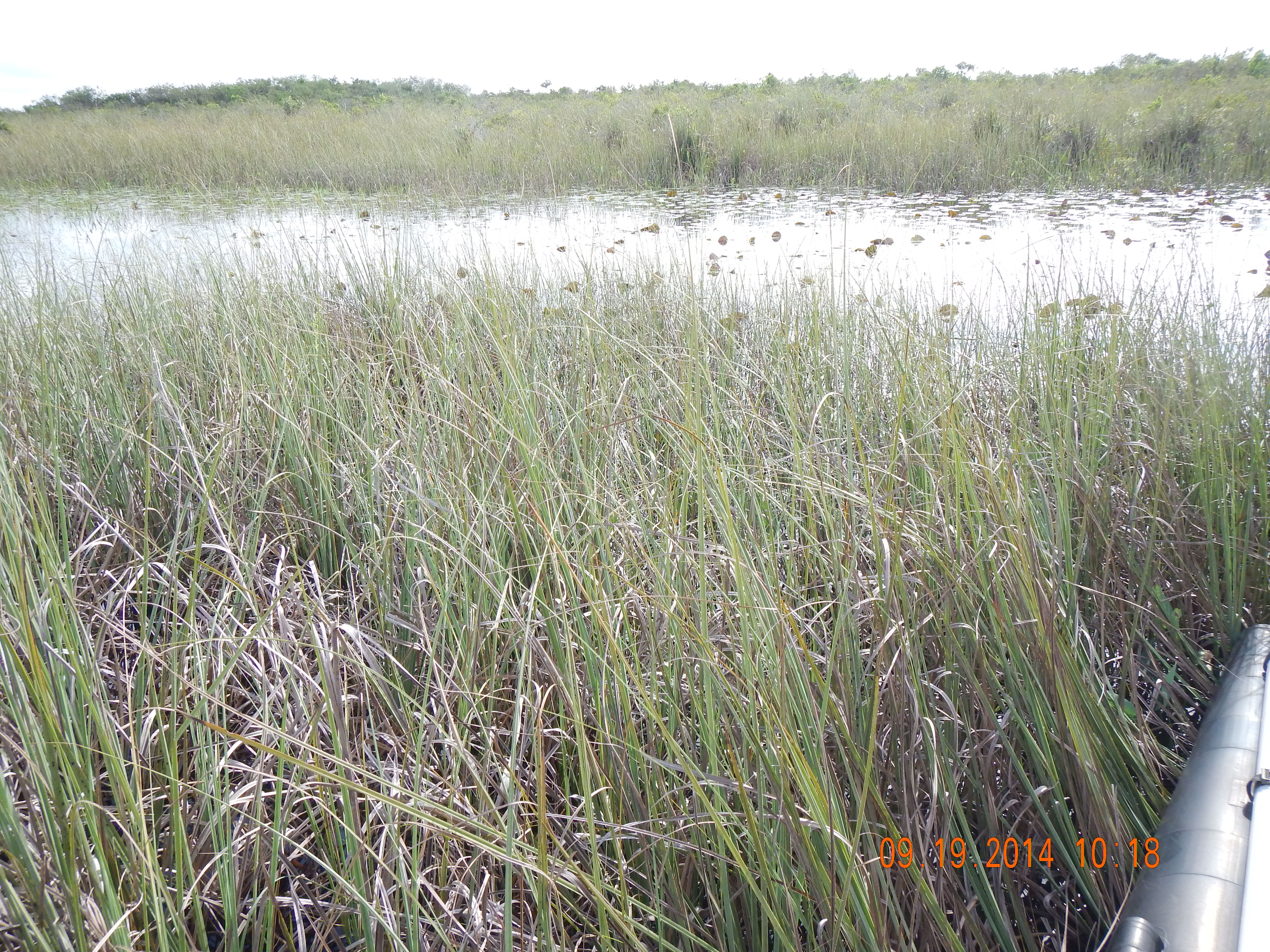
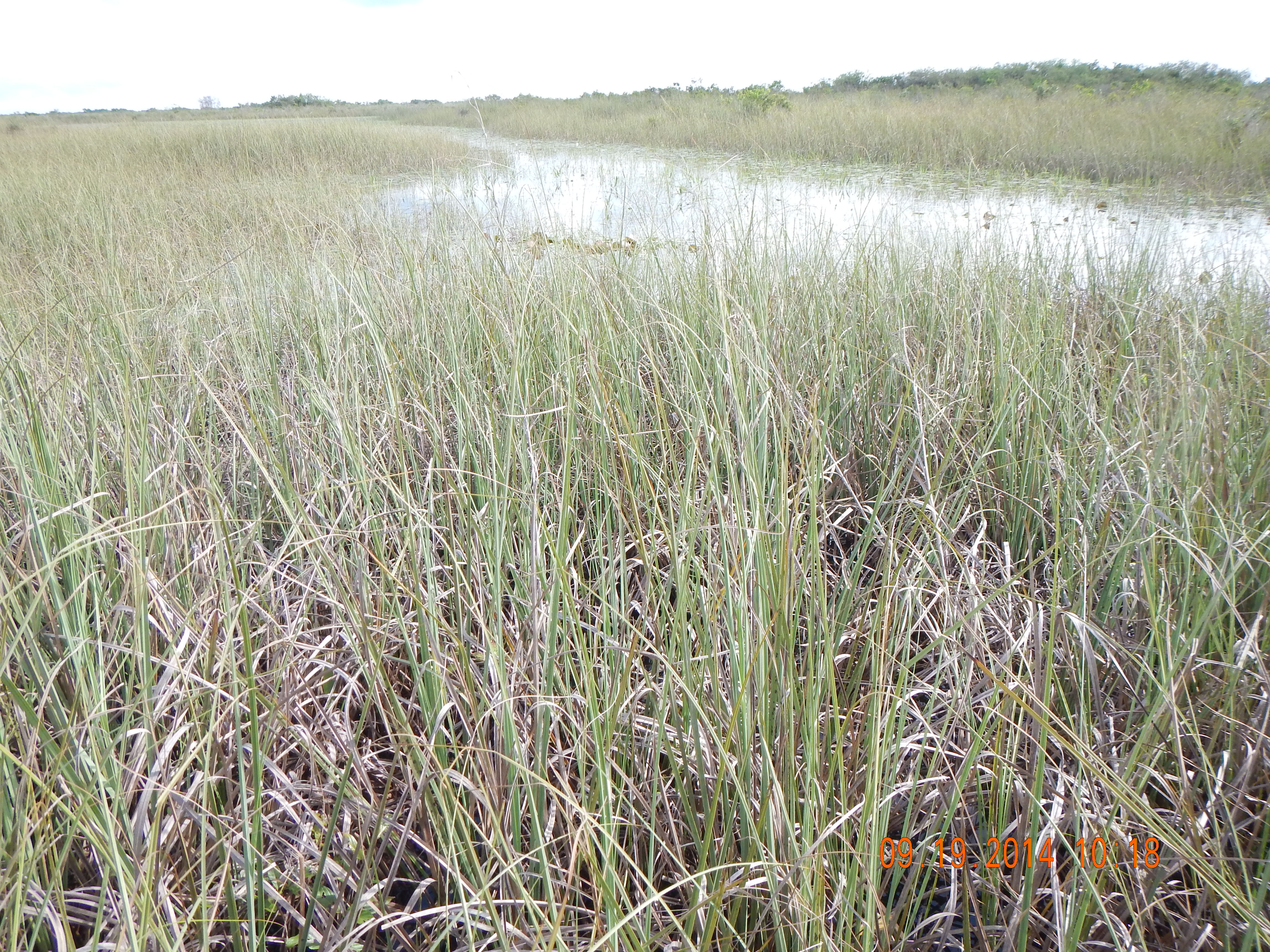
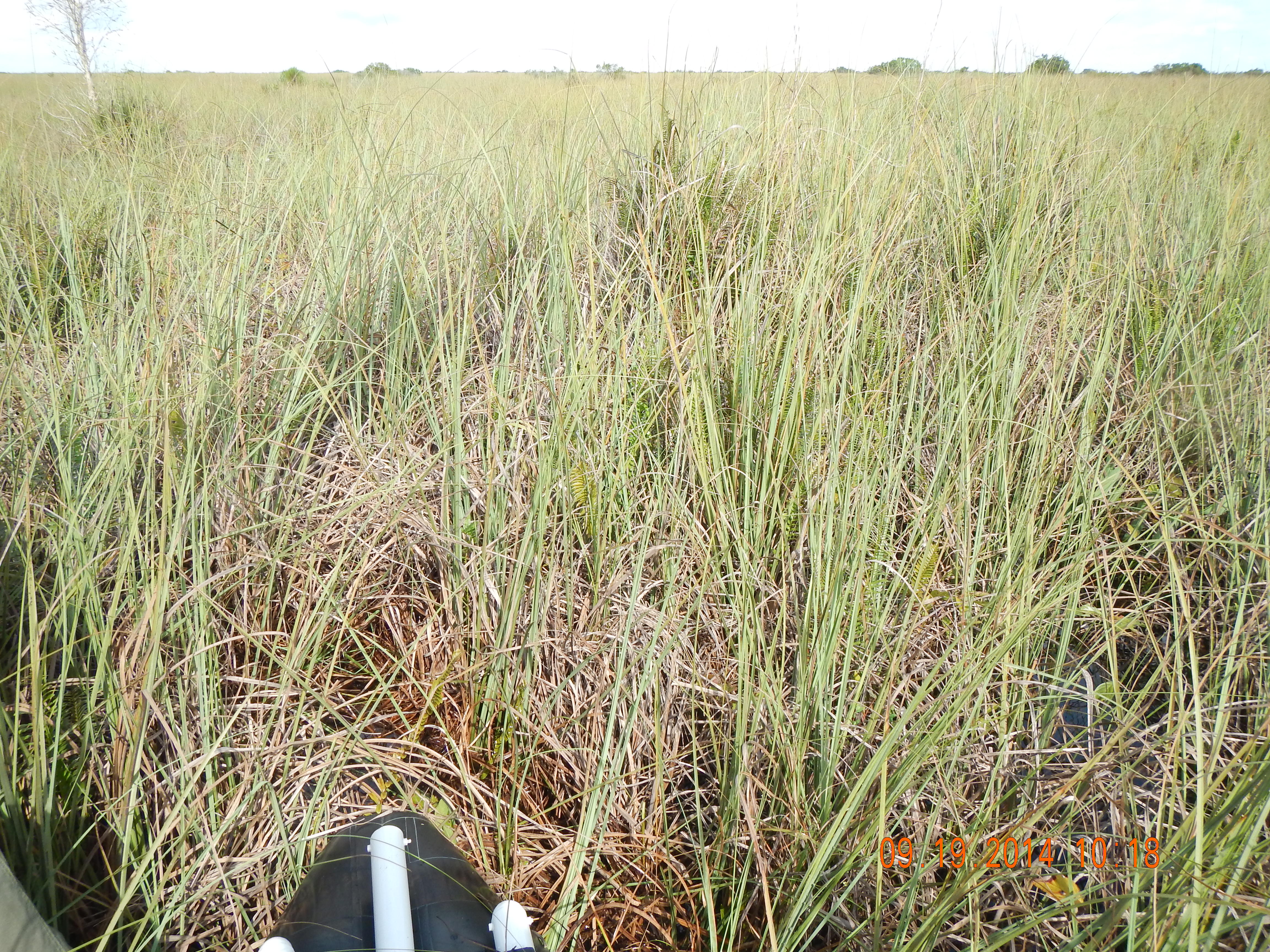
Plot