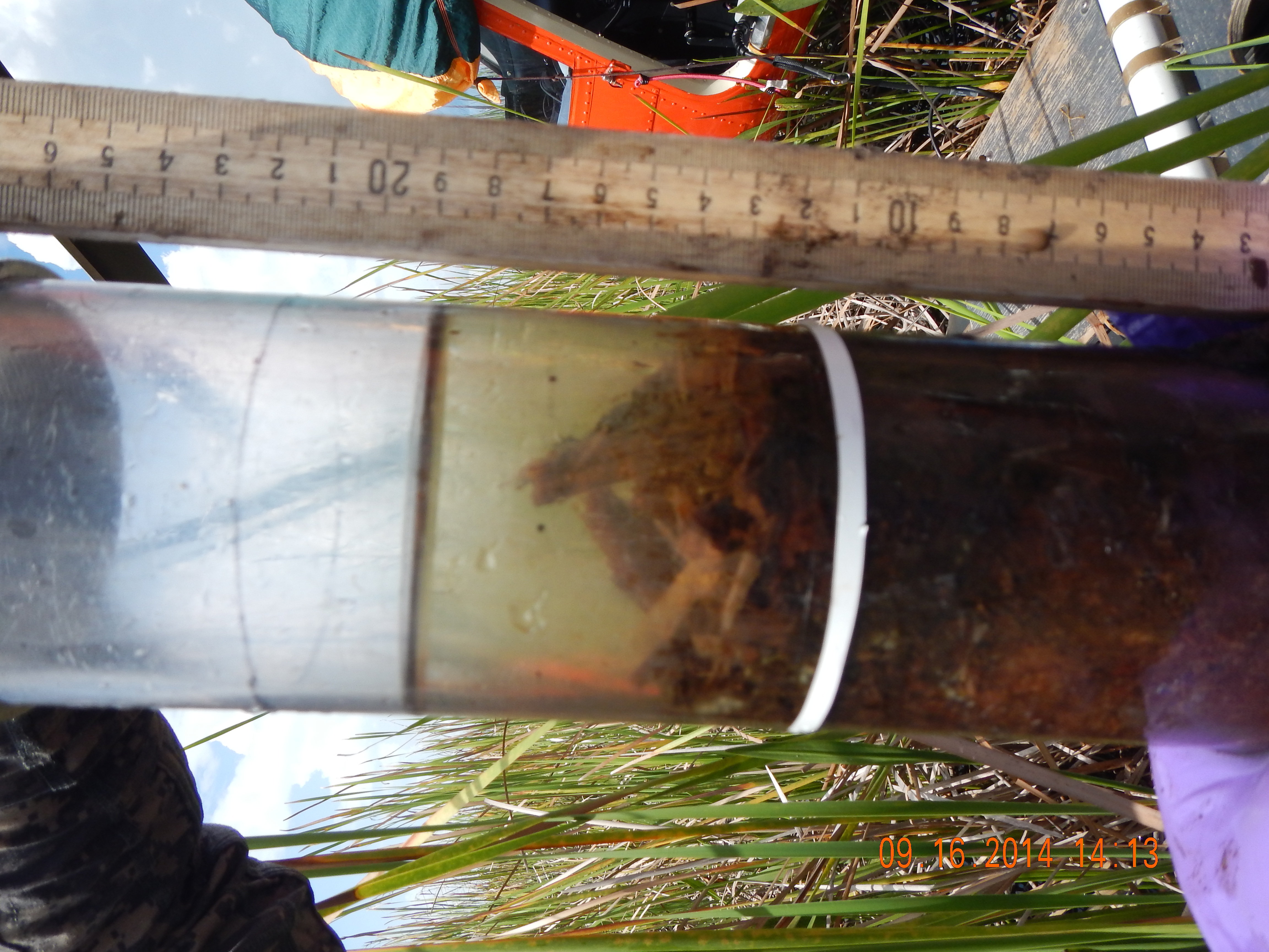
| ASHFCFS | 190000 | mg/kg | | FIU Soil/Sediment Biogeochemistry Laboratory | Ash in dry samples, floc, after ashing at 550 C, mg/kg, (FIU Soil/Sediment Biogeochemistry Lab) |
| ASHSDFS | 540000 | mg/kg | | FIU Soil/Sediment Biogeochemistry Laboratory | Ash in dry samples, soil, after ashing at 550 C, mg/kg, (FIU Soil/Sediment Biogeochemistry Lab) |
| ASHSDFSP | 54 | % | | FIU Soil/Sediment Biogeochemistry Laboratory | Ash in dry samples, soil, after ashing at 550 C, percent, (FIU Soil/Sediment Biogeochemistry Lab) |
| BDFCFS | 0.02 | g/cc | | FIU Soil/Sediment Biogeochemistry Laboratory | Bulk Density of floc, g/cc dry weight (FIU Soil/Sediment Biogeochemistry Laboratory) |
| BDSDFS | 0.11 | g/cc | | FIU Soil/Sediment Biogeochemistry Laboratory | Bulk Density of soil, g/cc dry weight (FIU Soil/Sediment Biogeochemistry Laboratory) |
| CHLAFCFB | 700 | mg/kg | | FIU nutrient analysis laboratory | Chlorophyll a in floc, mg/kg dry weight (FIU Nutrient Analysis Lab) |
| CHLASWFB | 4 | ug/L | | FIU nutrient analysis laboratory | Chlorophyll a in surface water, ug/L (FIU Nutrient Analysis Lab); MRL= 0.1 ug/L |
| CHLAVOL | 140 | ML | | | volume of surface water filtered for chlorophyll-a analysis, ml |
| CLSWEA | 46 | mg/L | | | Chloride in surface water, mg/L (EPA SESD); MRL=0.1 mg/L |
| FNH4SWFB | 0.014 | mg/L | J,Q-2 | FIU nutrient analysis laboratory | Filtered Ammonia in surface water, mg/L (FIU Nutrient Analysis Lab); MRL = 0.0031mg/L; PQL = 0.0140 mg/L |
| FNNSWFB | 0.0023 | mg/L | J,Q-2 | FIU nutrient analysis laboratory | Filtered Nitrite + Nitrate in surface water, mg/L (FIU Nutrient Analysis Lab) |
| FNO2SWFB | 0.0014 | mg/L | J,Q-2 | FIU nutrient analysis laboratory | Filtered Nitrite in surface water, mg/L (FIU Nutrient Analysis Lab) |
| FNO3SWFB | 0.0009 | mg/L | J, CV | FIU nutrient analysis laboratory | Filtered Nitrate in surface water, mg/L (FIU Nutrient Analysis Lab) |
| H2OFCFS | 98 | % | | FIU Soil/Sediment Biogeochemistry Laboratory | Water content of floc as percentage of wet weight (FIU Soil/Sediment Biogeochemistry Lab) |
| H2OSDFS | 87 | % | | | Water content of soil as percentage of wet weight (FIU Soil/Sediment Biogeochemistry Lab) |
| H2SBWEE | 0.37 | mg/L | | | Bottom water sulfide, mg/L, HACH method 8131 (EPA SESD Contractor) |
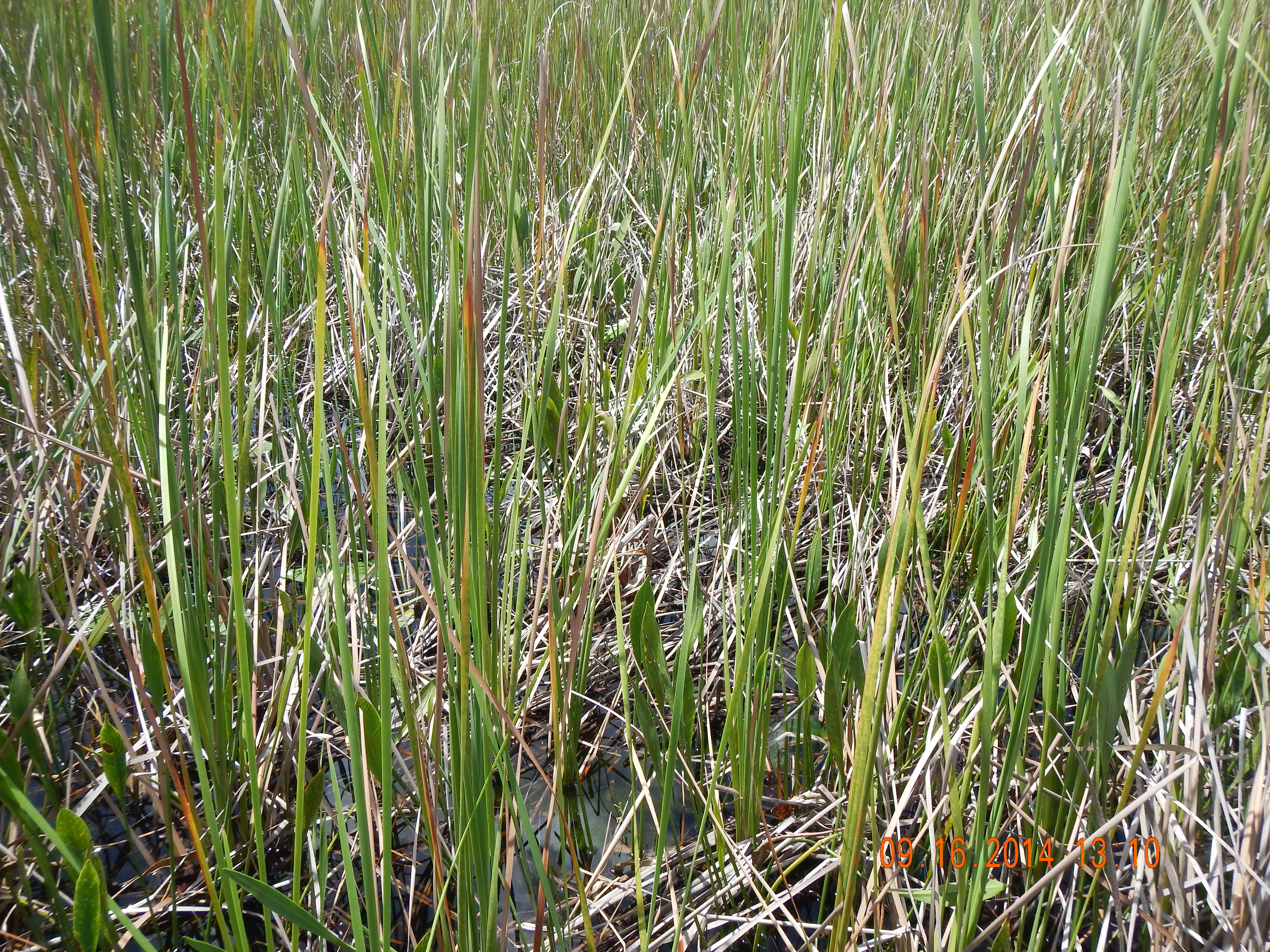
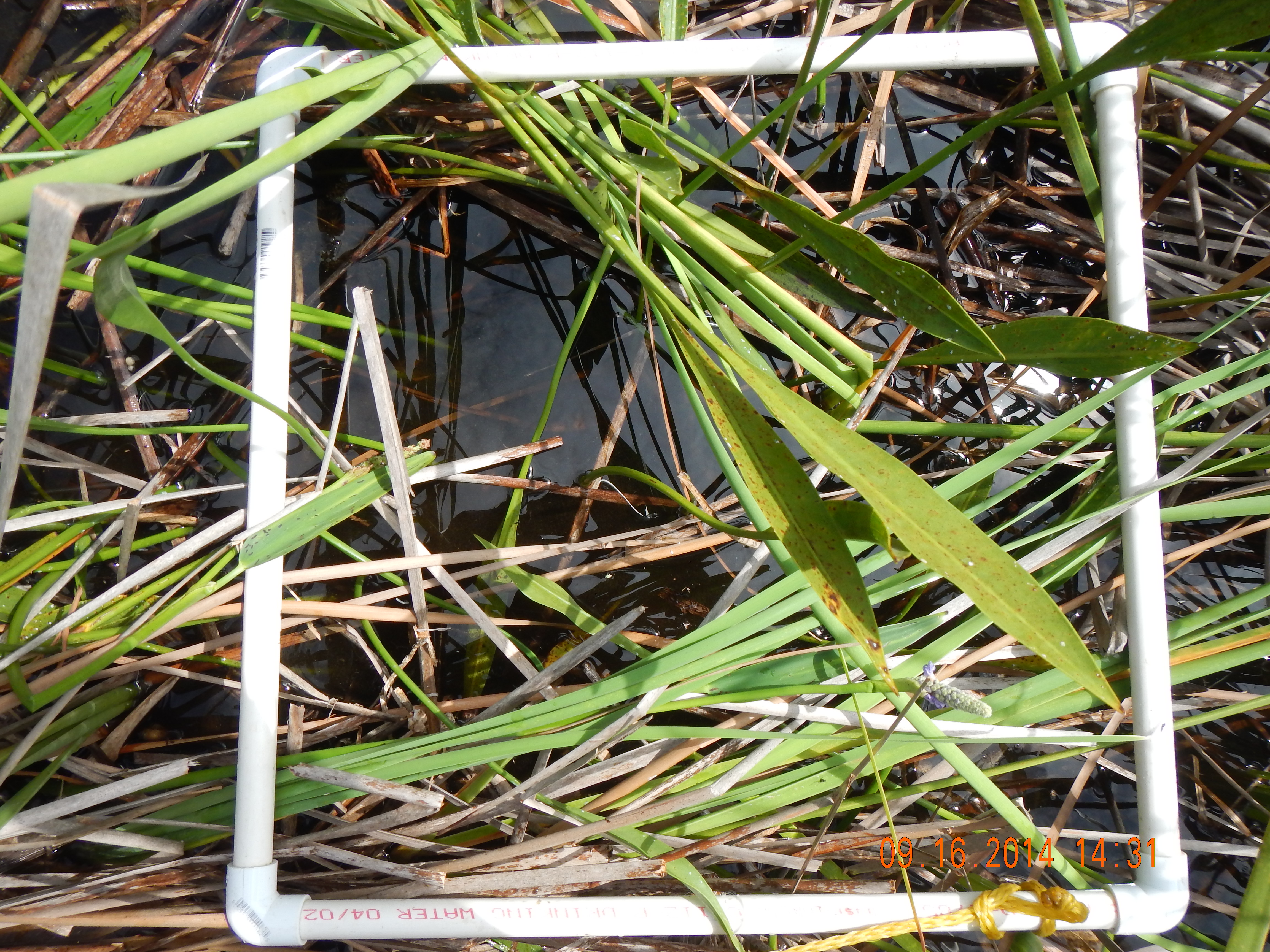
| LEAF_COLL | N | Y/N | | | sawgrass leaves collected for carbon, nitrogen and phosphorus analysis (Y/N) |
| MEHGFCFC | 0.64 | ng/g | | FIU mercury analytical laboratory | Methyl Mercury in floc, ng/g (FIU Mercury Lab); 2014 MDL=0.04 ng/g; MRL = 0.12 ng/g; results reported as dry weight |
| MEHGSDFC | 0.5 | ng/g | | FIU mercury analytical laboratory | Methyl Mercury in soil, ng/g (FIU Mercury Lab); 2014 MDL=0.04 ng/g; MRL= 0.12 ng/g; results reported as dry weight |
| MEHGSWFC | 0.084 | ng/L | U,B-4 | FIU mercury analytical laboratory | Methyl Mercury in surface water, ng/L (FIU Mercury Lab); MDL=0.02 ng/L; PQL=0.06 ng/L |
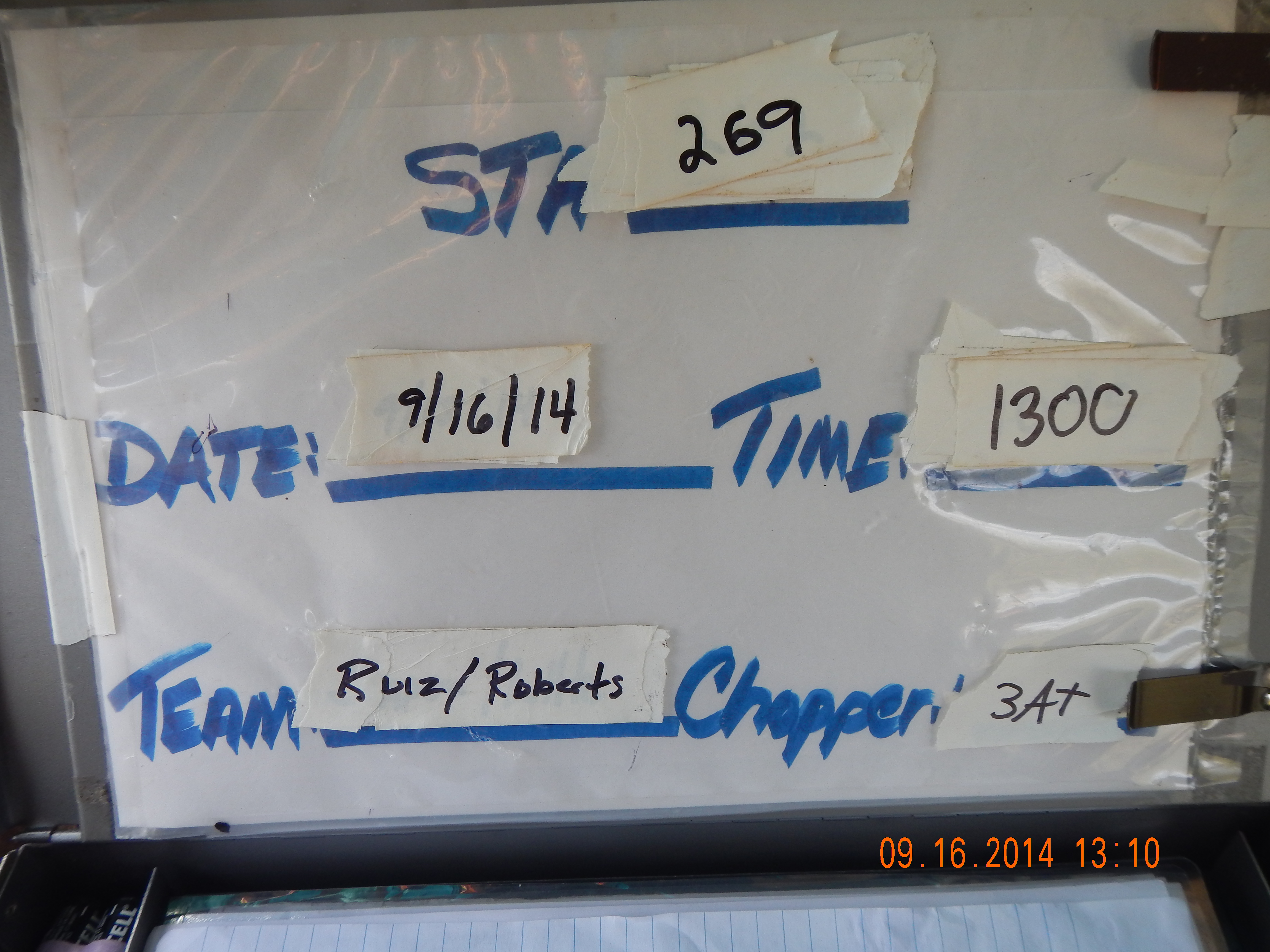
| ORPDEPTH | 1.7 | FEET | | | Depth of the YSI sonde redox potential probe, feet |
| pHFCFS | 7.75 | std units | | FIU Soil/Sediment Biogeochemistry Laboratory | pH in floc as measured in 1:1 (gram wet soil: g distilled de-ionized water) soil slurry (FIU Soil/Sediment Biogeochemistry Lab) |
| pHSDFS | 7.9 | std units | | FIU Soil/Sediment Biogeochemistry Laboratory | ex situ soil pH, std units, as measured in 1:1 (gram wet weight soil:gram de-ionized distilled water) soil slurry (FIU Soil/Sediment Biogeochemistry Laboratory) |
| SO4SWEA | 13 | mg/L | | | Sulfate in surface water, mg/L (EPA SESD); MRL=0.02 mg/L |
| SRPSWFB | 0.9 | ug/L | U,MDL-U | FIU nutrient analysis laboratory | Soluble Reactive Phosphorus in surface water,ug/L (FIU Nutrient Analysis Lab) |
| TCFCFS | 420 | mg/g | | FIU Soil/Sediment Biogeochemistry Laboratory | Total Carbon in floc, milligrams per gram dry weight (FIU Soil/Sediment Biogeochemistry Laboratory) |
| TCSDFS | 270 | mg/g | | FIU Soil/Sediment Biogeochemistry Laboratory | Total Carbon in soil, mg per gram dry weight (FIU Soil/Sediment Biogeochemistry Laboratory) |
| TEMP | 29.62 | C | | | in situ surface water temperature, YSI sonde, degrees C |
| THGFCFC | 84 | ng/g | | FIU mercury analytical laboratory | Total Mercury in floc, ng/g (FIU Mercury Lab) |
| THGFSFC | 22 | ng/g | | FIU mercury analytical laboratory | Total Mercury in mosquitofish (Gambusia affinis), ug/kg (FIU Mercury Lab); MDL = 3.2 ug/kg; MRL = 9.6 ug/kg; reported as wet weight, composite of up to seven fish |
| THGSDFC | 100 | ng/g | | FIU mercury analytical laboratory | Total Mercury in soil, ng/g (FIU Mercury Lab), MDL = 2.4 ng/g, MRL = 7.2 ng/g |
| THGSWFC | 1.7 | ng/L | | FIU mercury analytical laboratory | Total Mercury in surface water, ng/L (FIU Mercury Lab); MDL = 0.2 ng/L; PQL = 0.5 ng/L |
| TNFCFS | 34 | mg/g | | FIU Soil/Sediment Biogeochemistry Laboratory | Total Nitrogen in floc, mg per g dry weight (FIU Soil/Sediment Biogeochemistry Laboratory) |
| TNSDFS | 18 | mg/g | | FIU Soil/Sediment Biogeochemistry Laboratory | Total Nitrogen in soil, mg per g dry weight (FIU Soil/Sediment Biogeochemistry Laboratory) |
| TNSWFB | 0.6 | mg/L | | FIU nutrient analysis laboratory | Total Nitrogen in surface water, mg/L (FIU Nutrient Analysis Lab) |
| TOCSWEA | 18 | mg/L | | | Total organic carbon in surface water, mg/L (EPA SESD) |
| TPFCFB | 1200 | mg/kg | | FIU nutrient analysis laboratory | Total Phosphorus in floc, mg/kg dry weight (FIU Nutrient Analysis Lab) |
| TPSDFB | 580 | ug/g | | FIU nutrient analysis laboratory | Total Phosphorus in soil, ug/g (FIU Nutrient Analysis Lab) |
| TPSWFB | 11 | ug/L | | FIU nutrient analysis laboratory | Total Phosphorus in surface water, ug/L (FIU Nutrient Analysis Laboratory) |