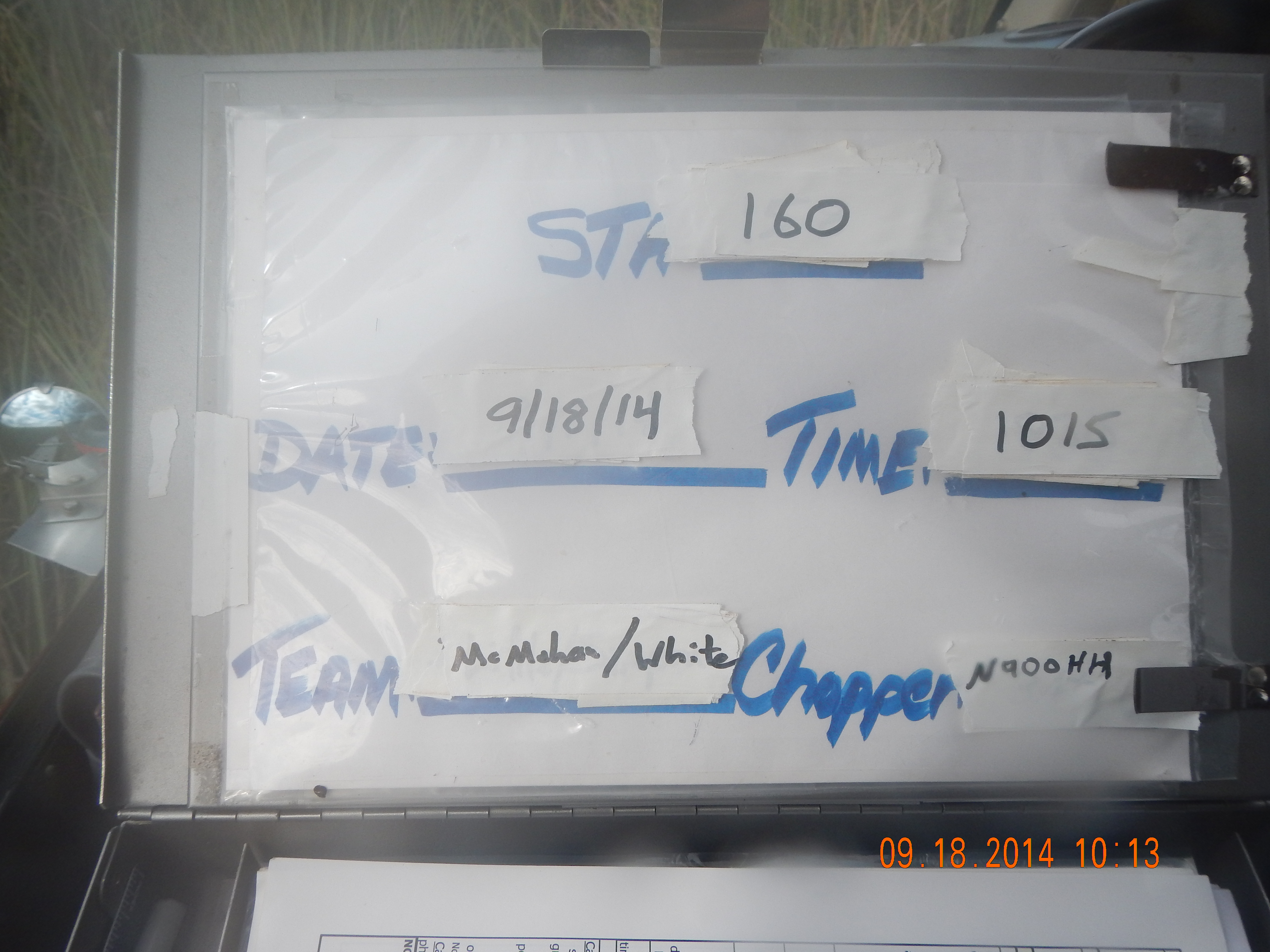
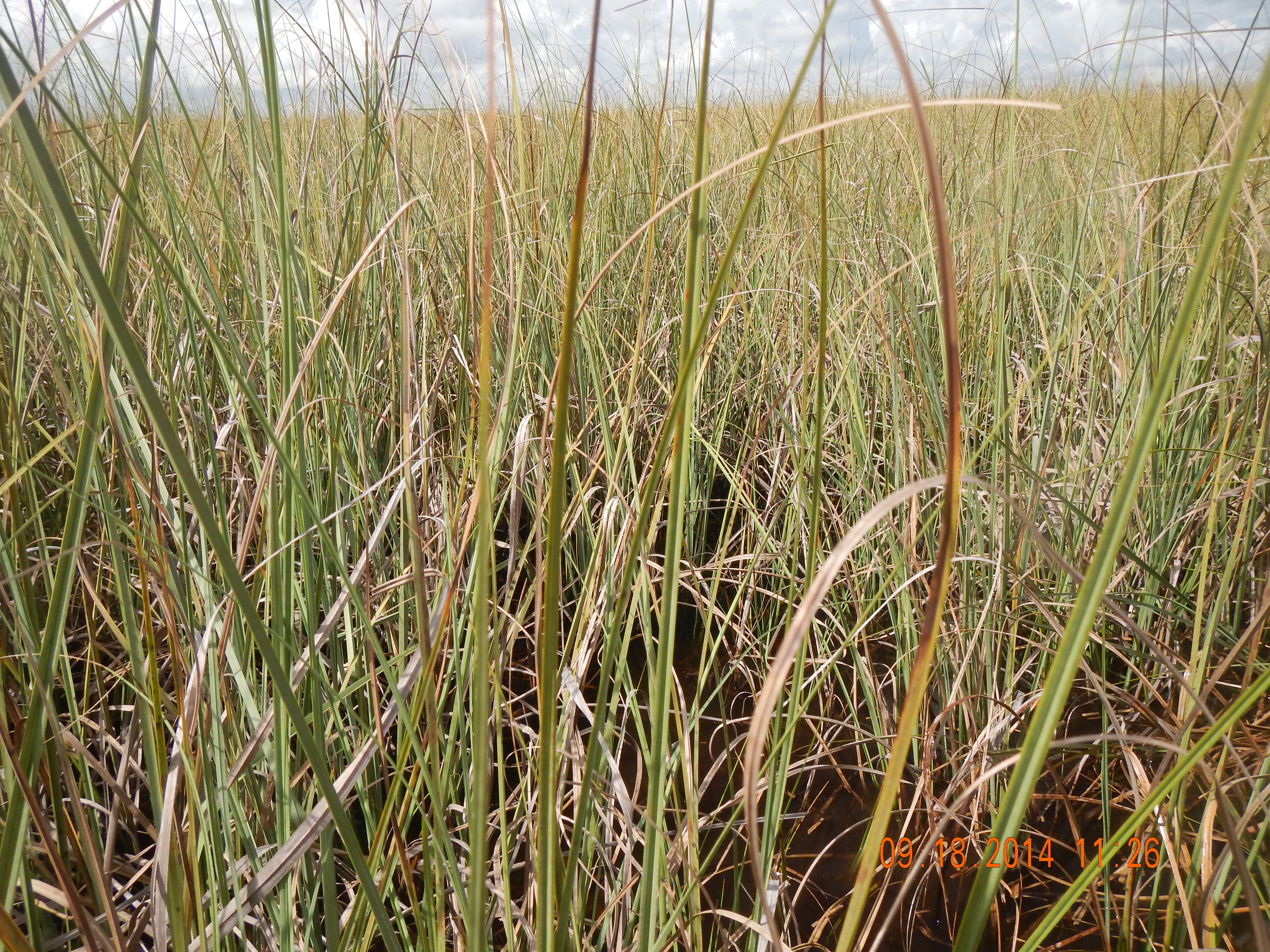
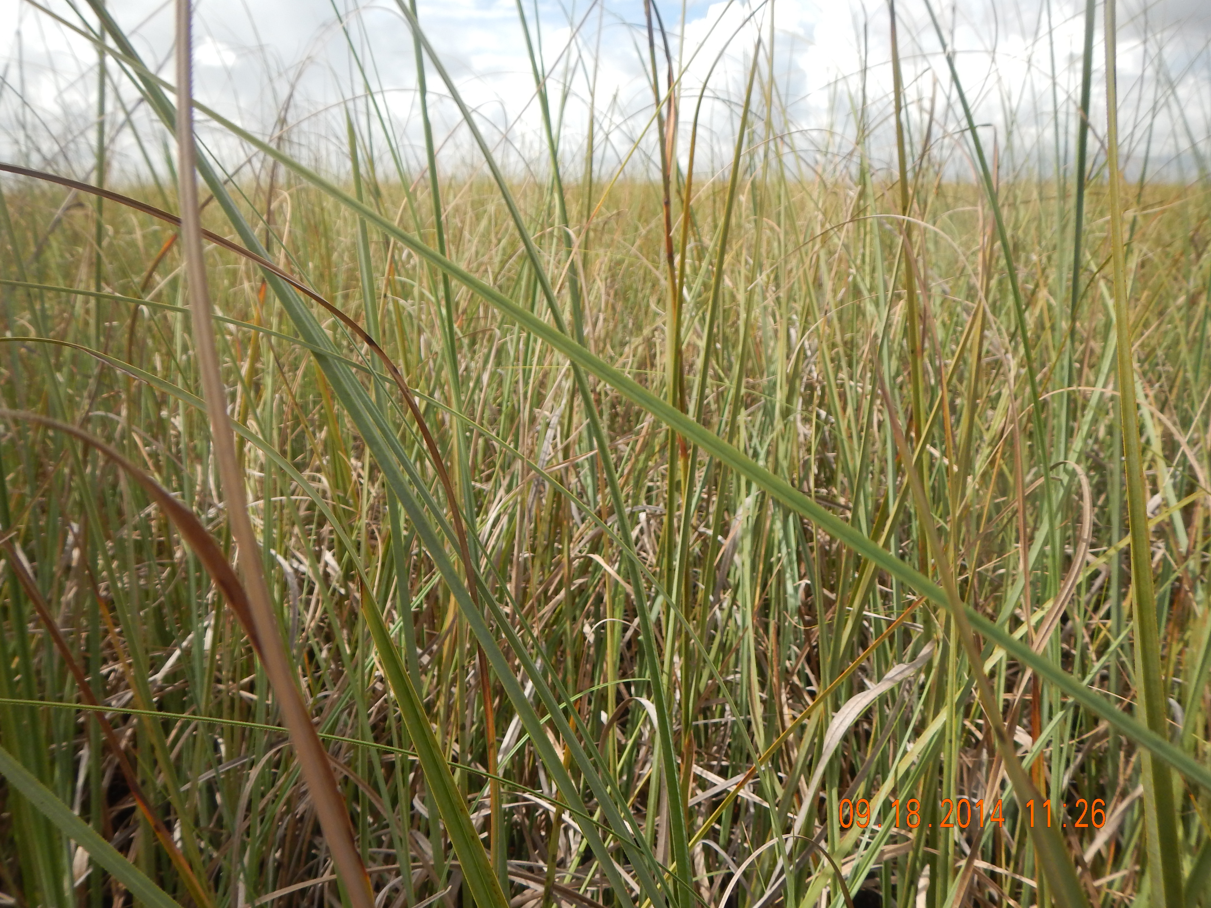
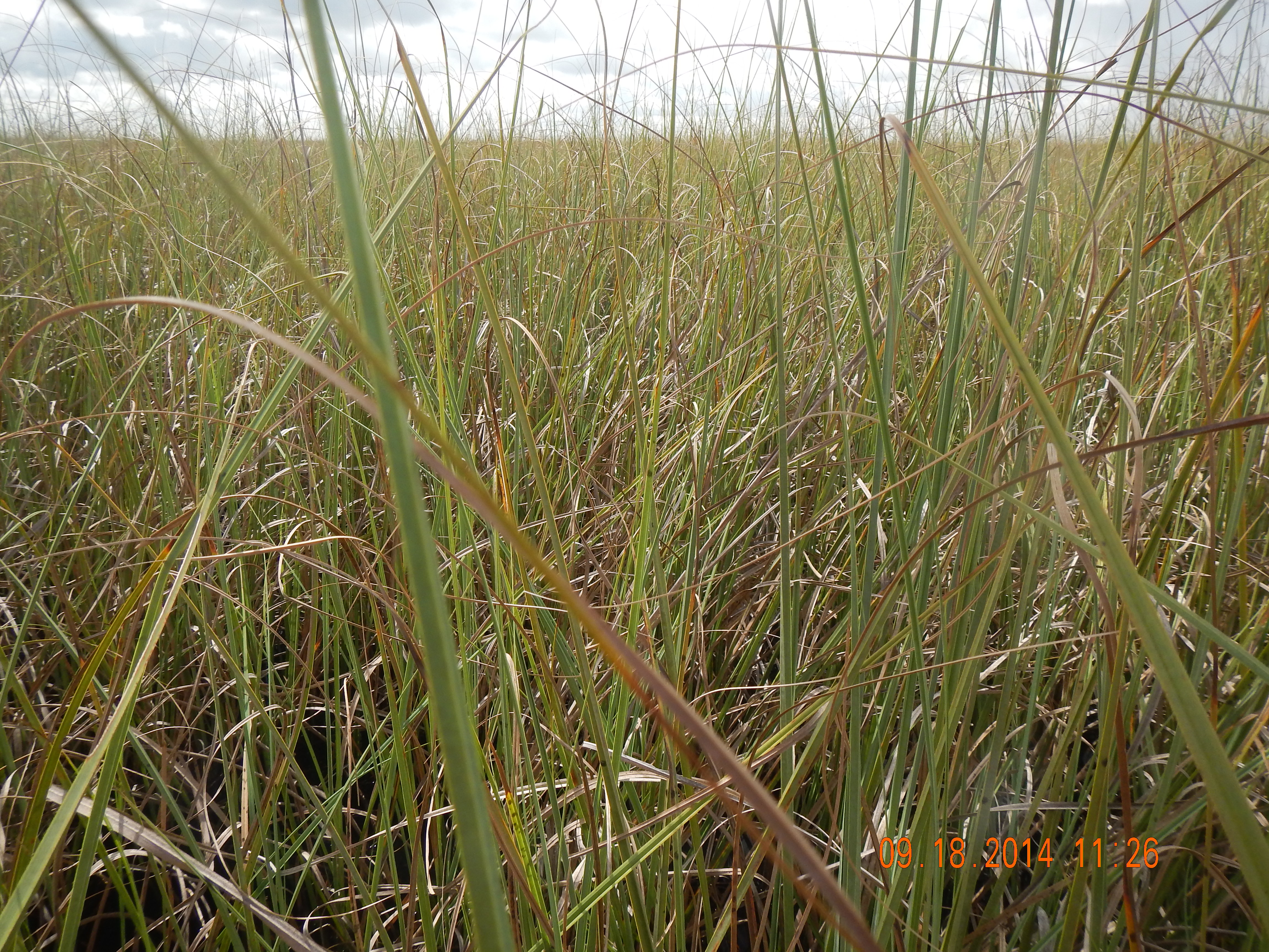
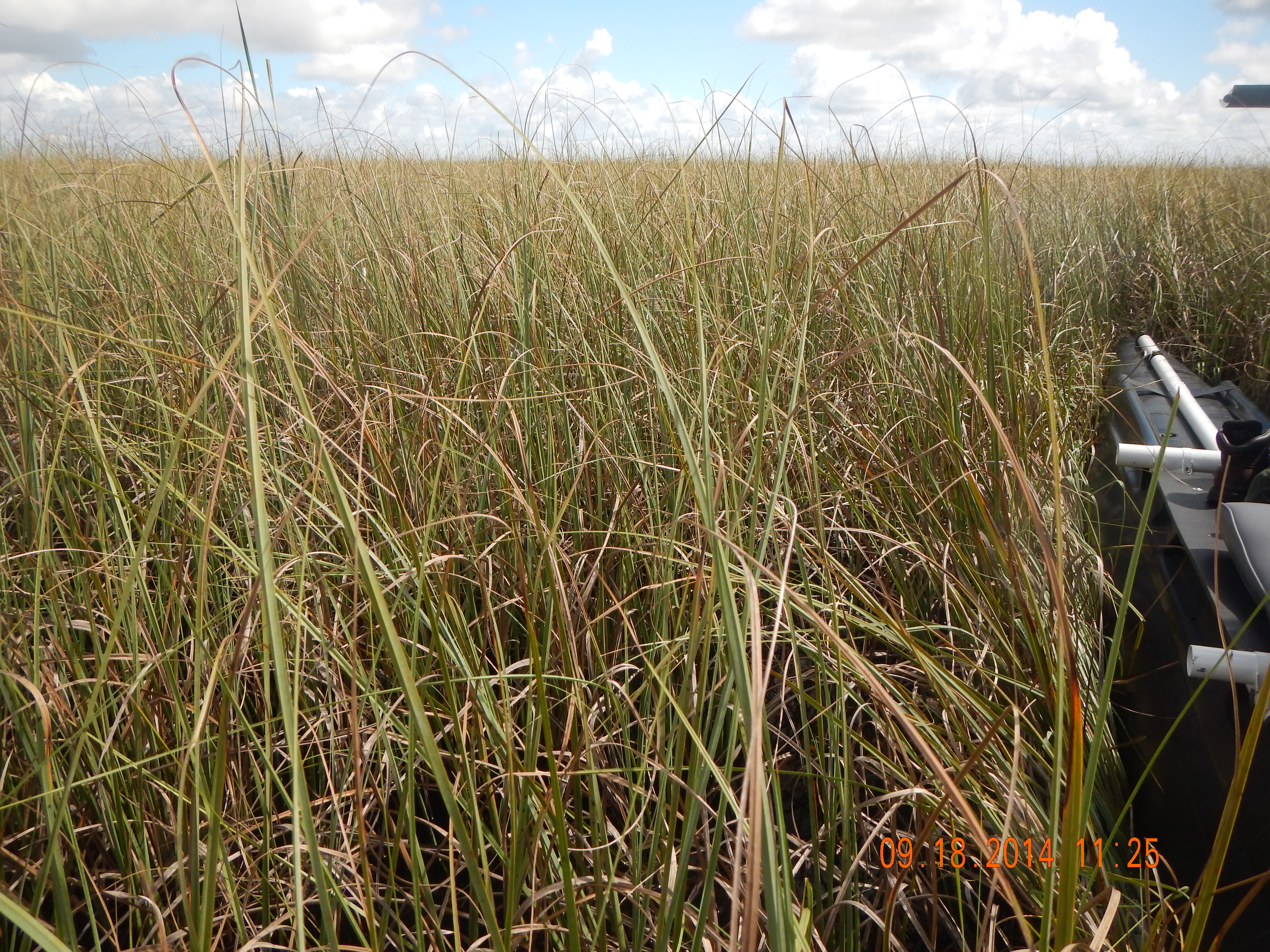
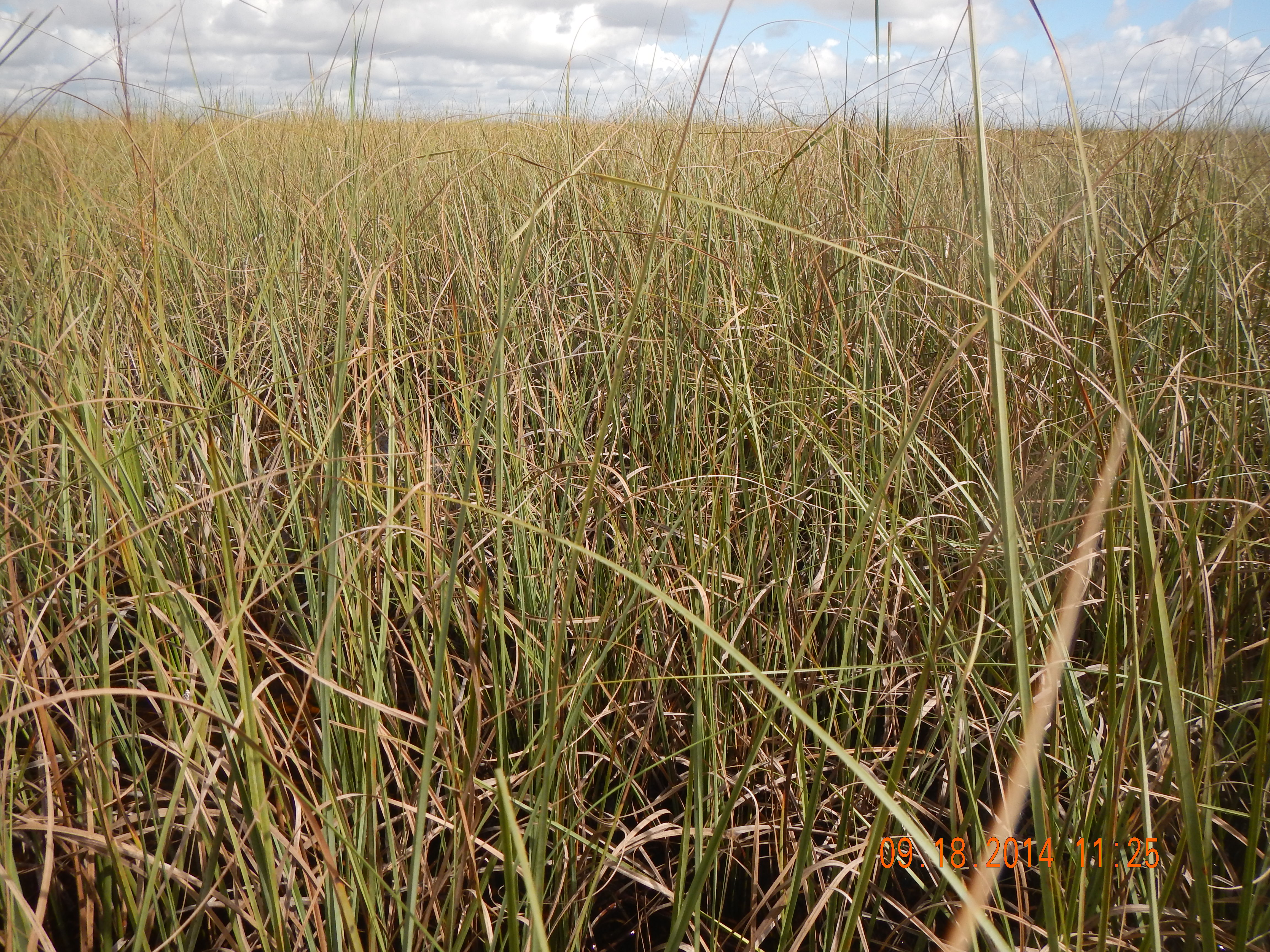
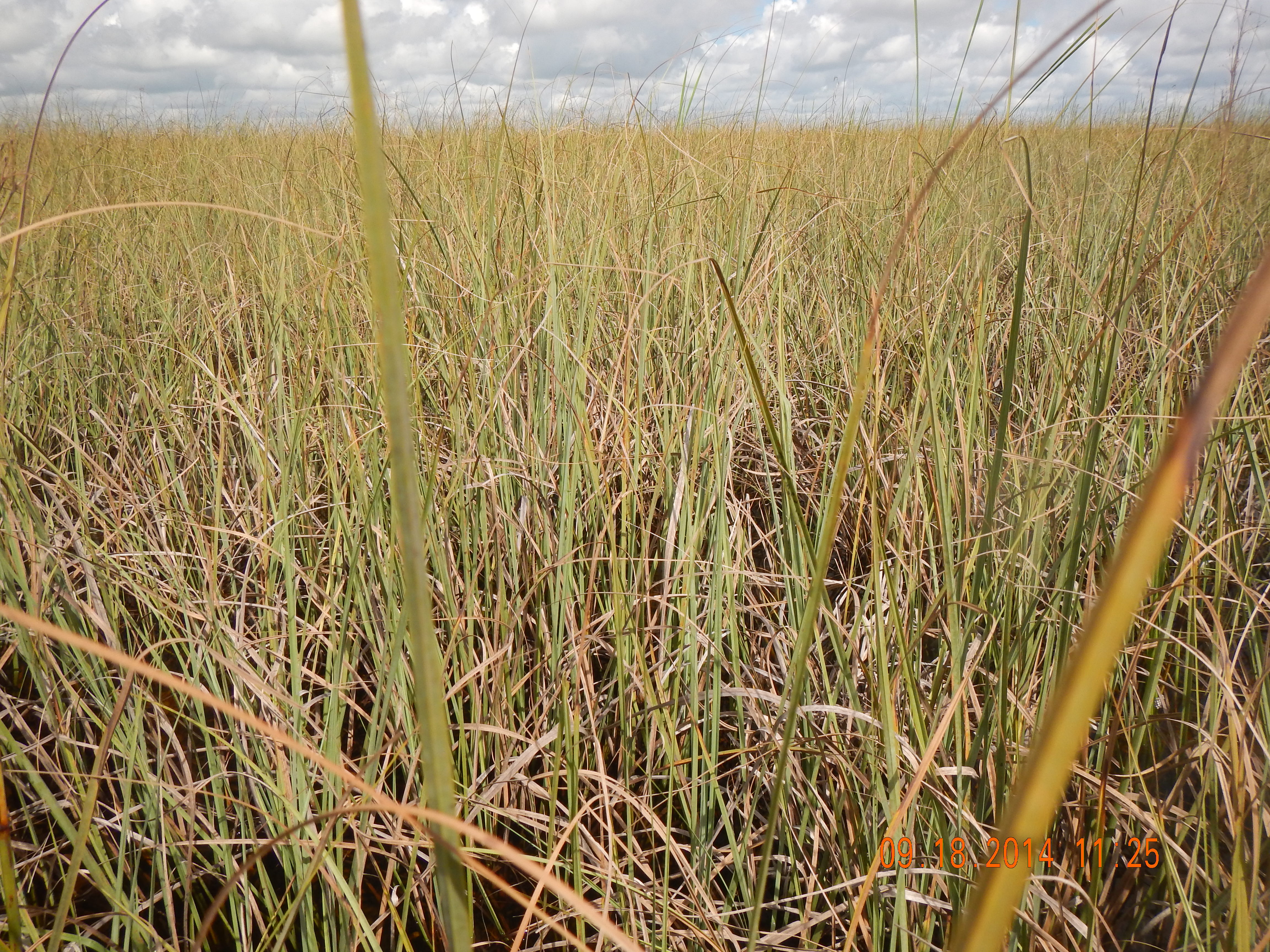
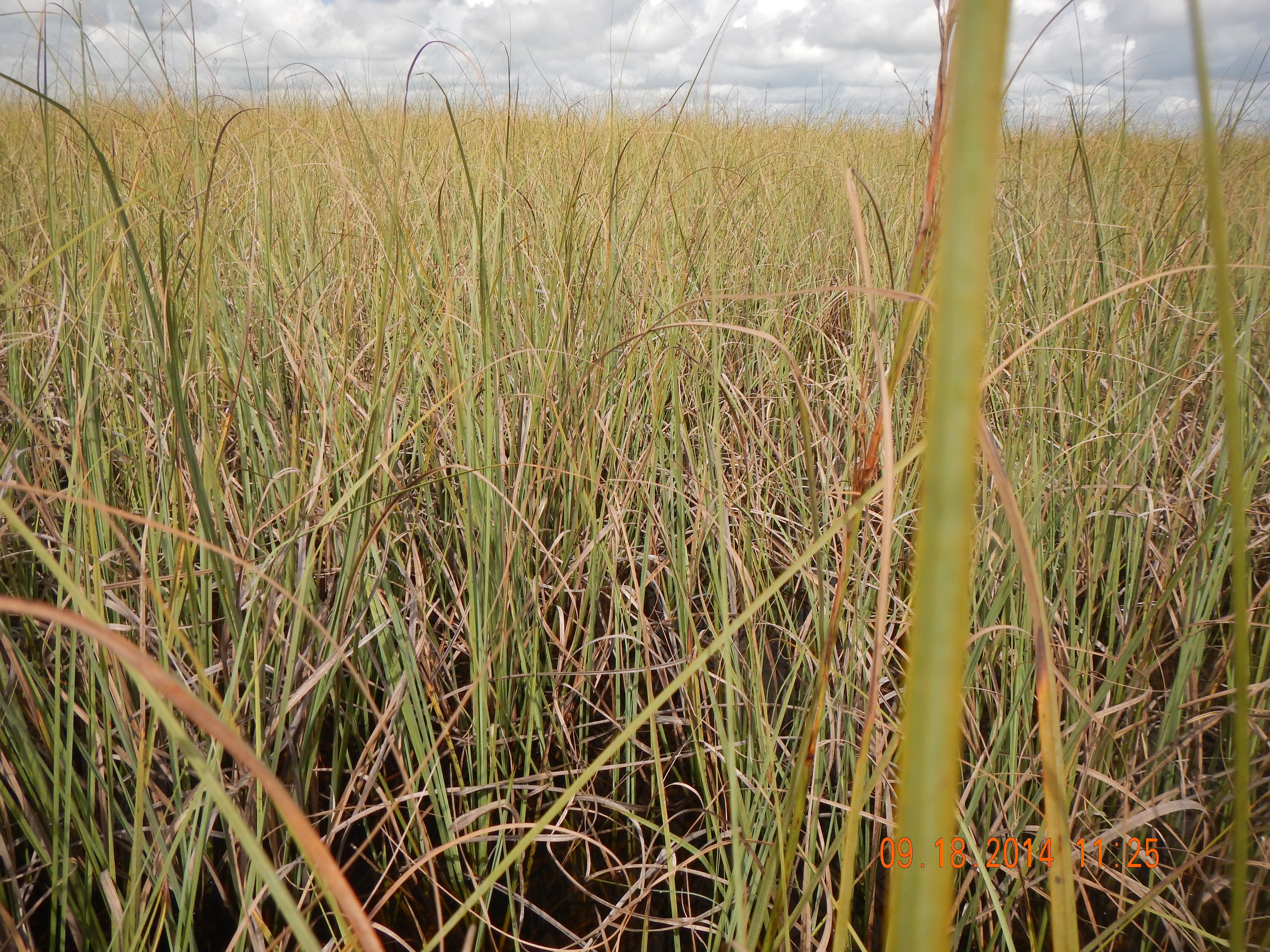
Station: 160
Sub Area: WCA2
| BioChem Date: 2014-09-18 | |
| BioChem Crew: GW/JLM |
| Location | |
|---|---|
| Latitude | 26.42739059 |
| Longitude | -80.41828975 |
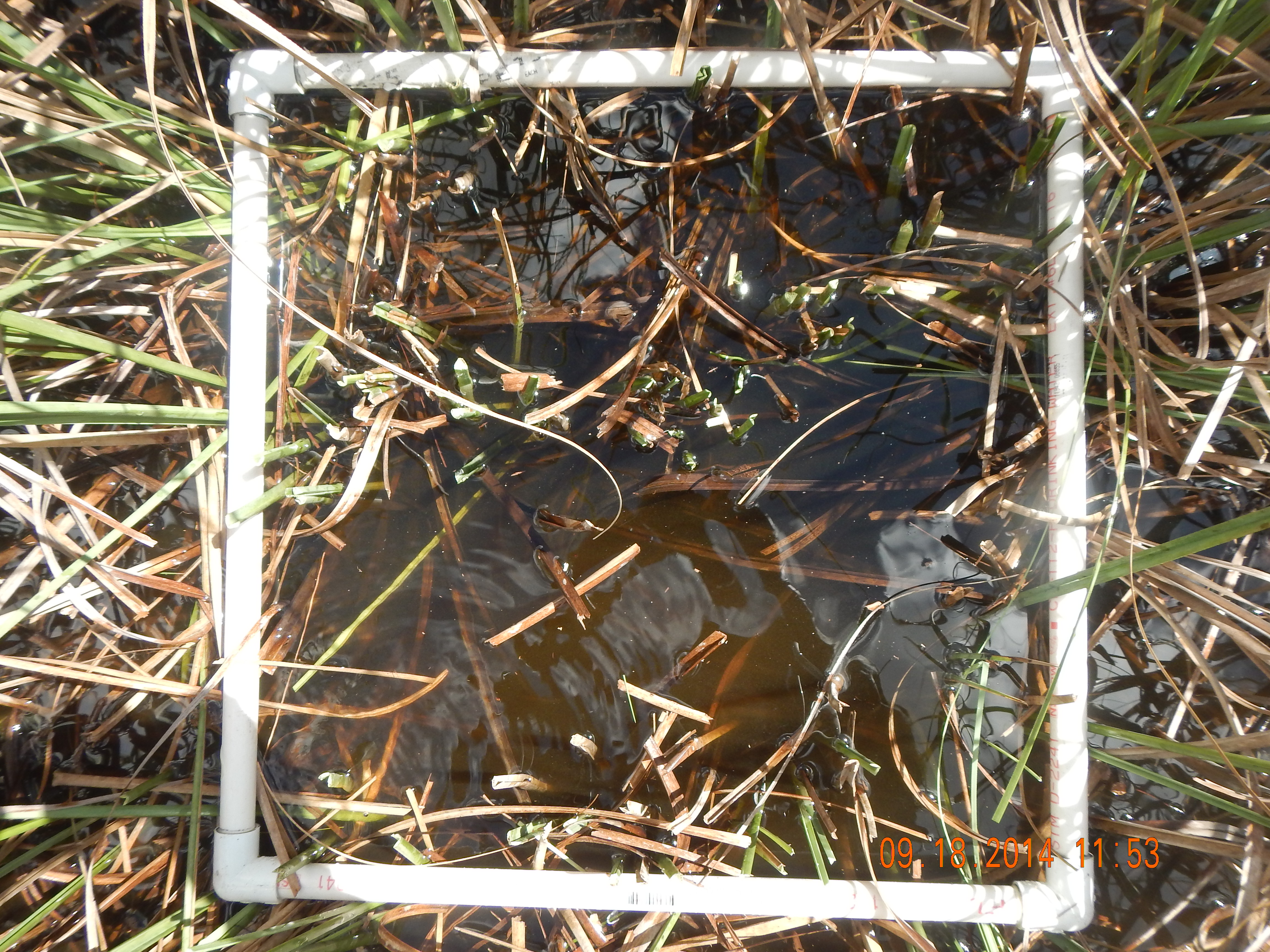
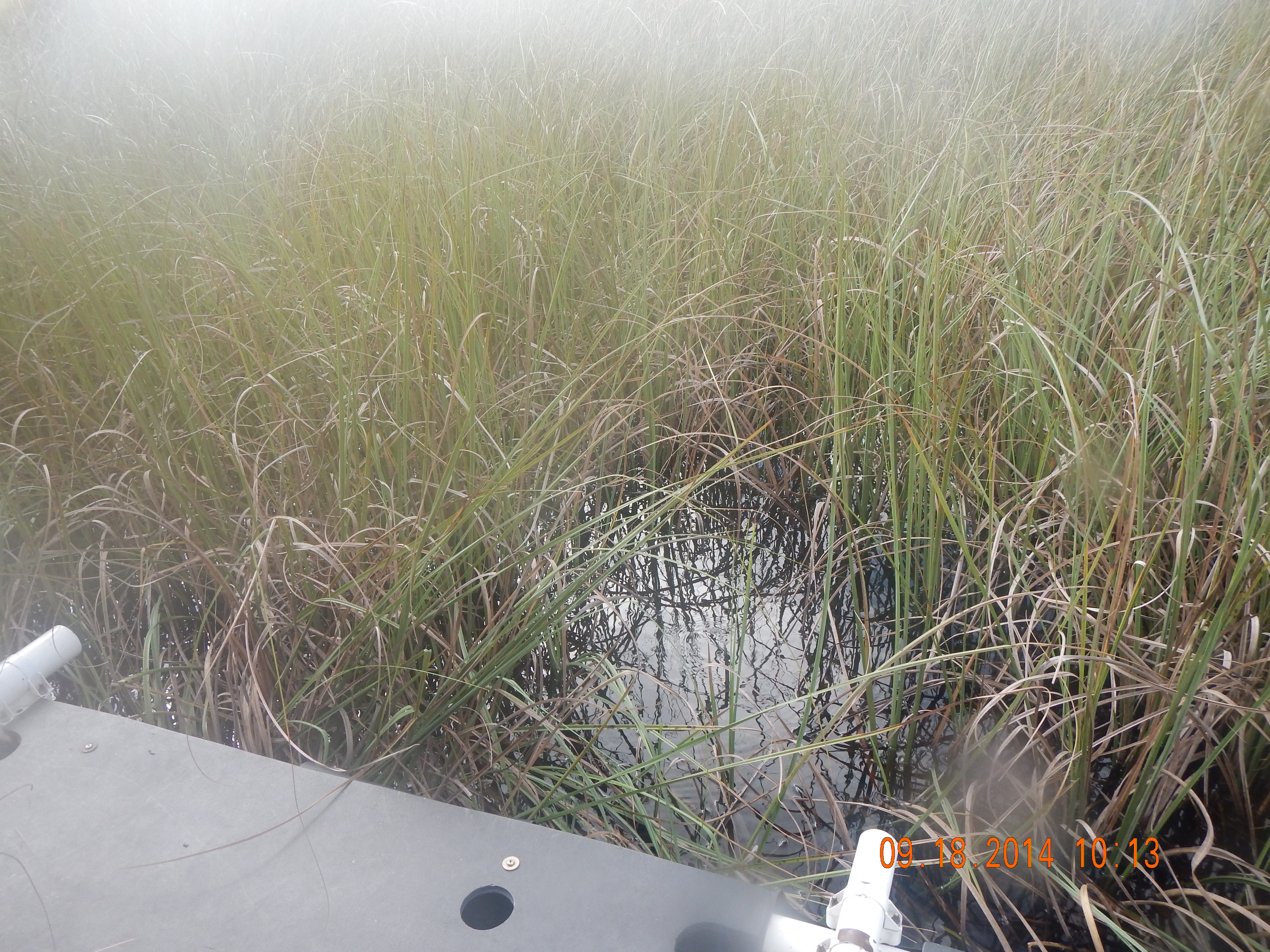
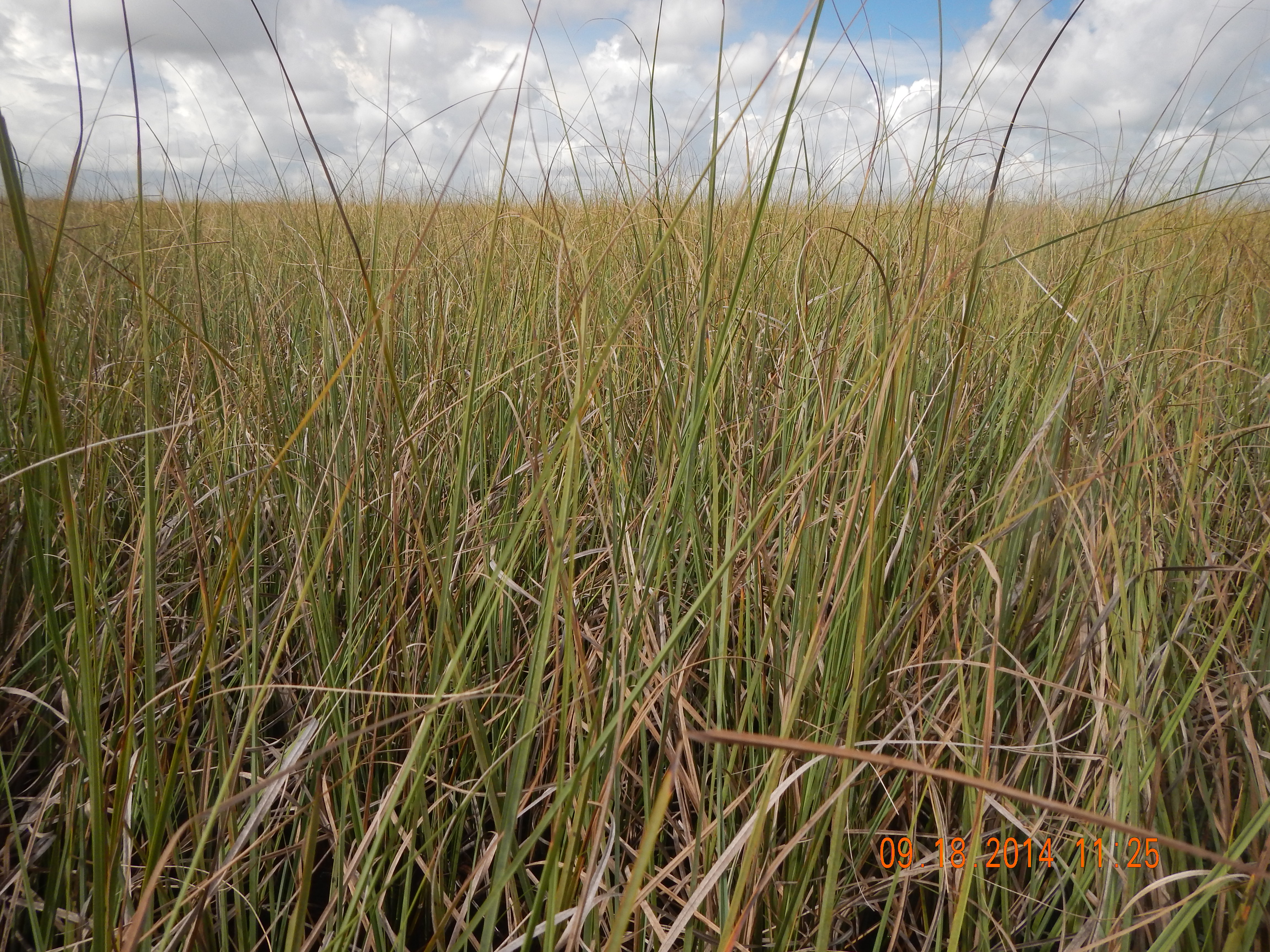
NOTES: Soil cores were attempted aprroximately 20 times. Each time, only rhizomous/root material was obtained. No actual soil above 10 cm. 20 cm soil coring was attempted but still only root like material. Soil cores werent collected as such. Benthic periphyton was never observed. Correction to periphyton in logbook: Periphyton was collected from proximity of periquadrat which included sweater and floating periphyton. PC sample comprised of sweaters and floating periphyton . 120 ml collected. Periquadrat did not contain periphyton, only very dense sawgrass. Approximately 10-15% cover in areas surrounding the periquadrat, within station. While searching for soil cores, no floc was observed in any of the core attempts.
Basic
| Item | Value | Description |
|---|---|---|
| AIR_DEP | Y | Mercury air deposition water sample field blank site (Y/N) |
| BIOVOLUME | 120 | Periphyton within water column (floating and sweaters) harvested from 0.25 square meter quadrat, measured in graduated cylinder, mL |
| CAMERA_A | S49551 | EPA property number of digital camera used for field documentation of habitat and soil core |
| CAMERA_B | S15996 | EPA property number of digital camera used for field documentation of habitat and soil core |
| CATTAIL | Y | Cattail present at the station, based on visual observation, Y/N |
| CHAMBER | 3 | EPA unit number for the surface water sampling chamber |
| CHOPPER | N900HH | number of helicopter and associated sampling equipment and supply cache |
| COND | 709 | in situ surface water specific conductance, YSI sonde, umhos/cm |
| CYCLE | 11 | sampling cycle number |
| DEVICE | Q | Device used for biovolume estimate, trash can T (area 0.062 square meters) or quadrat Q (area 0.25 square meters) |
| DO | 2.01 | in situ surface water dissolved oxygen, YSI sonde, mg/L |
| DOCSWEA | 25 | Dissolved organic carbon in surface water, mg/L (EPA SESD) |
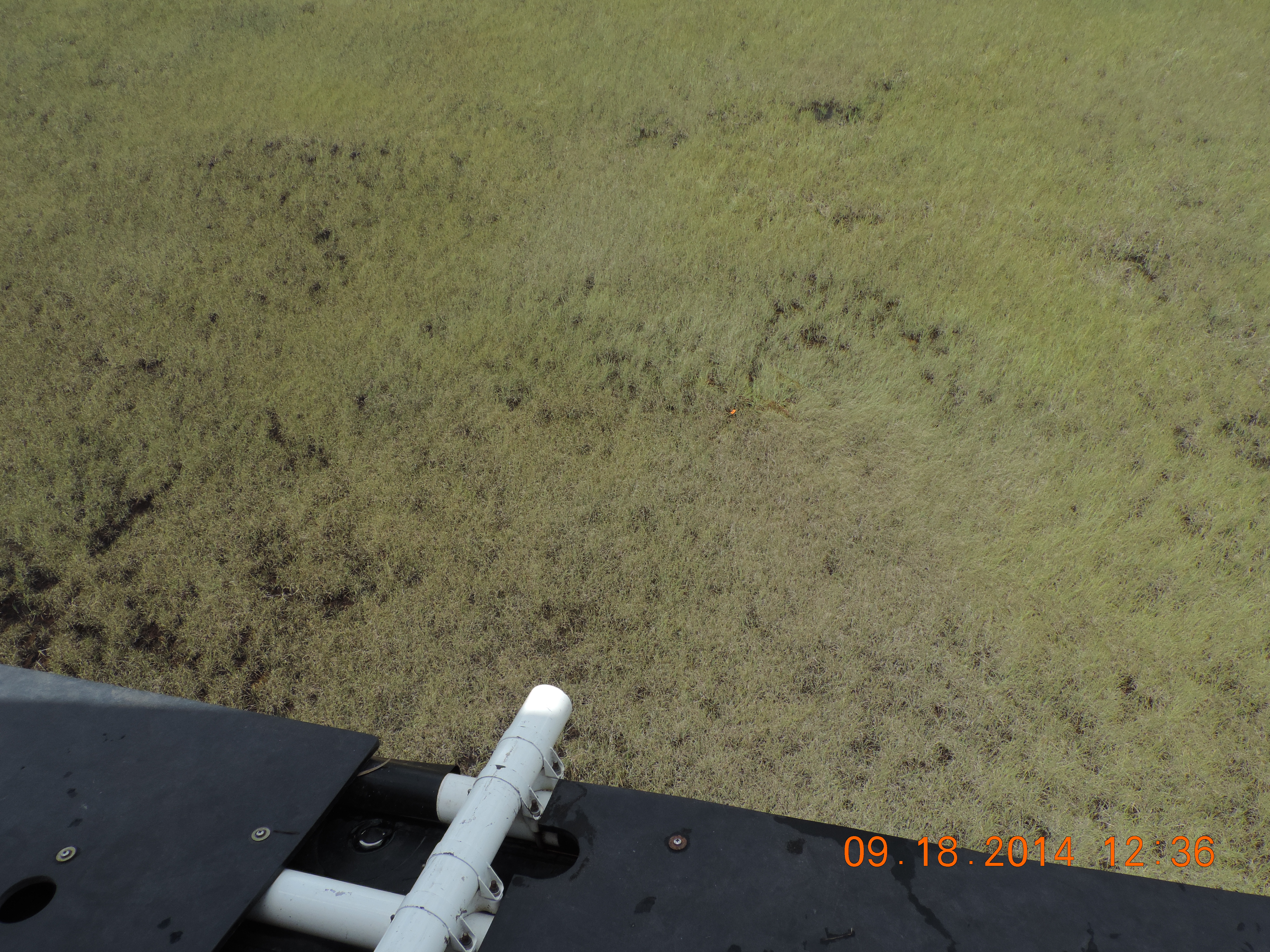
| DOMINANT_MACRO | sawgrass | Dominant macrophyte at station based on visual observation |
| DUPE | Y | Field duplicate station (Y/N) |
| FISHNUM | 20 | number of mosquitofish collected for Hg analysis |
| FLOC_or_FILM | N | biofilm or floc presence within 0.25 square meter quadrat (Y/N) |
| FLOCCOLPOR | ALL | Portion of floc collected from core; none, part or all |
| FLOCCONTB | 0 | number of storemore bottles used for floc collection |
| FLOCCONTT | 0 | number of tubs used for floc collection |
| FLOW | 3 | description of surface water flow at sampling site, based on visual observation: 1=sheetflow, 2=isolated pool (no flow), 3=uncertain |
| GARMIN | S49553 | Garmin Global Positioning System EPA property number, used for navigation to the station |
| GREEN_AL | N | green algae presence in 0.25 square meter quadrat (Y/N) |
| LOCATION | NOMINAL | sampled within 5 meters of GPS coordinates = nominal; 5-20 meters = shifted; >20 meters = station rejected; |
| LOGBOOK | 4 | Field logbook number |
| ORP | 97.6 | Redox potential from YSI sonde, mV |
| PB_PERISM | N | benthic periphyton (soil mat) presence in 0.25 square meter quadrat (Y/N) |
| PE_PERISW | N | epiphytic (sweaters) periphyton presence in 0.25 square meter quadrat (Y/N) |
| PERI | 0 | Total percent cover of periphyton within 0.25 square meter quadrat, covered by all periphyton (PE, PB, PF) if 3-dimensional quadrat volume was compressed into a 2-dimensional plane |
| PF_PERIF | N | floating periphyton presence in 0.25 square meter quadrat (Y/N) |
| pH | 7.16 | in situ surface water pH, YSI sonde, std units |
| PILOT | JORGE GOMES | Helicopter pilot |
| PLANT_COLL | N | whole sawgrass plant collected for mercury analysis? (Y/N) |
| SOILTYPE | 6 | soil type categories, by visual observation of core: 1=peat, 2=peat layers, 3=marl, 4=marl layers, 5=sand, 6=other, 7=peat over marl, 8=marl over peat, 9=marl+peat mixed |
| TIME_LANDING | 10:15:00 | Helicopter landing time at station |
| TIME_SAMPLE | 10:30:00 | Water sample collection time |
| TIME_TAKE_OFF | 12:35:00 | Helicopter departure time from station |
| TRIMBLE | A77114 | Trimble Global Positioning System EPA property number, used to determine final station coordinates, taken at the centroid of the soil core collection locations |
| TRIMBLE_FILE_NAME | 4091811A | File name logged at the station by the Trimble unit |
| TRIMBLE_LONG | 80.41828975 | Longitude, decimal degrees, from Trimble, post-processed |
| TURB | 0.1 | in situ surface water turbidity, YSI sonde, NTU |
| VEGTYPE | 2 | plant community observed at sampling site: 1=wet prairie, 2=sawgrass marsh, 3=pond/gator hole, 4=cattail, 5=willow, 6=cypress, 7=brush, 8=other, 9=slough |
| WEATHER | 2 | weather conditions: 1=clear, 2=slightly overcast, 3=medium overcast, 4=very overcast, 5=drizzle, 6=rain |
| YSI_DEPTH | 6 | depth of deployment of probe array in surface water, inches |
| YSI_ID | 18 | EPA unit number for the YSI sonde |
| Item | Value 1 | Value 2 | Value 3 | Average | Units | Description |
|---|---|---|---|---|---|---|
| DEPBEDR | 10.3 | 10.25 | 10.55 | 10.37 | FEET | depth to bedrock, point of refusal with metal probe, feet |
| SOILTHI | 8.35 | 8.55 | 8.9 | 8.6 | FEET | soil thickness, feet, metal probe to point of refusal, calculated as difference between WATDEPTH and DEPBEDR |
| WATDEPTH | 1.95 | 1.7 | 1.65 | 1.77 | FEET | water depth, measured with probe, feet |
BioChemistry
| Item | Value | Units | Q | Protocol | Description |
|---|---|---|---|---|---|
| ASHPCFS | 140000 | mg/kg | FIU Soil/Sediment Biogeochemistry Laboratory | Ash in dry samples, composite epiphytic and floating periphyton, after ashing at 550 C, mg/kg, (FIU Soil/Sediment Biogeochemistry Lab) | |
| BDPCFS | 0.05 | g/cc | FIU Soil/Sediment Biogeochemistry Laboratory | Bulk Density of composite floating and epiphytic periphyton, g/cc dry weight (FIU Soil/Sediment Biogeochemistry Laboratory) | |
| CHLAPCFB | 1 | mg/kg | FIU nutrient analysis laboratory | Chlorophyll a in composite epiphytic and floating periphyton, mg/kg, dry weight (FIU Nutrient Analysis Lab) | |
| CHLASWFB | 1.3 | ug/L | FIU nutrient analysis laboratory | Chlorophyll a in surface water, ug/L (FIU Nutrient Analysis Lab); MRL= 0.1 ug/L | |
| CHLAVOL | 140 | ML | volume of surface water filtered for chlorophyll-a analysis, ml | ||
| CLSWEA | 84 | mg/L | Chloride in surface water, mg/L (EPA SESD); MRL=0.1 mg/L | ||
| FNH4SWFB | 0.007 | mg/L | J,Q-2 | FIU nutrient analysis laboratory | Filtered Ammonia in surface water, mg/L (FIU Nutrient Analysis Lab); MRL = 0.0031mg/L; PQL = 0.0140 mg/L |
| FNNSWFB | 0.002 | mg/L | J,Q-2 | FIU nutrient analysis laboratory | Filtered Nitrite + Nitrate in surface water, mg/L (FIU Nutrient Analysis Lab) |
| FNO2SWFB | 0.0015 | mg/L | J,Q-2 | FIU nutrient analysis laboratory | Filtered Nitrite in surface water, mg/L (FIU Nutrient Analysis Lab) |
| FNO3SWFB | 0.0005 | mg/L | J, CV | FIU nutrient analysis laboratory | Filtered Nitrate in surface water, mg/L (FIU Nutrient Analysis Lab) |
| H2OPCFS | 95 | % | FIU Soil/Sediment Biogeochemistry Laboratory | Water content of composite epiphytic and floating periphyton as percentage of wet weight (FIU Soil/Sediment Biogeochemistry Lab) | |
| H2SBWEE | 0.016 | mg/L | Bottom water sulfide, mg/L, HACH method 8131 (EPA SESD Contractor) | ||
| LEAF_COLL | N | Y/N | sawgrass leaves collected for carbon, nitrogen and phosphorus analysis (Y/N) | ||
| MEHGPCFC | 2 | ng/g | FIU mercury analytical laboratory | Methyl Mercury in composite epiphytic and floating periphyton, ng/g (FIU Mercury Lab) | |
| MEHGSWFC | 0.091 | ng/L | FIU mercury analytical laboratory | Methyl Mercury in surface water, ng/L (FIU Mercury Lab); MDL=0.02 ng/L; PQL=0.06 ng/L | |
| ORPDEPTH | 1.06 | FEET | Depth of the YSI sonde redox potential probe, feet | ||
| pHPCFS | 7.66 | std units | FIU Soil/Sediment Biogeochemistry Laboratory | pH in composite epiphytic and floating periphyton as measured in 1:1 (gram wet soil: g de-ionized distilled water) soil slurry (FIU Soil/Sediment Biogeochemistry Lab) | |
| SO4SWEA | 34 | mg/L | Sulfate in surface water, mg/L (EPA SESD); MRL=0.02 mg/L | ||
| SRPSWFB | 1.4 | ug/L | J,Q-2 | FIU nutrient analysis laboratory | Soluble Reactive Phosphorus in surface water,ug/L (FIU Nutrient Analysis Lab) |
| TCPCFS | 420 | mg/g | J,QM-4 | FIU Soil/Sediment Biogeochemistry Laboratory | Total Carbon in combined floating and epiphytic periphyton, mg per gram, dry weight (FIU Soil/Sediment Biogeochemistry Laboratory) |
| TEMP | 27.32 | C | in situ surface water temperature, YSI sonde, degrees C | ||
| THGFSFC | 120 | ng/g | FIU mercury analytical laboratory | Total Mercury in mosquitofish (Gambusia affinis), ug/kg (FIU Mercury Lab); MDL = 3.2 ug/kg; MRL = 9.6 ug/kg; reported as wet weight, composite of up to seven fish | |
| THGPCFC | 43 | ng/g | FIU mercury analytical laboratory | Total Mercury in composite epiphytic and floating periphyton, ng/g (FIU Mercury Lab) | |
| THGSWFC | 1.6 | ng/L | FIU mercury analytical laboratory | Total Mercury in surface water, ng/L (FIU Mercury Lab); MDL = 0.2 ng/L; PQL = 0.5 ng/L | |
| TNPCFS | 21 | mg/g | FIU Soil/Sediment Biogeochemistry Laboratory | Total Nitrogen in composite floating and epiphytic periphyton, mg per g, dry weight (FIU Soil/Sediment Biogeochemistry Laboratory) | |
| TNSWFB | 0.93 | mg/L | FIU nutrient analysis laboratory | Total Nitrogen in surface water, mg/L (FIU Nutrient Analysis Lab) | |
| TOCSWEA | 26 | mg/L | Total organic carbon in surface water, mg/L (EPA SESD) | ||
| TPPCFB | 330 | ug/g | FIU nutrient analysis laboratory | Total Phosphorus in composite floating and epiphytic periphyton, ug/g dry weight (FIU Nutrient Analysis Lab) | |
| TPSWFB | 12 | ug/L | FIU nutrient analysis laboratory | Total Phosphorus in surface water, ug/L (FIU Nutrient Analysis Laboratory) |
Panorama
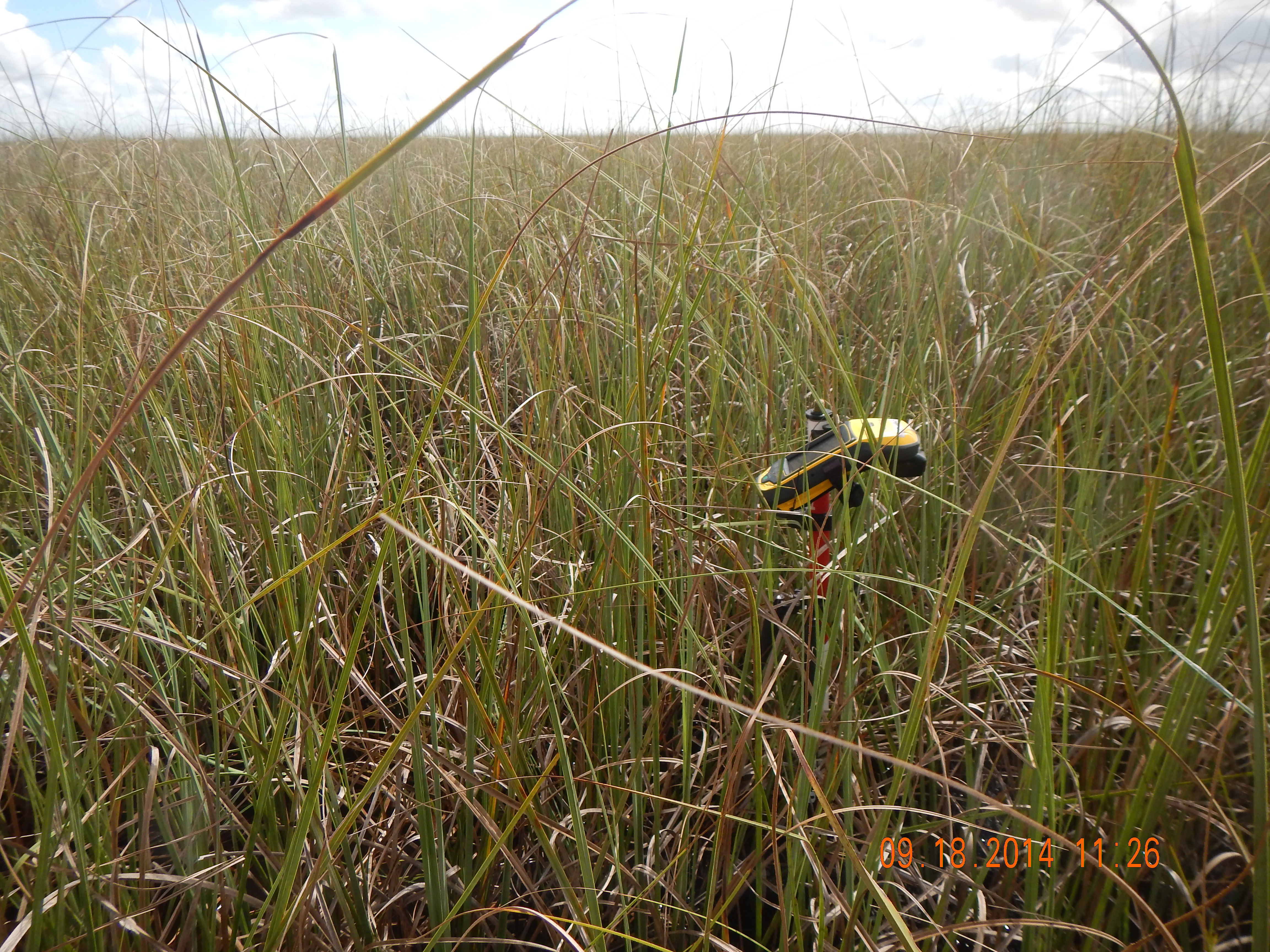
Plot