Olsen: 76
Everglades National Park (ENP NESS)
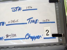
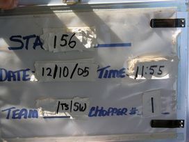
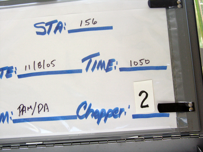
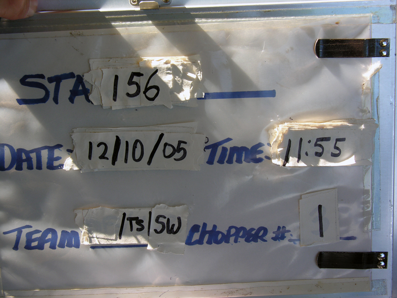
FIU Station: 156
| Panel: Regular | Season: Fall |
| BioChem Date/Time: 2005-11-08 10:50:00 |
| BioChem Crew: Phyllis Meyer/Danny Adams |
| Plants Date: 2005-12-10 | Aquatic Date: |
| Location | | NAD83 | NAD27 |
|---|
| Latitude | 25.616643 | 25.61672 | |
| Longitude | -80.598032 | -80.597841 | |
| UTM Y (northing) | | 2833097 | 2833300 |
| UTM X (easting) | | 540356 | 540377 |
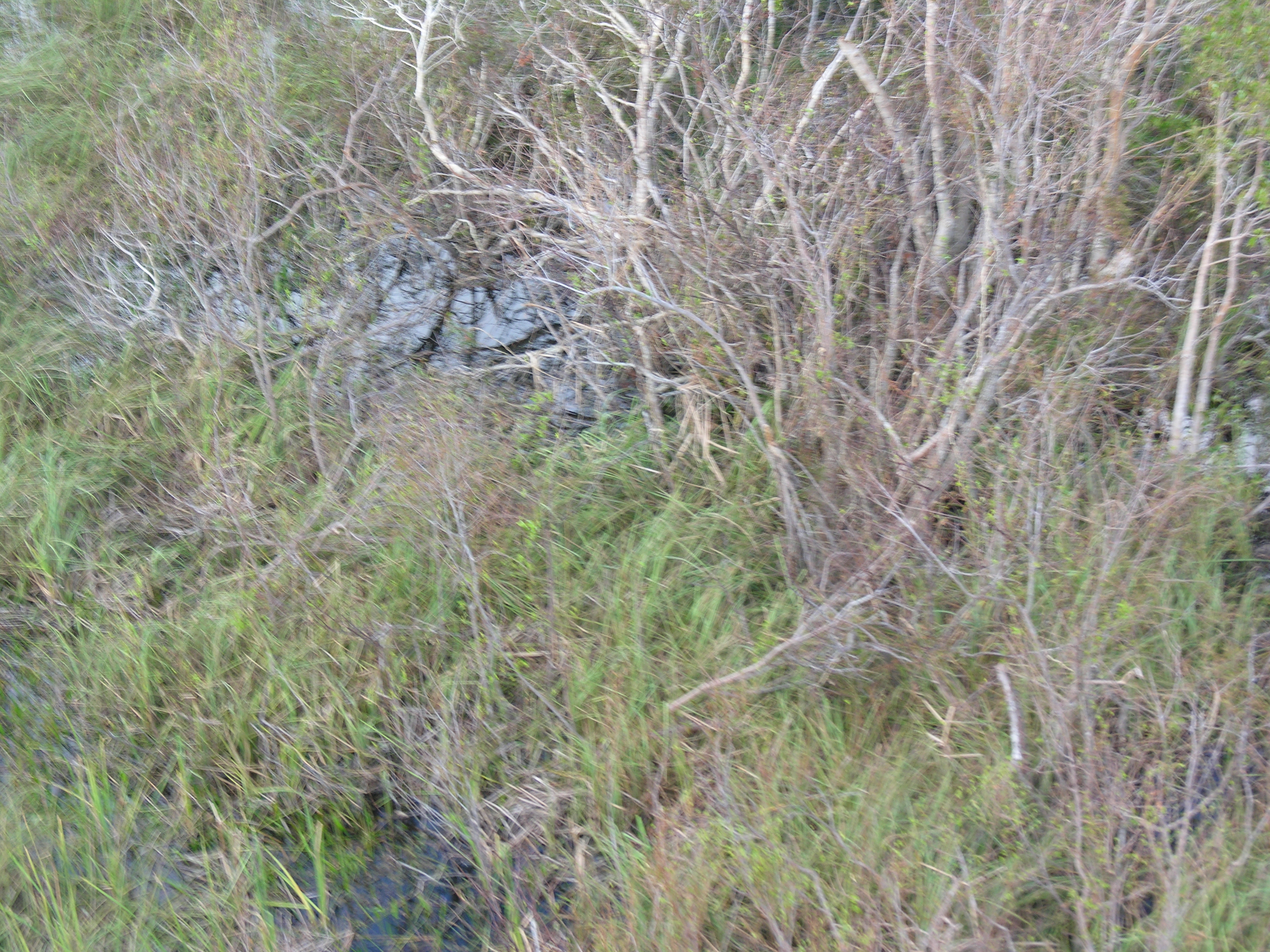
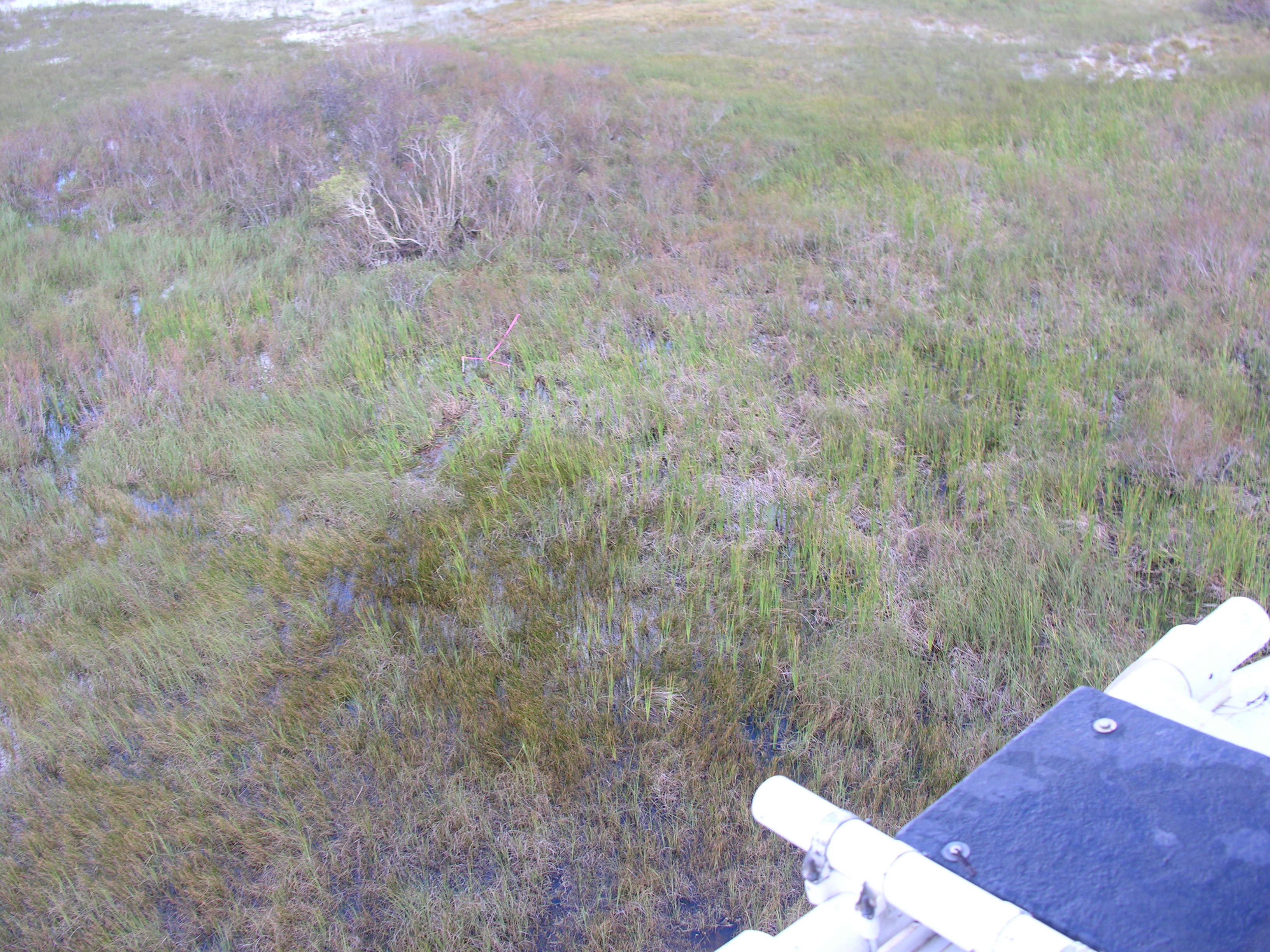
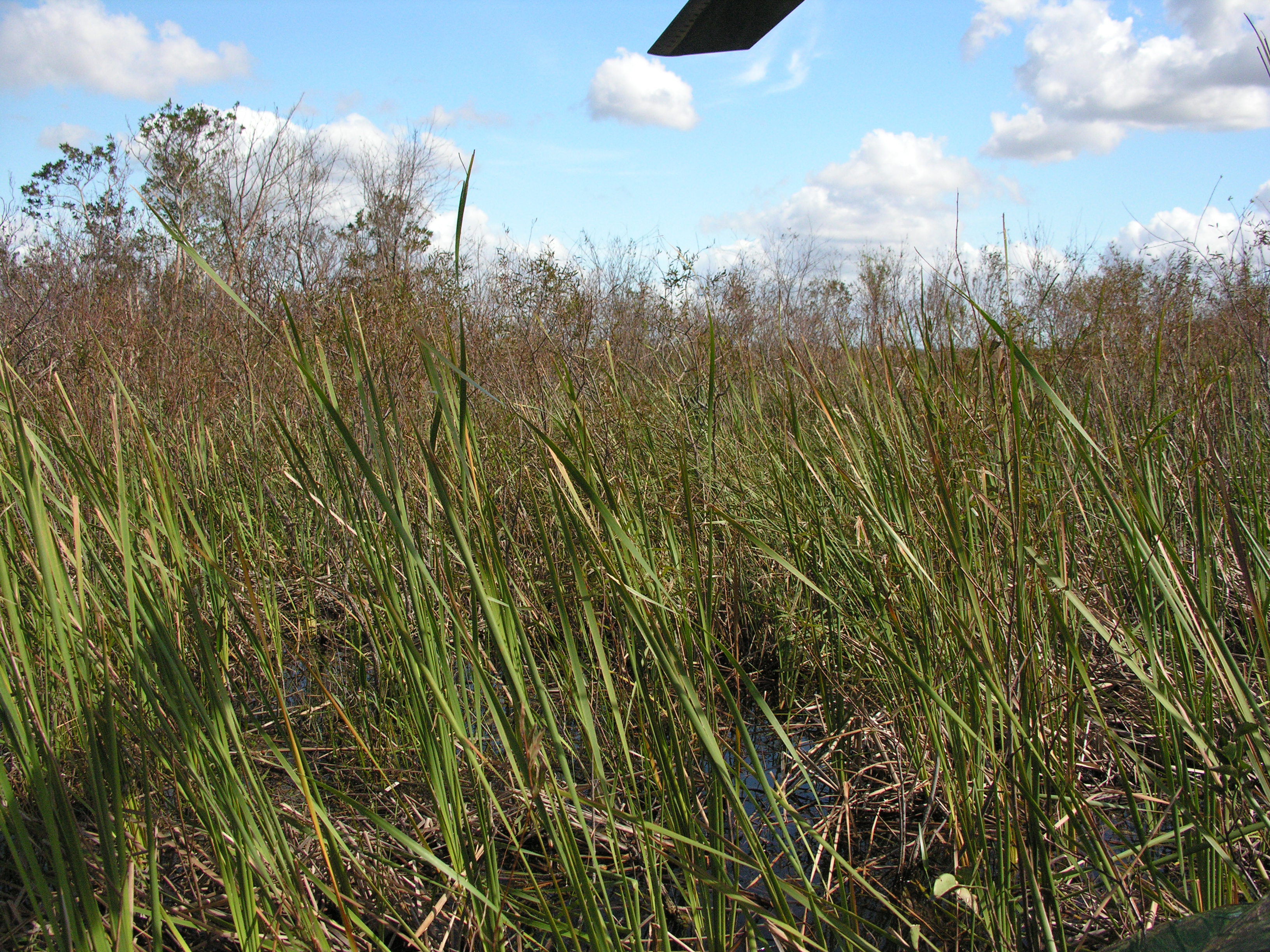
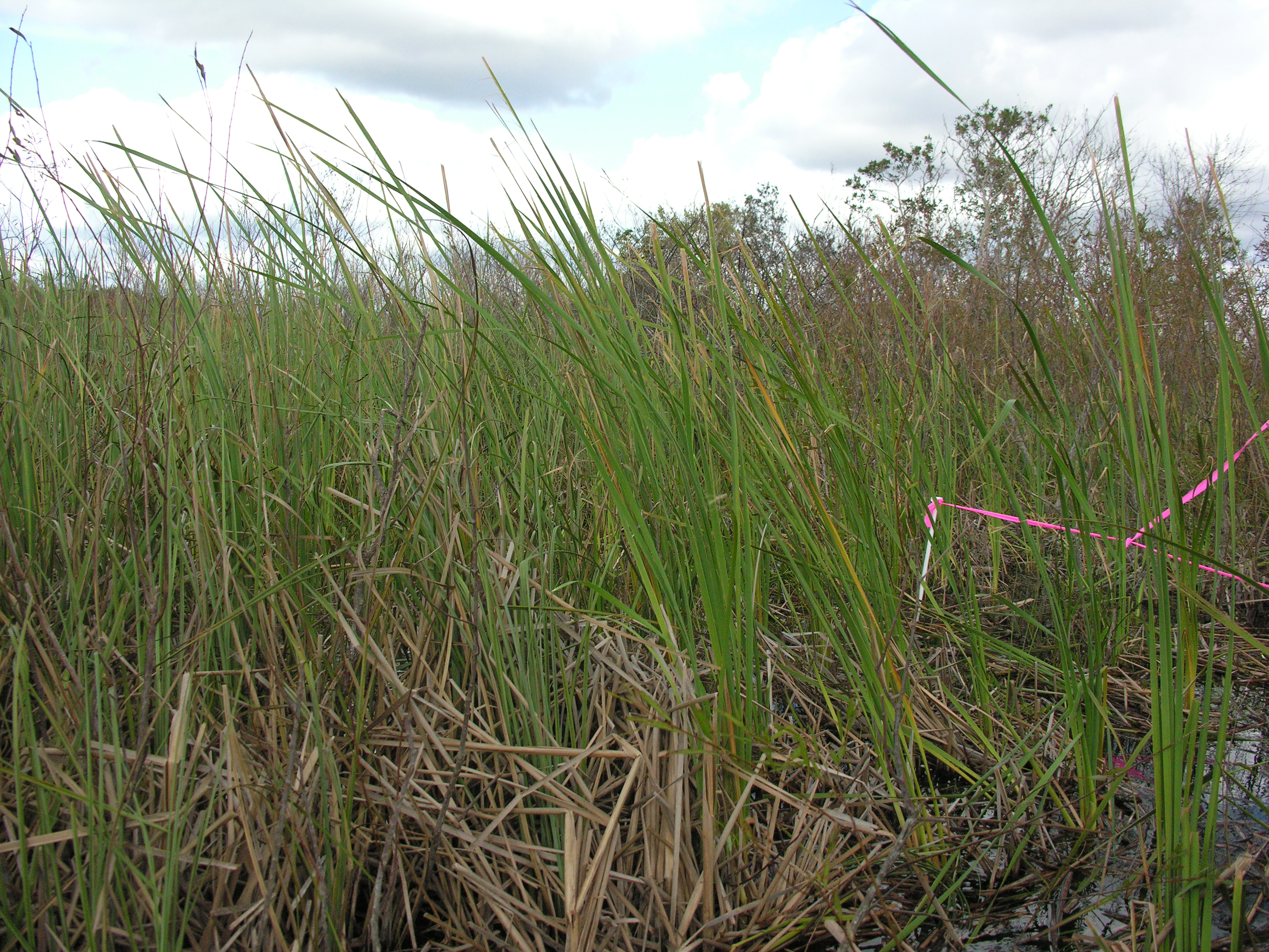
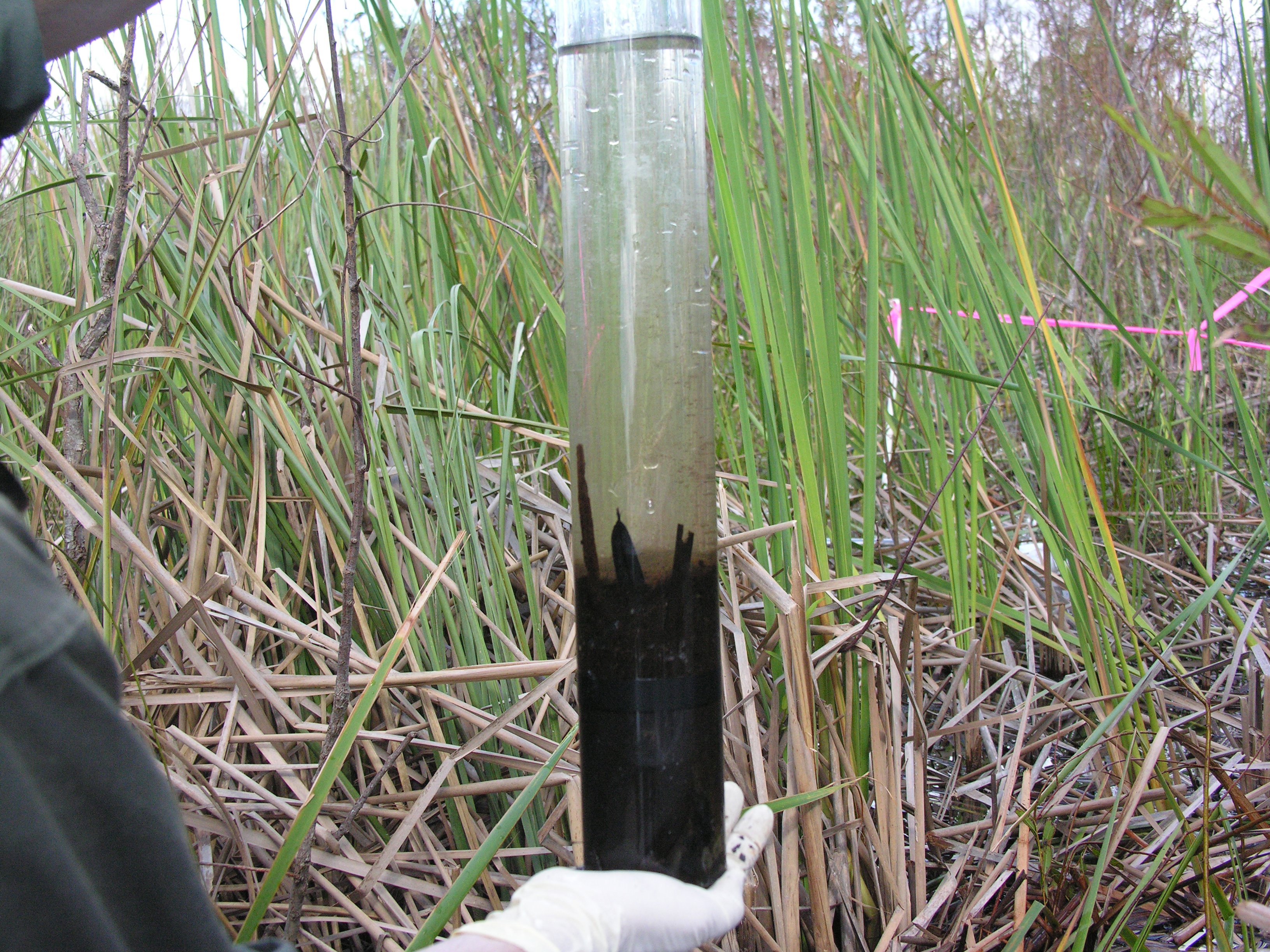
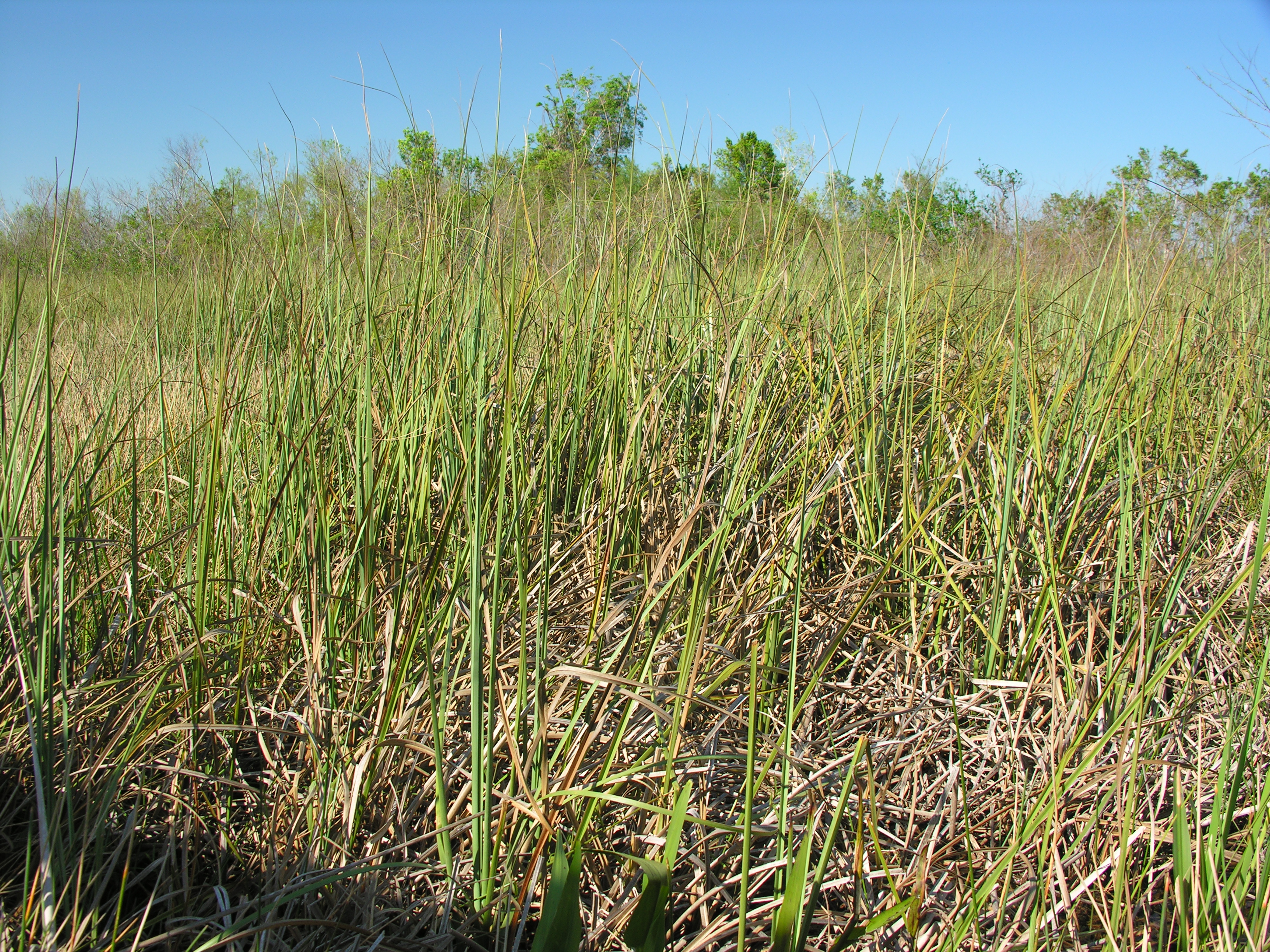
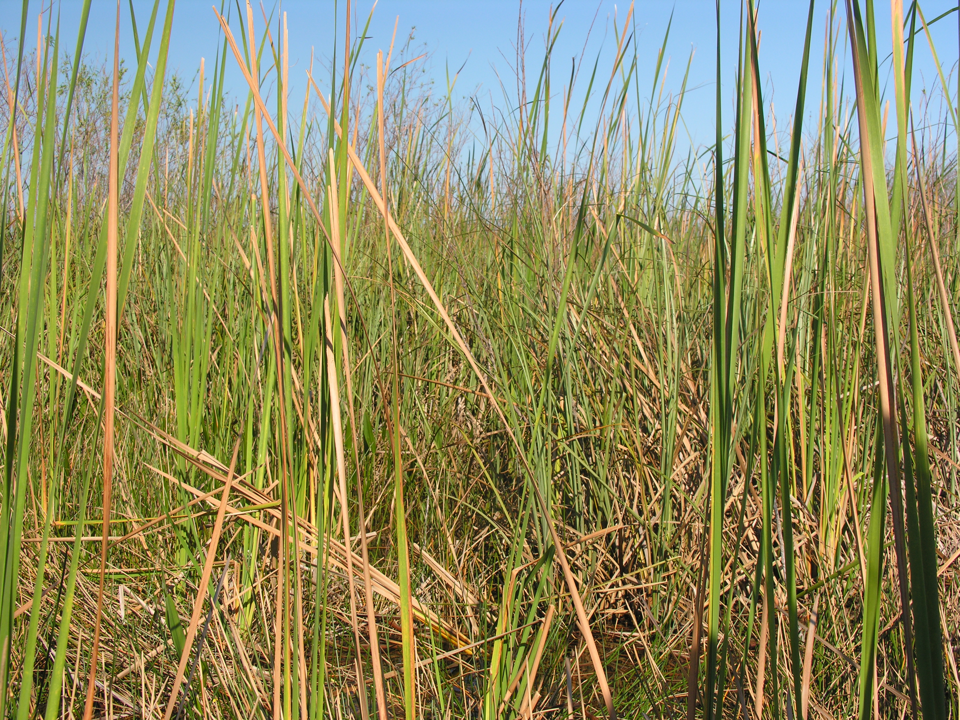
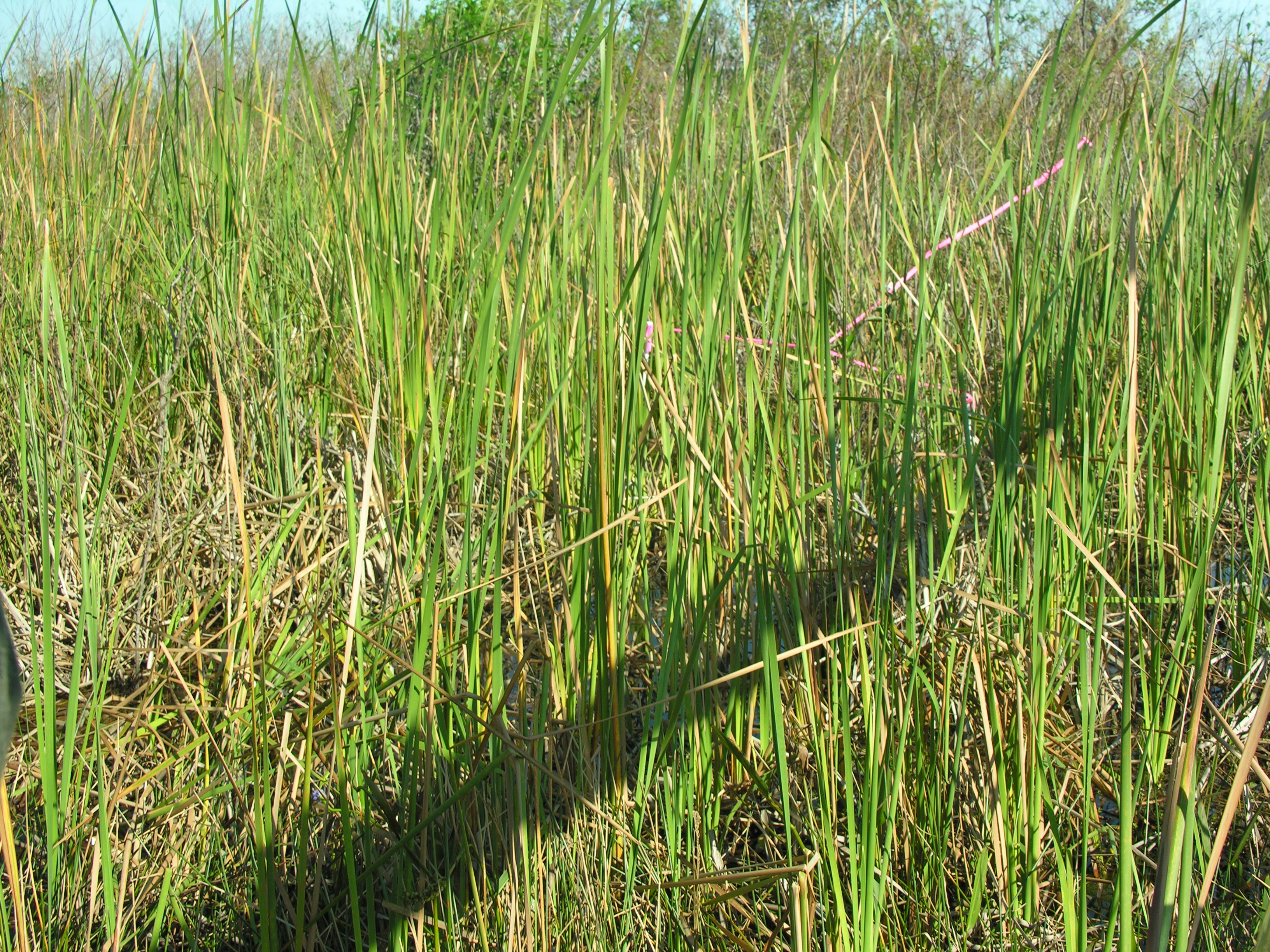
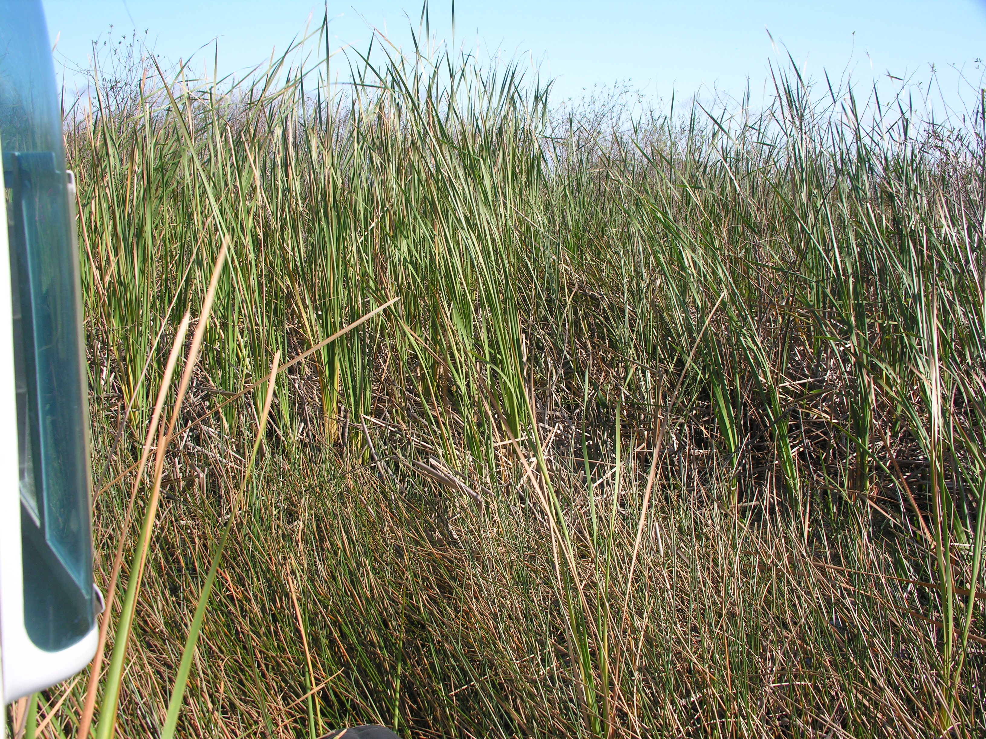
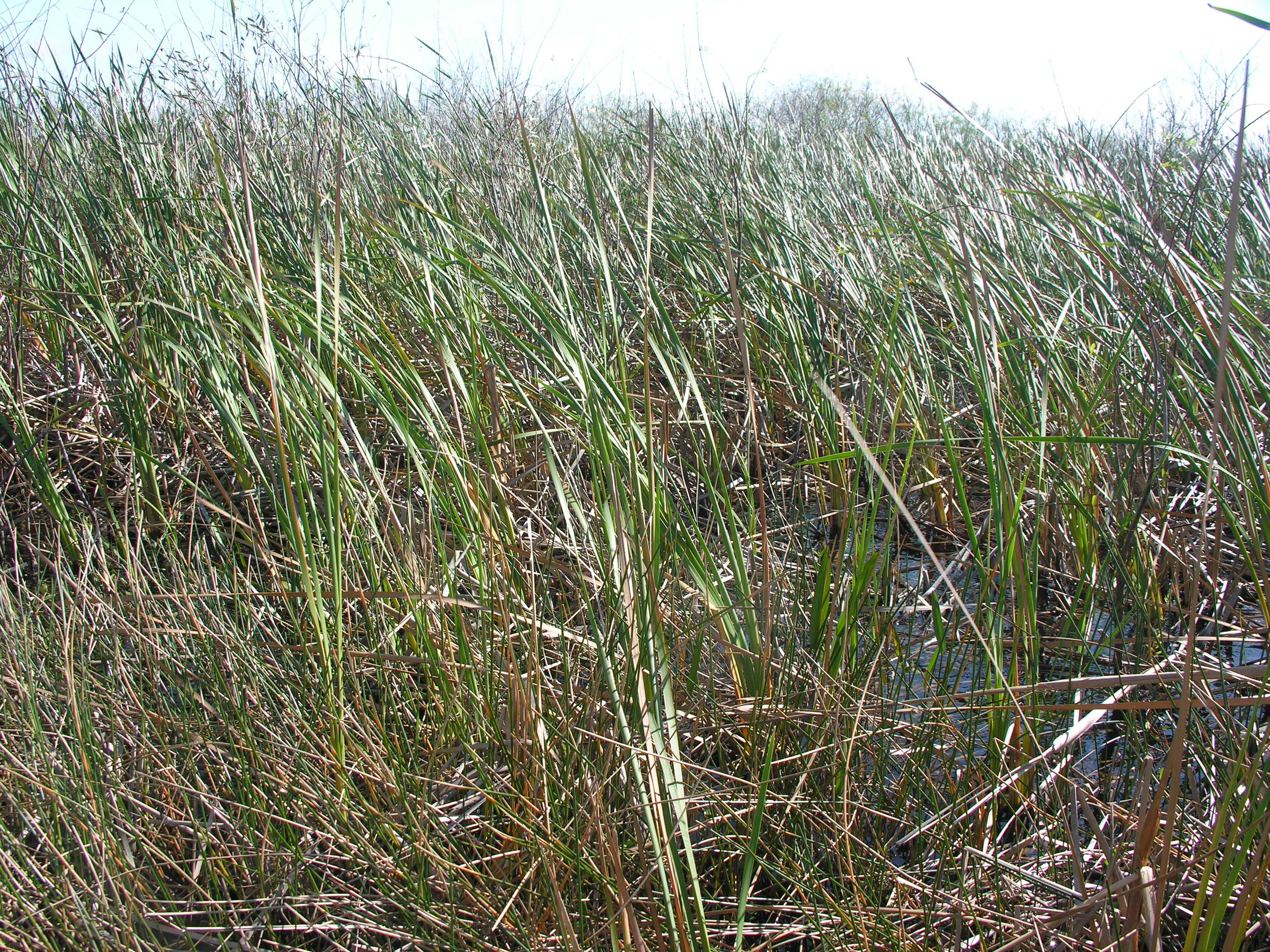
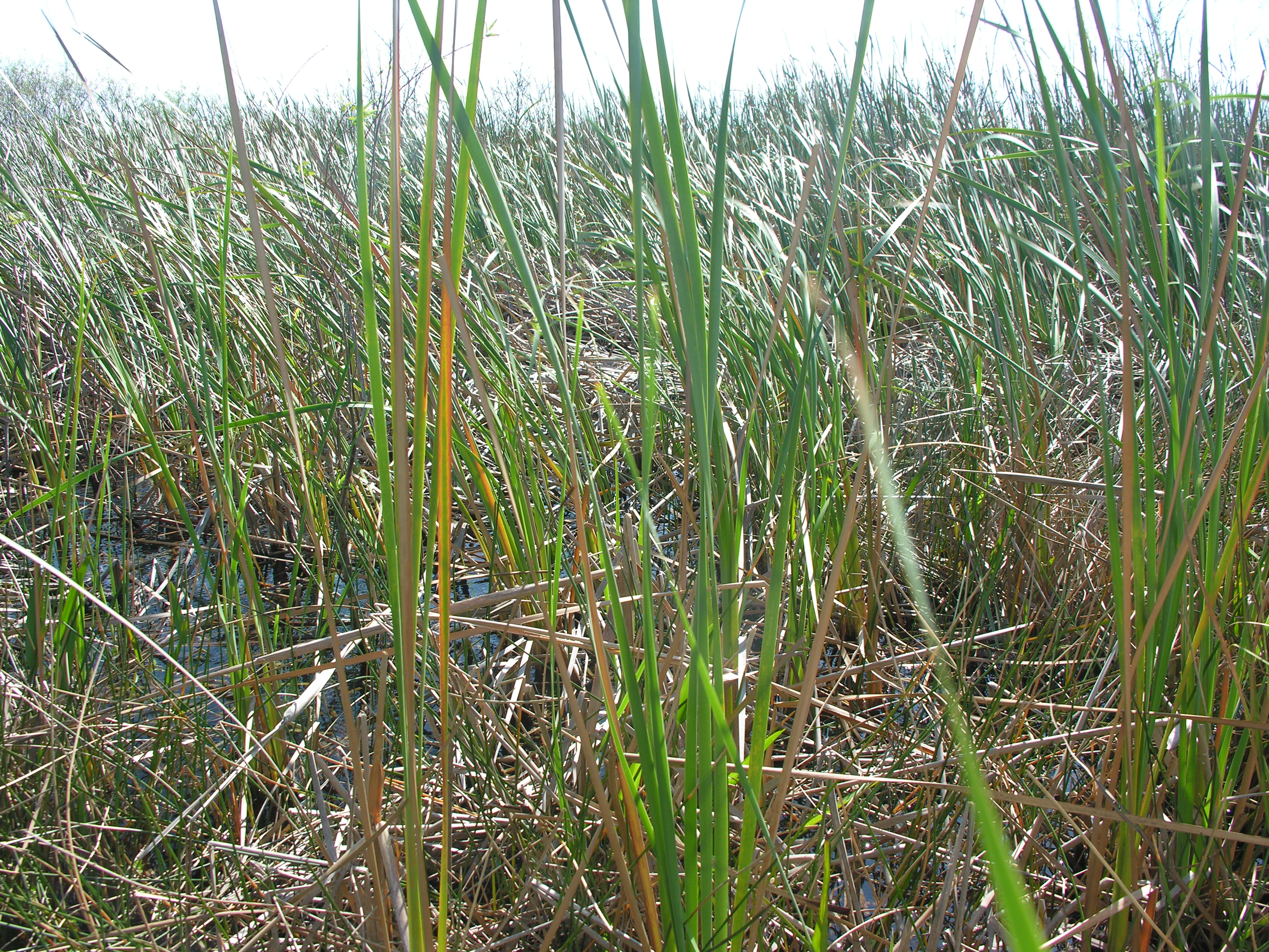
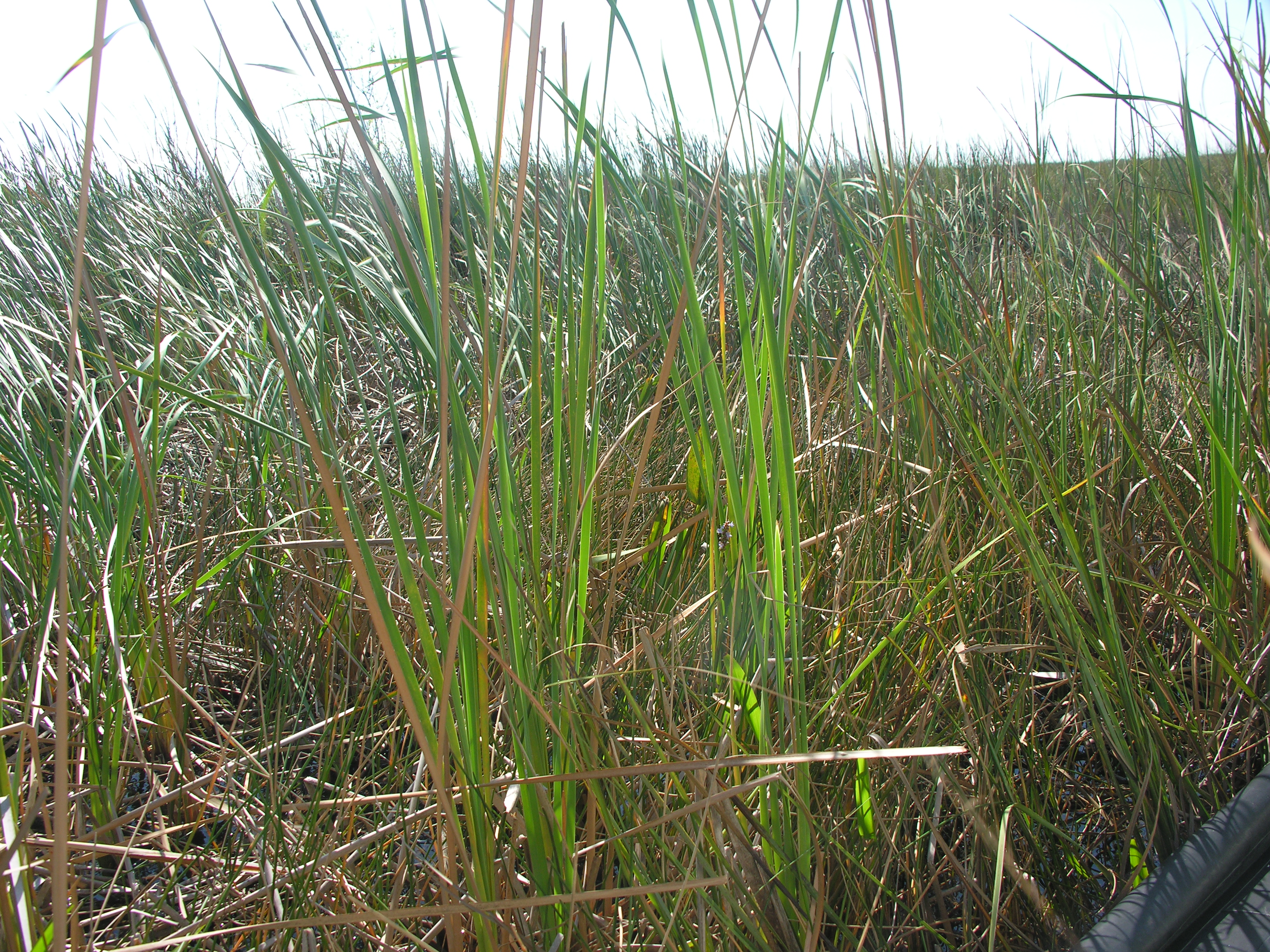
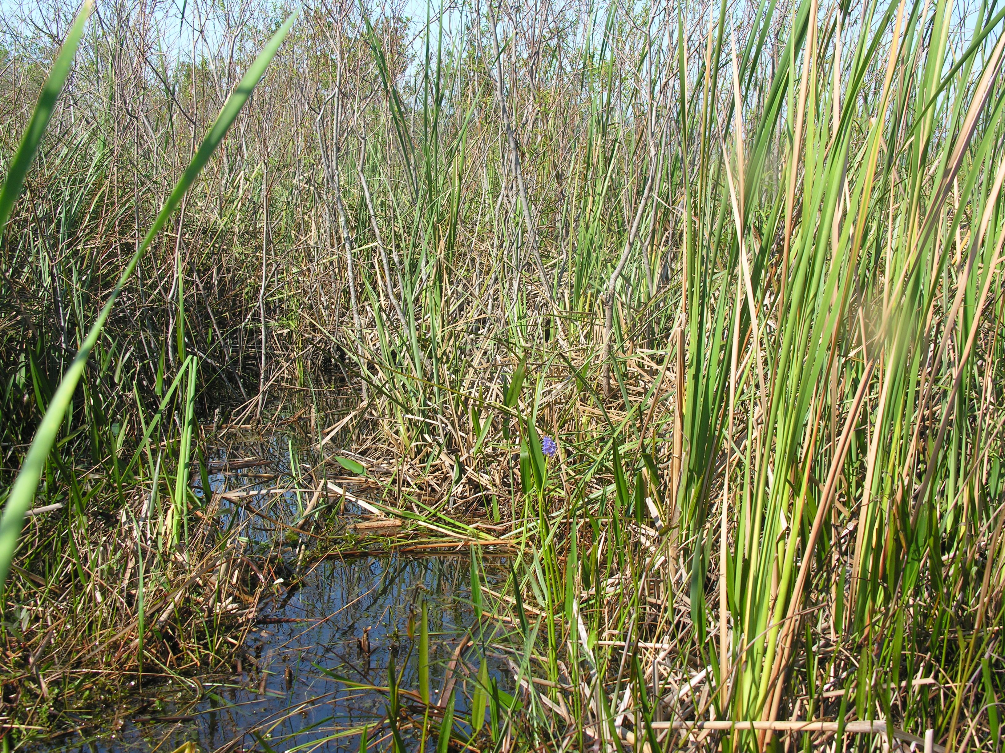
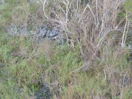
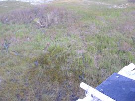
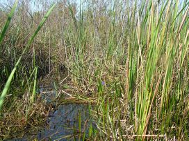
Comments: Veg type: 2,4,5. Willow edge/sawgrass and cattail. Only 20 ml collected for nutrients for SW. Chlorophyll collected from unscreened H2O
Basic
| Item | Value | Description |
|---|
| Camera | 2 | Digital camera used for field documentation of habitat and soil core |
| CHLAVOL | 140 | volume of surface water filtered for chlorophyll a analysis |
| Chopper | 2 | number of helicopter and associated sampling equipment and supply cache |
| COND | 494 | in situ surface water conductivity, YSI sonde |
| Cycle | 7 | sampling cycle number |
| DO | 3.76 | in situ surface water DO, YSI sonde |
| FISHNO1 | 15 | number of mosquitofish collected for Hg analysis |
| FLOCCOLperc | 100 | Percent of floc collected from core |
| FLOCCONT | 1 storemore | number and kind of container used for floc |
| Flow | sheetflow | description of surface water flow at sampling site |
| PERIDOM | epiphytic | dominant periphyton type |
| PERIPB | no | benthic periphyton collected |
| PERIPE | yes | epiphytic periphyton collected |
| PERIPF | no | floating mat periphyton collected |
| pH | 7.07 | in situ surface water pH, YSI sonde |
| Soiltype | peat | soil type categories, by visual observation |
| Station | 156 | sampling station numbers, unique for 2005, assigned by EPA to the Olsen site numbers; many of the FIU researchers use these numbers as their sample identifiers |
| Temp | 24.6 | in situ surface water temperature, YSI sonde |
| Turb | 0.5 | in situ surface water turbidity, YSI sonde |
| VEGTYPE | cattail | plant community observed at sampling site |
| Weather | 2 lt overcast | weather conditions |
| X | SHIFTED | nominal = sampled within 5 meters of GPS coordinates
shifted = 5-20 meters
station rejected = >20 meters |
| YSIDEPTH | 6 | depth of deployment of probe array in surface water |
| PlantDate | 2005-12-10 | Plant collection date |
| Item | Value 1 | Value 2 | Value 3 | Average | Units | Description |
|---|
| DEPBEDR | 3.3 | 3.5 | 2.4 | 3.07 | feet | depth to bedrock, point of refusal with metal probe |
| FLOCTH | 1 | 1 | 1 | 1 | cm | vertical extent (length) of floc layer in core |
| PWEAgCl | -99.6 | -113.6 | -151.1 | -121.43 | mV | pore water, field-measured, in-line Ag/AgCl reference microprobe |
| PWEh | 99.4 | 85.4 | 47.9 | 77.6 | mV | pore water, field-measured, in-line Ag/AgCl reference microprobe corrected to standard Hydrogen electrode by adding 199 mV |
| SoilCTH | 10 | 10 | 10 | 10 | cm | vertical extent (length) of soil sample, from soil surface to bottom of core |
| SoilTHI | 1.6 | 1.7 | 0.6 | 1.3 | feet | soil thickness, metal probe to point of refusal |
| WatDept | 1.7 | 1.8 | 1.8 | 1.77 | feet | water depth |
BioChemistry
110805PMDA.jpg)

| Item | Value | Units | Q | Protocol | Description |
|---|
| AFDWFCFS | 0.9 | g/g | | FIU SERC | Ash Free Dry Weight of floc |
| AFDWSDFS | 48.66 | % | | FIU SERC | Ash Free Dry Weight for soil |
| APASWEE | 0.84 | µmole/L*hr | | EPA ESAT | Alkaline Phosphatase Activity in surface water |
| BDSDFS | 0.21 | g/cc | | FIU SERC | Bulk Density for soil |
| BRPWEA | 0.12 | mg/L | | EPA SESD | Bromide in pore water |
| BRSWEA | 0.1 | mg/L | U | EPA SESD | Bromide in surface water |
| CHLASWFB | 2 | µg/L | | FIU SERC | Chlorophyll a in surface water |
| CLPWEA | 50 | mg/L | | EPA SESD | Chloride in pore water |
| CLSWEA | 54 | mg/L | | EPA SESD | Chloride in surface water |
| DOCSWD | 14 | mg/L | | FDEP | Dissolved Organic Carbon in surface water |
| FDOCPWD | 18 | mg/L | | FDEP | Dissolved Organic Carbon in porewater |
| FNH4RPWF | 0.25 | mg/L | | FIU SERC | Filtered Ammonia in pore water, recalculated |
| FNH4RSWF | 0.037 | mg/L | | FIU SERC | Filtered Ammonia in surface water, recalculated |
| FNNRPWFB | 0.034 | mg/L | | FIU SERC | Filtered Nitrite + Nitrate in pore water, recalculated |
| FNNRSWFB | 0.018 | mg/L | | FIU SERC | Filtered Nitrite + Nitrate in surface water, recalculated |
| FNO2RPWF | 0.0093 | mg/L | | FIU SERC | Filtered Nitrite in pore water, recalculated |
| FNO2RSWF | 0.0029 | mg/L | | FIU SERC | Filtered Nitrite in surface water, recalculated |
| FNO3RPWF | 0.025 | mg/L | | FIU SERC | Filtered Nitrate in pore water, recalculated |
| FNO3RSWF | 0.015 | mg/L | | FIU SERC | Filtered Nitrate in surface water, recalculated |
| FPWEA | 0.22 | mg/L | | EPA SESD | Fluoride in pore water |
| FSWEA | 0.16 | mg/L | | EPA SESD | Fluoride in surface water |
| H2SPWEE | 0.054 | mg/L | J | EPA ESAT | Sulfide in pore water |
| H2SSWEE | 0.02 | mg/L | U | EPA ESAT | Sulfide in surface water |
| MCFCFS | 0.1 | g/g | | FIU SERC | Mineral Content of floc |
| MCSDFS | 0.51 | g/g | | FIU SERC | Mineral Content of soil |
| MEHGFCFC | 5.4 | ng/g | | FIU SERC | Methyl Mercury in floc |
| MEHGPEFC | 1.6 | ng/g | | FIU SERC | Methyl Mercury in epiphytic periphyton |
| MEHGSDFC | 0.53 | ng/g | | FIU SERC | Methyl Mercury in soil |
| MEHGSWB | 0.14 | ng/L | AJ | Battelle | Methyl Mercury in surface water |
| pHSDEE | 6.72 | | | EPA SESD | ex situ soil pH |
| SO4PWEA | 0.32 | mg/L | | EPA SESD | Sulfate in pore water |
| SO4SWEA | 0.69 | mg/L | | EPA SESD | Sulfate in surface water |
| SRPRPWFB | 0.014 | mg/L | | FIU SERC | Soluble Reactive Phosphorus in pore water, recalculated |
| SRPRSWFB | 6.5 | µg/L | U | FIU SERC | Soluble Reactive Phosphorus in surface water, recalculated |
| TCFCFB | 40 | % | | FIU SERC | Total Carbon in floc |
| TCSDFB | 22 | % | | FIU SERC | Total Carbon in soil |
| THGFCFC | 120 | ng/g | J | FIU SERC | Total Mercury in floc |
| THGFSFC | 66 | µg/kg | | FIU SERC | Total Mercury in mosquitofish (Gambusia affinis), average of 7 individuals |
| THGFSSD | 17 | µg/kg | | | standard devaition of total mercury in individual mosquitofish for 7 individuals |
| THGPEFC | 28 | ng/g | U | FIU SERC | Total Mercury in epiphytic periphyton |
| THGSDFC | 160 | ng/g | | FIU SERC | Total Mercury in soil |
| THGSWD | 2.1 | ng/L | | FDEP | Total Mercury in surface water |
| TINAPWFB | 0.29 | mg/L | | FIU SERC | Total Inorganic Nitrogen (calculated) in pore water, recalculated |
| TINSWFB | 0.058 | mg/L | | FIU SERC | Total Inorganic Nitrogen (calculated) in surface water, recalculated |
| TNFCFB | 3.2 | % | | FIU SERC | Total Nitrogen in floc |
| TNRSWFB | 0.29 | mg/L | | FIU SERC | Total Nitrogen in surface water, recalculated |
| TNSDFB | 1.8 | % | | FIU SERC | Total Nitrogen in soil |
| TONSWFB | 0.23 | mg/L | | FIU SERC | Total Organic Nitrogen (calculated) in surface water, recalculated |
| TPRFCFB | 840 | µg/g | | FIU SERC | Total Phosphorus in floc, recalculated |
| TPRSDFB | 590 | µg/g | | FIU SERC | Total Phosphorus in soil, recalculated |
| TPRSWFB | 6.3 | µg/L | | FIU SERC | Total Phosphorus in surface water, recalculated |
| WCSDFS | 0.82 | g/g | | FIU SERC | Water Content of soil |
Plants
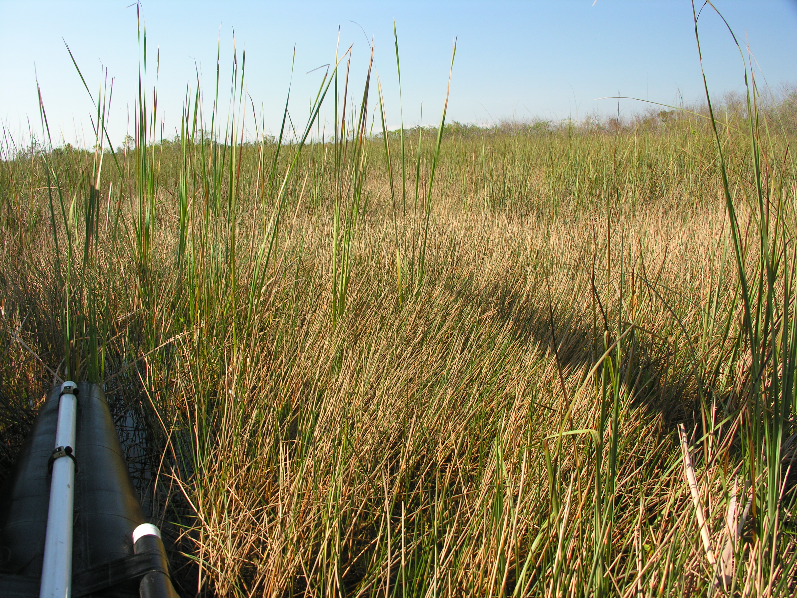
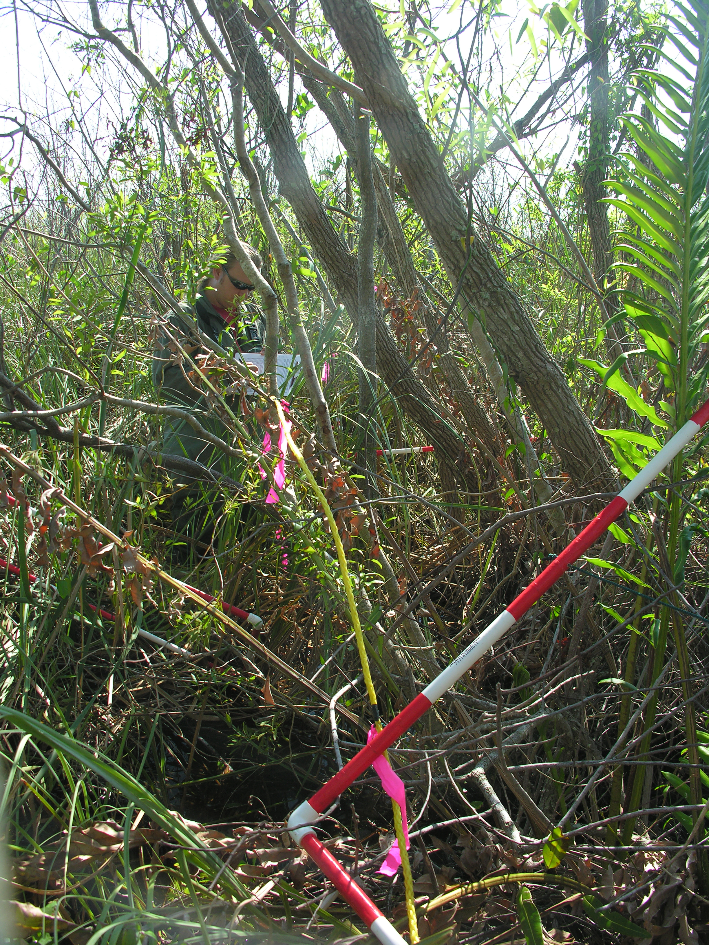
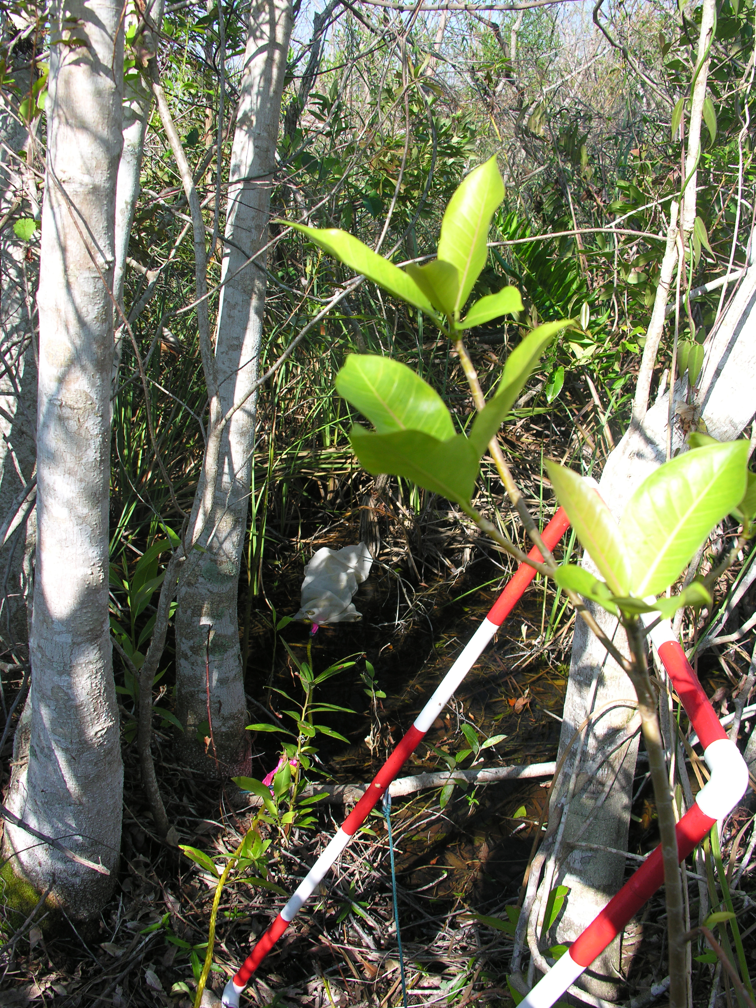
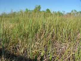
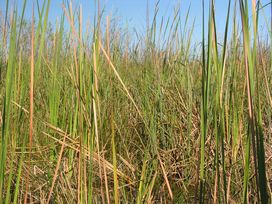
All sites sampled had 1 transect that ran south to north, with the southern end sampled 5 m due west of the biogeochemical sampling point.
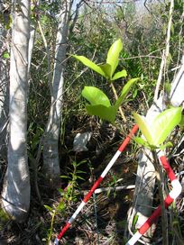
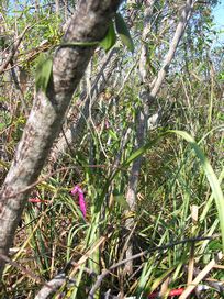
If a second “habitat type”, as based on visual assessment of the botanist in the crew, was located within a 50 m radius of the first sampling point, a second transect was done in that habitat.
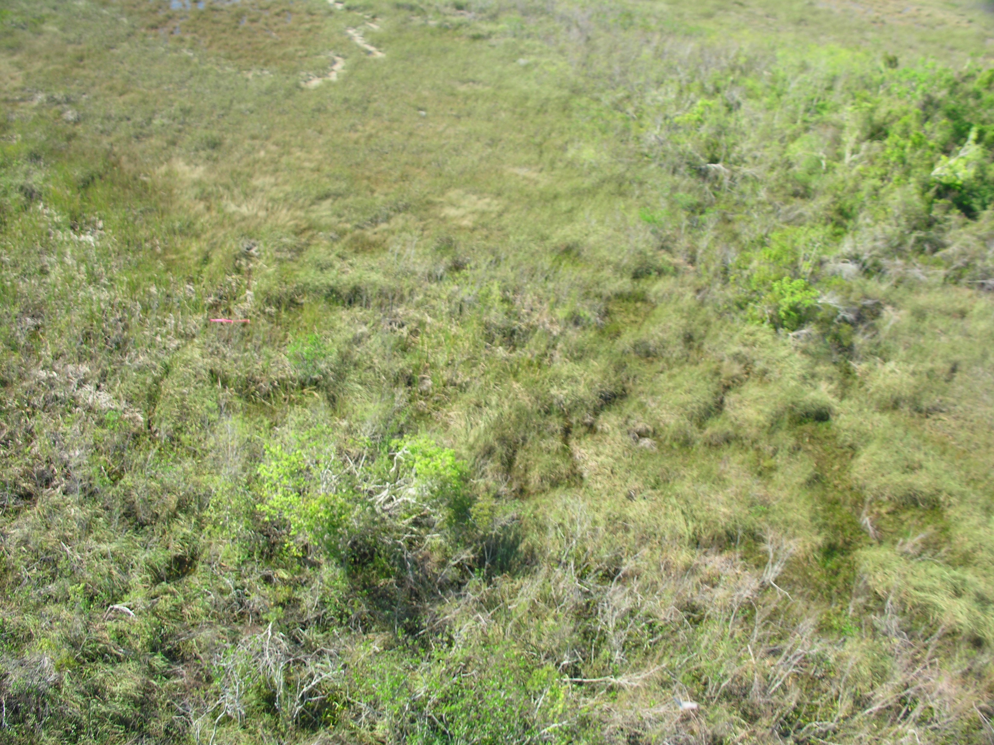
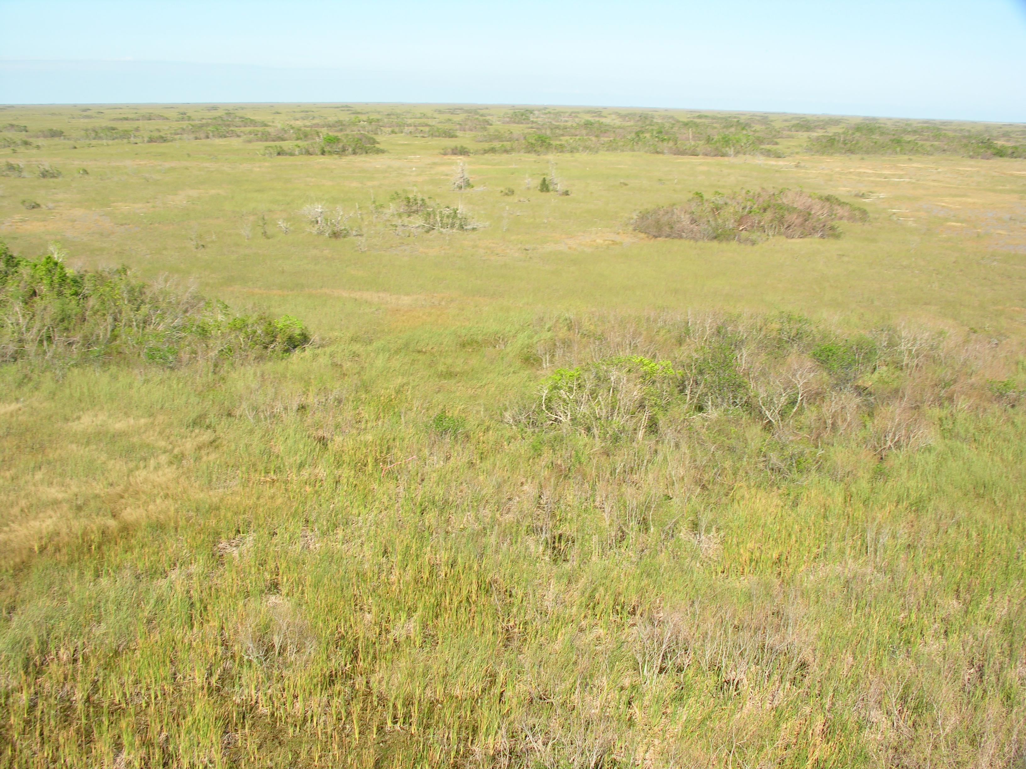
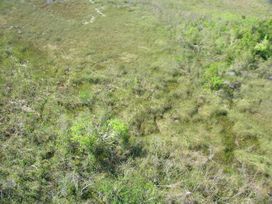
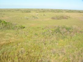
Left Panorama

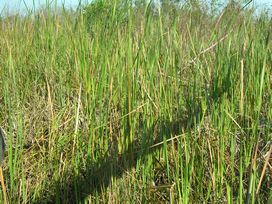
Right Panorama
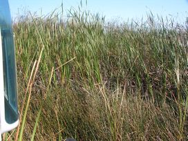
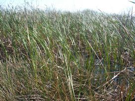
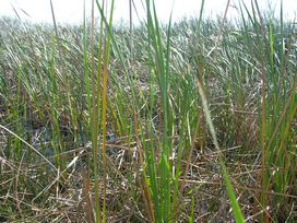
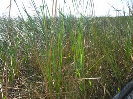
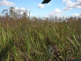
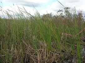
Transects

The number in each plant column records the number of quarter-meter-squared quadrats in 5 (1-meter-squared) quadrats in which that species was found at any given site.The 5 (1-meter-squared) quadrats were distributed to the right and left every 2 m along the 10 m transect.If the plant was not present, the cell has a 0;if the plant was present in every quarter-meter-squared quadrat, the number in the cell is 20.
| Item | Transect 1 | Transect 2 | Family | Scientific Name | Common Name |
|---|
| AnnoGlab | 0 | 2 | Annonaceae | Annona glabra | Pond-apple |
| IlexCass | 0 | 1 | Aquifoliaceae | Ilex cassine | Dahoon holly, Dahoon |
| PeltVirg | 0 | 2 | Araceae | Peltandra virginica | Green arum, Green arrow arum |
| SarcClau | 0 | 13 | Asclepiadaceae | Sarcostemma clausum | Whitevine, White twinevine |
| EupaLept | 1 | 0 | Asteraceae | Eupatorium leptophyllum | Falsefennel |
| PlucRose | 1 | 0 | Asteraceae | Pluchea rosea | Rosy camphorweed |
| CladJama | 9 | 5 | Cyperaceae | Cladium jamaicense | Saw-grass, Jamaica swamp sawgrass |
| AescAmer | 1 | 0 | Fabaceae | Aeschynomene americana | Shyleaf |
| ProsPalu | 2 | 0 | Haloragaceae | Proserpinaca palustris | Mermaid weed, Marsh mermaidweed |
| PersPalu | 0 | 2 | Lauraceae | Persea palustris | Swamp bay |
| FicuAure | 0 | 2 | Moraceae | Ficus aurea | Strangler fig, Golden fig |
| MyriCeri | 0 | 1 | Myricaceae | Myrica cerifera | Wax myrtle, Southern Bayberry |
| LudwRepe | 0 | 1 | Onagraceae | Ludwigia repens | Creeping primrosewillow |
| PaniHemi | 4 | 0 | Poaceae | Panicum hemitomon | Maidencane |
| PaniRigi | 1 | 0 | Poaceae | Panicum rigidulum | Redtop panicum |
| SaccStri | 5 | 0 | Poaceae | Sacciolepis striata | American cupscale |
| PolyHydr | 13 | 1 | Polygonaceae | Polygonum hydropiperoides | Mild water-pepper, Swamp smartweed |
| PontCord | 10 | 0 | Pontederiaceae | Pontederia cordata | Pickerelweed |
| AcroDana | 0 | 2 | Pteridaceae | Acrostichum danaeifolium | Giant leather fern |
| SaliCaro | 5 | 6 | Salicaceae | Salix caroliniana | Coastal Plain willow |
| TyphDomi | 7 | 0 | Typhaceae | Typha domingensis | Southern cat-tail |
| BoehCyli | 0 | 2 | Urticaceae | Boehmeria cylindrica | Button-hemp, False nettle, Bog hemp |
| PariFlor | 0 | 2 | Urticaceae | Parietaria floridana | Florida pellitory |
| BacoCaro | 8 | 0 | Veronicaceae | Bacopa caroliniana | Lemon hyssop, Lemon bacopa, Blue waterhyssop |
| PartQuin | 0 | 1 | Vitaceae | Parthenocissus quinquefolia | Virginia-creeper, Woodbine |
Exotics
In the 2005 R-EMAP sampling invasive exotic plant species were surveyed in two ways. The first survey was done on the helicopter fly-in to the GPS site and covered the general area of the site, while the second was a 360° site survey from the helicopter pontoons after landing and covered the immediate area of the site. In the aerial (A) helicopter survey we looked for the presence of six invasive exotic species (Casuarina spp., Lygodium microphyllum, Melaleuca quinquenervia, Neyraudia reynaudiana, Pennisetum purpureum and Schinus terebinthefolius), as well as the presence of cattail (Typha domingensis). In the survey from the helicopter floats (F) we recorded the presence of any exotic seen; the only additional exotic species observed from the floats was Salvinia minima. In both surveys we recorded the presence of species and quantified their abundance using categories for the number of individuals. The categories used were 0 (i.e., not present), 1 individual, 2 - 10 individuals, and > 10. We did not find Neyraudia reynaudiana at any site, so this species was not included in the database.
| Item | Abundance | Scientific Name | Source |
|---|
| CasuSp_A | 2 - 10 | Casuarina species | aerial fly-in |
| CasuSp_F | 0 | Casuarina species | floats |
| LygoMicr_A | 0 | Lygodium microphyllum | aerial fly-in |
| LygoMicr_F | 0 | Lygodium microphyllum | floats |
| MelaQuin_A | 0 | Melaleuca quinquenervia | aerial fly-in |
| MelaQuin_F | 0 | Melaleuca quinquenervia | floats |
| PennPurp_A | 0 | Pennisetum purpureum | aerial fly-in |
| PennPurp_F | 0 | Pennisetum purpureum | floats |
| SalvMini_F | 0 | Salvinia minima | floats |
| SchiTere_A | 0 | Schinus terebinthefolius | aerial fly-in |
| TyphDomi_A | > 10 | Typha domingensis | aerial fly-in |
| TyphDomi_F | > 10 | Typha domingensis | floats |
Vegetation Map


110805PMDA.JPG)