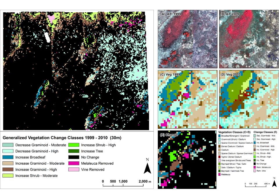
Vegetation Trends in Indicator Regions of Everglades National Park
Project Link: Synthesis Report (http://digitalcommons.fiu.edu/gis/29/)
Funding Agency: Everglades National Park
People:Jennifer H. Richards, PI / Daniel Gann, Co-PI / Jimi Sadle, Everglades National Park Representative Program Manager
A web-based, interactive decision making tool that visualizes the potential effects of Sea Level Rise and storm surges in the City of Coral Gables. The tool is able to dynamically visualize statistics about affected population, critical facilities, road network, property value and land use.
Date
February 13, 2010
Category
Ecosystems