Regional Environmental Monitoring and Assessment Program (R-EMAP) IV: Greater Everglades Whole-Ecosystem Monitoring and Assessment
Funding Agency: Everglades National Park, U.S. Environmental Protection Agency
People: Jennifer H. Richards, PI / Yong Cai, Co-PI / Daniel Gann, Co-PI / Guangliang Liu, Co-PI / Len Scinto, Co-PI / Joffre Castro, Everglades National Park Representative / Peter Kalla, US-Environmental Protection Agency Representative / Dan Scheidt, US-Environmental Protection Agency Representative
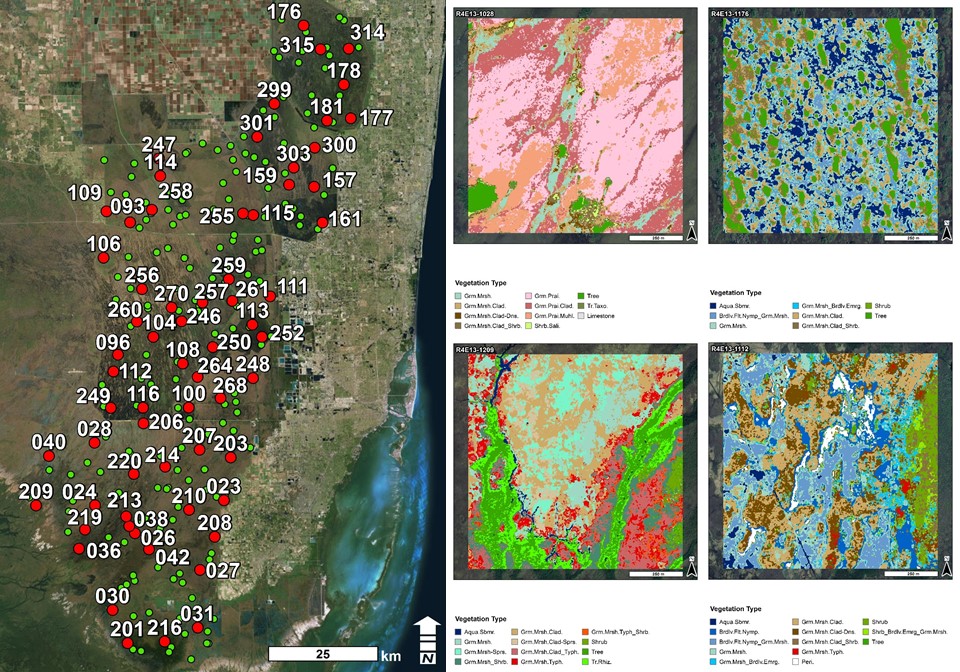
The US Environmental Protection Agency’s Everglades Regional Environmental Monitoring and Assessment Program is a long-standing research, monitoring, and assessment effort. Begun in 1993, its goal is to provide critical, timely, scientific information needed for management decisions on the Everglades ecosystem and its restoration. The program combines a probabilistic-based sampling design, which permits quantitative inferences across space about the condition of the ecosystem, with sampling of multiple media at each sample location, and has extensive spatial coverage. Florida International University (FIU), in cooperation with the US-EPA and Everglades National Park, undertook R-EMAP IV sampling in Sept. and Oct., 2014, in order to sample soil, surface water, floc, periphyton and fish total mercury and methyl mercury at 125 sites distributed throughout the Greater Everglades Ecosystem. Biogeochemical analyses of these samples provide a characterization of the soil and water biogeochemistry of the sample sites. In order to understand the environmental context for mercury transformations throughout the ecosystem, and to integrate the biogeochemical and mercury data with vegetation and other environmental parameters, Richards and Gann are using WorldView-2 satellite imagery to map vegetation within 1 km2 around the sampling sites at a subsample of the R-EMAP IV sampling locations. The combined biogeochemical and landscape vegetation data will be used to estimate vegetation standing stocks of C, N, P and Hg and to determine how these nutrients vary on a landscape scale.
Date
August 7, 2009
Category
Ecosystems