Mangrove Ecotone Vegetation Monitoring
Project Link: Coral Gables Sea Level Rise Impact Planning Tool (https://slr.fiu.edu/CoralGables)
Funding Agency: National Science Foundation
People: Daniel Gann, PI / Jennifer H. Richards, Co-PI / Tiffany Troxler, FCE-LTER Representative / Morgan Wilson, FCE-LTER Intern
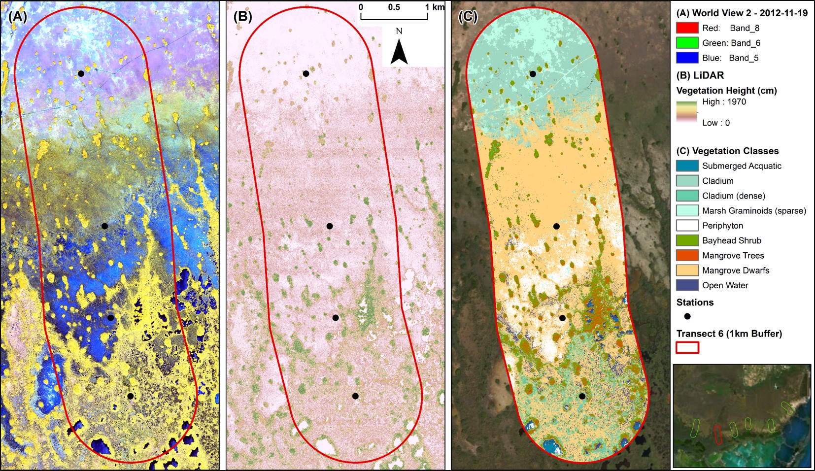
The Florida Coastal Everglades (FCE) LTER Program is part of the National Science Foundation’s Long Term Ecological Research (LTER) Network . FCE research focuses on the Everglades ecotone where freshwater meets saltwater along the Florida coast, a hotspot for sea level rise effects. FCE researchers study how hydrology, climate, and human activities affect ecosystem and population dynamics in the ecotone and, more broadly, the Florida coastal Everglades. Daniel Gann and Jennifer Richards are providing a landscape context for some of this ongoing research in the southeastern coastal Everglades. Using WorldView-2 2×2 m pixel satellite imagery, supplemented by LIDAR data where available, they are mapping a 1-km-wide belt around six pre-existing, long-term nutrient- and salinity-monitoring transects that stretch from freshwater marshes in the north to mangrove mashes in the south, crossing the oligohaline ecotone. Vegetation class percent cover derived from these maps will be used to estimate vegetation biomass, relying on pre-existing and/or literature data for estimates of standing stock per unit area.
Date
February 7, 2013
Category
Ecosystems