Evaluating High-Resolution Aerial Photography Acquired by Unmanned Aerial Systems for Use in Mapping Everglades Wetland Plant Associations
Project Link: Synthesis Report (http://digitalcommons.fiu.edu/gis/25/)
Funding Agency: U.S. Army Corps of Engineers, University of Florida
People: Daniel Gann, PI / Jennifer H. Richards, Co-PI
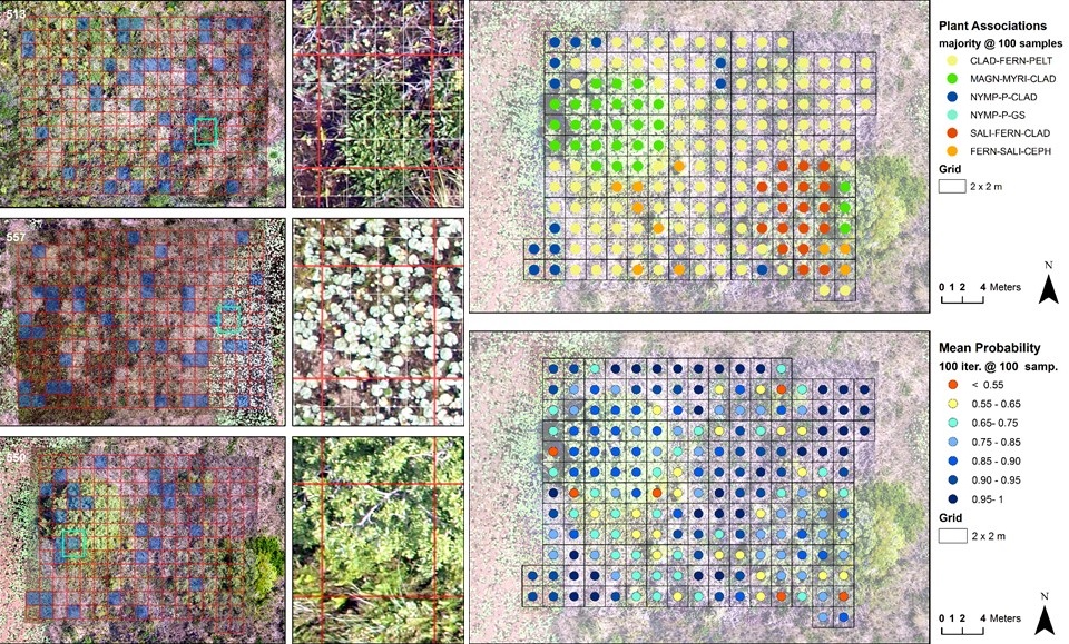
Mapping of vegetation patterns over large areas using remote sensing methods requires field sample collections for two different purposes: (1) the establishment of plant association classification systems from samples of relative abundance estimates; and (2) training for supervised image classification and accuracy assessment of satellite data derived maps. One challenge for both procedures is the establishment of confidence in results and the analysis across multiple spatial scales. Continuous data sets that enable cross-scale studies are very time consuming and expensive to acquire, and such extensive field sampling can be invasive. The use of high-resolution aerial photography (hrAP) offers an alternative to extensive, invasive field sampling and can provide high-volume, spatially continuous reference information that can meet the challenges of confidence building and multi-scale analysis.
In order for large-extent mapping projects utilizing hrAP to be successful, reliable detection of plant species is essential. Therefore, the first objective of this study was to evaluate the suitability of hrAP acquired from an UAS to support vegetation identification and detection for a specific target resolution of 2 m. We addressed the spatial accuracy of geographically referenced photography products and evaluated the adequacy of two different resolutions to detect presence and to estimate relative abundance of Everglades wetland species. The second objective was to demonstrate how spatially continuous abundance data derived from hrAP can be used to establish consistent and stable plant association classification systems in a re-sampling framework.
Date
January 13, 2013
Category
Ecosystems