Coral Gables Sea Level Rise Impact Planning Tool
Project Link: Coral Gables Sea Level Rise Impact Planning Tool (https://slr.fiu.edu/CoralGables)
Funding Agency: City of Coral Gables
People: Levente Juhasz, Technical Lead / Jennifer Fu, PI / Julian Gottlieb, UI / Jorge Sotolongo, Designer
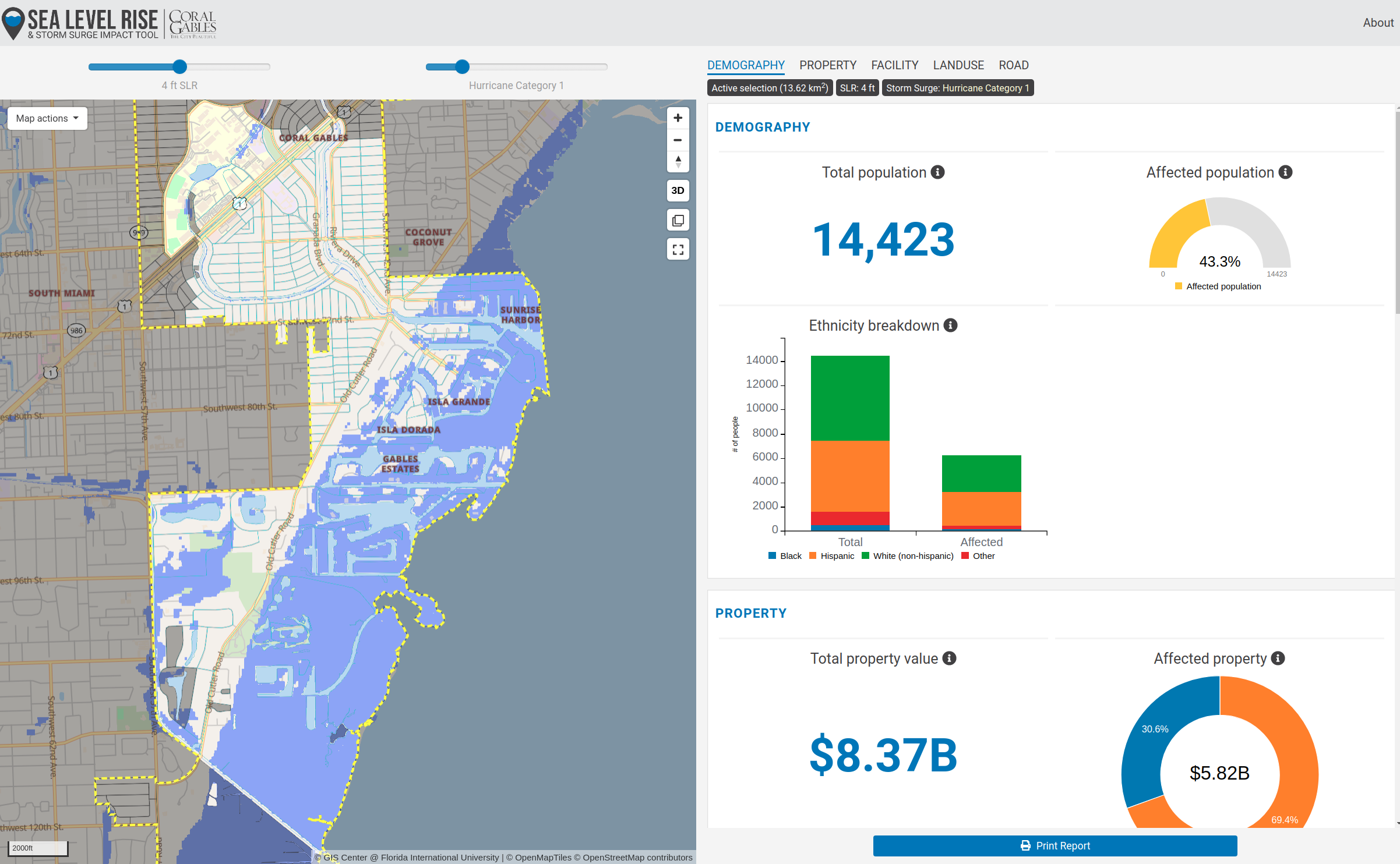
A web-based, interactive decision making tool that visualizes the potential effects of Sea Level Rise and storm surges in the City of Coral Gables. The tool is able to dynamically visualize statistics about affected population, critical facilities, road network, property value and land use.
Date
October 7, 2019
Category
Other, Sea Level Rise